Lake Wawasee facts for kids
Quick facts for kids Lake Wawasee |
|
|---|---|
 |
|
| Location | Syracuse, Indiana, Kosciusko County, Indiana |
| Coordinates | 41°24′N 85°42′W / 41.400°N 85.700°W |
| Lake type | Glacial lake |
| Primary inflows | Spring, Lake Papakeechie |
| Primary outflows | Lower Turkey Creek |
| Catchment area | 23,618 acres (95.58 km2) |
| Basin countries | United States |
| Surface area | 3,000 acres (12 km2) |
| Average depth | 22 ft (6.7 m) |
| Max. depth | 77 ft (23 m) |
| Residence time | 3.5 years |
| Surface elevation | 856 ft (261 m) |
| Islands | 2 |
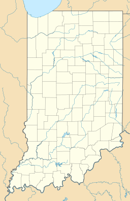
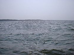
Lake Wawasee, once known as Turkey Lake, is a large natural lake located southeast of Syracuse in Kosciusko County, Indiana, United States. It is the biggest natural lake found entirely within the state of Indiana. The lake is just east of Indiana State Road 13.
Contents
History of Lake Wawasee
Lake Wawasee has a long and interesting past. It formed during the Pleistocene Ice Age. Later, early settlers arrived and the area grew. The lake gets its name from Wawasee, a Miami chief. His brother was Chief Papakeecha, whose name means "Flat Belly."
Lake Wawasee became a popular summer vacation spot. Many people from Indianapolis and Chicago would visit. The Spink's Hotel, now condominiums, was a fancy hotel there. Famous people like Eli Lilly, who founded the pharmaceutical company, had a home on the lake. His house is still a well-known landmark.
Exploring Geographic Places Around Wawasee
Lake Wawasee has many unique spots around its shores. Some well-known places include Black's Point, Willow Grove, Pickwick Park, Kale Island, Oakwood, and Vawter Park. Other areas are Ideal Beach, Waveland Beach, Conkling Hill, and Natti Crow Beach.
Black Stump Point
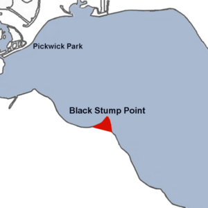
Black Stump Point is at the northwest end of Lake Wawasee. It sticks out into the lake. In the 1950s and 1960s, there were businesses here like Mocks' Marina and Waco, a restaurant where you could arrive by boat or car.
Cedar Beach and Wawasee Community
Cedar Beach was a small community in the area. It even had its own post office starting in 1879. The community's name changed to Wawasee in 1893. The post office stayed open until 1938.
Crow's Bay
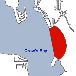
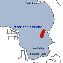
Crow's Bay is on the eastern side of Lake Wawasee. It sits between Cedar Point to the north and Morrison's Island to the south. The bay is named after Nathaniel Crow, who started a place called the Crow's Nest. Natti Crow Beach is a famous spot at the southern end of the bay.
Jarrett's Bay (Buttermilk Bay)
Jarrett's Bay is at the very southern end of Lake Wawasee. It is also known as Buttermilk Bay today. This bay stretches southeast, with Morrison's Island to the east. It was named after Lewis Jarrett, who owned a resort called Buttermilk Point.
Johnson's Bay
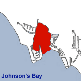
Johnson's Bay is on the east side of Lake Wawasee. Ogden Island and Cedar Point form the edges of this bay. Most of Johnson's Bay does not have lakeside homes. Its northern parts are cat tail marsh areas. Because of its quiet location, it became a popular spot for water skiing in the 1950s.
Morrison Island
Morrison Island was first called Eagle Island. It is named after William T. Morrison, who lived there until 1890. Today, many homes line the lake side of the island. There are also boat houses on the eastern side, with channels leading to Lake Wawasee.
The island has seawalls, and the ground is only a few feet above the lake's level. This makes Morrison Island one of the lowest residential areas on Lake Wawasee. A large public grass green space with trees is in the center of the island. You can reach the island by car using E. Morrison Island Road.
|
|
Main Channel
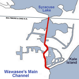
The main channel is not officially part of Lake Wawasee. However, it acts as a path for water flowing north from the lake. This channel starts at the lake's northwest shore. Oakwood Park is on its west side, and Kale Island is on its east. The channel flows north through Mudd Lake and then into Syracuse Lake. Homes and a marina line the western side of the channel. On the east side, there is a large wetland marsh where a gristmill used to be.
Fun Activities and Recreation
Marinas on Lake Wawasee
Marinas are places where boats can be docked, repaired, and stored.
- Griffith's Wawasee Marina opened in 1946. It is on the southeast end of Wawasee, near Buttermilk Bay.
- Main Channel Marina started in 1976. It is on the west side of the Main Channel, on the northwest side of Wawasee.
- Wawasee Boat Company was founded in 1929. You can find it on Wawasee's north shore.
Wawasee Yacht Club
The Wawasee Yacht Club was started in 1935. It is on the northeast shore of the lake. During the summer, the club hosts sailboat races. They have different types of racing boats, including the 28-foot E-Scow and the 13-foot Sunfish (sailboat).
The club's goal is to encourage and promote sailboat racing. They also teach about seamanship, which is the skill of handling a boat.
Annual Fireworks Display
Every year, around the 4th of July weekend, Lake Wawasee has a special fireworks show. The fireworks are launched from three platforms on the water. They are set to music played by a local radio station. There is also a "Flotilla," which is a parade of decorated boats around the lake.
Understanding Lake Depth (Bathymetry)
Bathymetry is the study of the depth and shape of a lake's bottom. Lake Wawasee's bottom has channels and raised areas. In 1895, it was noted that if the water level in Wawasee dropped 30 feet (9.1 m), the lake would look like four separate bodies of water. These would be connected by channels about 100 to 200 feet (30 to 61 m) wide and 8 to 10 feet (2.4 to 3.0 m) deep.
If the lake lost 40 feet (12 m) of water, these four areas would become completely separate lakes, with no channels connecting them.
How Lake Wawasee Works (Hydrology)
Lake Classification
Lake Wawasee covers about 12 km2 (3,000 acres) of area. It is classified as a healthy lake with two main basins (deepest parts). The lake is currently in good condition. It has a balanced aquatic ecosystem, meaning the plants and animals living in the water are thriving together.
Water Quality and Wetlands
The people living around Lake Wawasee care a lot about keeping the water clear and clean for the future. The Wawasee Area Conservancy Foundation (WACF) is a very active group working to protect the wetlands and water quality. This non-profit organization was formed in 1991.
The WACF works to find and fix problems that could harm the Wawasee area and its water quality. They work closely with property owners, the State Department of Natural Resources, and other groups that share their goals. They are dedicated to preserving and improving the area.
Lake Wawasee is known for being unusually clear for a lake in the Midwest. One reason for this is its location near a continental divide. This divide separates water that flows to the Mississippi River from water that flows to Lake Michigan. Another reason for the clear water is that many of the lake's nutrients are held in plants and zebra mussels. A study in 1995 showed that you could see up to 15-foot (4.6 m) deep in Wawasee. In other Midwest lakes, you can usually only see 2-to-6-foot (0.61 to 1.83 m) deep.
Since 1991, zebra mussels, which are an invasive species, have been found in Lake Wawasee. They can sometimes be a problem for marinas, fishermen, and people who own property on the lake.


