West Warwick, Rhode Island facts for kids
Quick facts for kids
West Warwick, Rhode Island
|
||
|---|---|---|

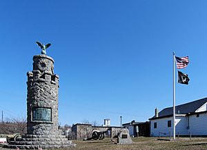
War Memorial Park West Warwick
|
||
|
||
| Nickname(s):
The Center of Rhode Island
|
||

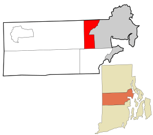
Location in Kent County and the state of Rhode Island.
|
||
| Country | United States | |
| State | Rhode Island | |
| County | Kent | |
| Area | ||
| • Total | 8.1 sq mi (21.0 km2) | |
| • Land | 7.9 sq mi (20.5 km2) | |
| • Water | 0.2 sq mi (0.5 km2) | |
| Elevation | 269 ft (82 m) | |
| Population
(2020)
|
||
| • Total | 31,012 | |
| • Density | 3,918/sq mi (1,512.8/km2) | |
| Time zone | UTC−5 (Eastern (EST)) | |
| • Summer (DST) | UTC−4 (EDT) | |
| ZIP code |
02893
|
|
| Area code(s) | 401 | |
| FIPS code | 44-78440 | |
| GNIS feature ID | 1220060 | |
West Warwick is a town in Kent County, Rhode Island, United States. It is home to about 31,012 people, based on the 2020 census.
West Warwick became an official town in 1913. This makes it the newest town in Rhode Island. Before 1913, this area was part of a larger town called Warwick. West Warwick was the main center for people and factories in the old Warwick area. The town split off because local politicians wanted to have more control over their part of town. They wanted to separate from the farming areas to the east.
Contents
History of West Warwick
The area that is now West Warwick was very important for early textile mills in the United States. These mills were built along the Pawtuxet River. The small mill villages in the Pawtuxet River Valley helped the textile industry grow in North America.
Early Mills and Industry
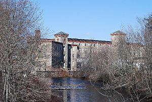
Lippitt Mill was started in 1809 by Christopher Lippitt. He was a hero from the Revolutionary War. This mill was one of the first in the area. The 1810 Lippitt Mill is now on the National Register of Historic Places. It is one of the oldest American textile mills still used for making things today.
Another important mill area is River Point. It is where the North and South branches of the Pawtuxet River meet. Many mills there have been turned into homes. These buildings are part of the Royal Mill Complex. The Original Bradford Soap Works is in the Valley Queen Mill. It started in the 1800s and still makes soap today.
The Station Nightclub Memorial
On February 20, 2003, a nightclub called The Station had a terrible fire. The fire happened during a concert. A special effects display set fire to soundproofing foam. This event led to the creation of the Station Fire Memorial Park. The park opened in May 2017. It is a place to remember those affected by the fire.
Major Flooding Event
In 2010, there was a very heavy rainfall. The Pawtuxet River rose to 21 feet high. This was 12 feet above its normal flood level. The high water caused a lot of flooding throughout West Warwick.
Geography and Villages
West Warwick covers about 8.1 square miles. Most of this area is land, about 7.9 square miles. The rest, about 0.2 square miles, is water.
West Warwick has several small villages within its borders:
- Arctic: This is in the center of West Warwick. Many town buildings are located here.
- Birch Hill: This used to be its own village. Now it is considered part of Clyde. It is in northern West Warwick.
- Centerville: This village has one of the first textile mills in West Warwick. It is in the center of town.
- Clyde: This is another village in West Warwick.
- Crompton: This is also one of the villages.
- Harris: This village is on the north branch of the Pawtuxet River. It is partly in West Warwick and partly in Coventry.
- Jericho: This area is now considered part of Arctic.
- Lippitt: This village is home to the historic Lippitt Mill. The mill was built in 1809.
- Natick: This is a neighborhood in the northeast part of town.
- Phenix: This village is in the northwest corner of town. It is home to the William B. Spencer house. This house is now on the National Register of Historic Places.
- River Point: This village is home to the historic Royal Mills. It also has Horgan Elementary School.
- Westcott: This village is unique because it did not grow around a factory. It provided homes for workers from nearby River Point mills.
The town of West Warwick is surrounded by other cities and towns. Warwick is to the east. Coventry is to the west. Cranston is to the north. East Greenwich is to the south.
Population and People
| Historical population | |||
|---|---|---|---|
| Census | Pop. | %± | |
| 1920 | 15,461 | — | |
| 1930 | 17,696 | 14.5% | |
| 1940 | 18,188 | 2.8% | |
| 1950 | 19,096 | 5.0% | |
| 1960 | 21,414 | 12.1% | |
| 1970 | 24,323 | 13.6% | |
| 1980 | 27,026 | 11.1% | |
| 1990 | 29,268 | 8.3% | |
| 2000 | 29,581 | 1.1% | |
| 2010 | 29,191 | −1.3% | |
| 2020 | 31,012 | 6.2% | |
| U.S. Decennial Census | |||
In 2000, there were about 29,581 people living in West Warwick. There were 12,498 households, which are groups of people living together. About 28% of these households had children under 18.
The people in West Warwick come from many different backgrounds. Most residents are White. There are also people who are African American, Native American, Asian, and from other races. About 3.1% of the population is Hispanic or Latino.
The average age of people in West Warwick in 2000 was 36 years old. About 22.4% of the population was under 18. About 14.1% were 65 or older.
Notable People from West Warwick
Many interesting people have connections to West Warwick:
- Wendy Davis: She was a state senator in Texas.
- Robert E. Quinn: He was the 58th Governor of Rhode Island. He also served as a judge.
- Mike Roarke: He played as a catcher in Major League Baseball. He also worked as a coach.
- Xavier Truss: He is an American football player. He plays as a guard.
- Bob Wylie: He is a coach in the National Football League.
See also
 In Spanish: West Warwick para niños
 | DeHart Hubbard |
 | Wilma Rudolph |
 | Jesse Owens |
 | Jackie Joyner-Kersee |
 | Major Taylor |


