Westville, New Jersey facts for kids
Quick facts for kids
Westville, New Jersey
|
||
|---|---|---|
|
Borough
|
||
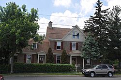
Thomas West House, built c. 1746
|
||
|
||
| Motto(s):
"The Gateway to South Jersey"
|
||
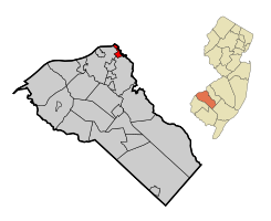
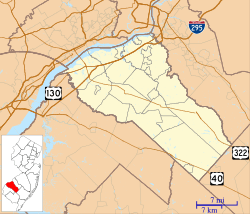
Map of Westville highlighted in Gloucester County. Inset: Location of Gloucester County in New Jersey.
|
||
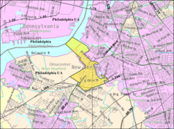
Census Bureau map of Westville, New Jersey
|
||
| Country | ||
| State | ||
| County | ||
| Incorporated | April 28, 1914 | |
| Named for | Thomas West | |
| Government | ||
| • Type | Borough | |
| • Body | Borough Council | |
| Area | ||
| • Total | 1.38 sq mi (3.58 km2) | |
| • Land | 1.02 sq mi (2.65 km2) | |
| • Water | 0.36 sq mi (0.93 km2) 25.94% | |
| Area rank | 463th of 565 in state 21st of 24 in county |
|
| Elevation | 23 ft (7 m) | |
| Population
(2020)
|
||
| • Total | 4,264 | |
| • Estimate
(2023)
|
4,317 | |
| • Rank | 405th of 565 in state 18th of 24 in county |
|
| • Density | 4,165.2/sq mi (1,608.2/km2) | |
| • Density rank | 149th of 565 in state 2nd of 24 in county |
|
| Time zone | UTC−05:00 (Eastern (EST)) | |
| • Summer (DST) | UTC−04:00 (Eastern (EDT)) | |
| ZIP Code |
08093
|
|
| Area code | 856 | |
| FIPS code | 3401580120 | |
| GNIS feature ID | 0885440 | |
Westville is a small town, also known as a borough, located in Gloucester County, New Jersey. It is often called "The Gateway to South Jersey!"
In 2020, about 4,264 people lived in Westville. This was a slight decrease from the 4,288 people counted in 2010.
Westville officially became a borough on April 28, 1914. It was formed from parts of Deptford Township and West Deptford Township. The town is named after Thomas West, who built a house here in 1775. That house is still standing today!
Contents
Exploring Westville's Geography
Westville covers a total area of about 1.38 square miles (3.58 square kilometers). Most of this area, 1.02 square miles (2.65 square kilometers), is land. The rest, 0.36 square miles (0.93 square kilometers), is water.
Neighboring Towns and Cities
Westville shares its borders with several other towns. In Gloucester County, it borders Deptford Township and West Deptford Township. In nearby Camden County, it borders Bellmawr, Brooklawn, and Gloucester City. Westville also sits across the Delaware River from Philadelphia in Pennsylvania.
Understanding Westville's Population
The number of people living in Westville has changed over the years.
| Historical population | |||
|---|---|---|---|
| Census | Pop. | %± | |
| 1920 | 2,380 | — | |
| 1930 | 3,462 | 45.5% | |
| 1940 | 3,585 | 3.6% | |
| 1950 | 4,731 | 32.0% | |
| 1960 | 4,951 | 4.7% | |
| 1970 | 5,170 | 4.4% | |
| 1980 | 4,786 | −7.4% | |
| 1990 | 4,573 | −4.5% | |
| 2000 | 4,500 | −1.6% | |
| 2010 | 4,288 | −4.7% | |
| 2020 | 4,264 | −0.6% | |
| 2023 (est.) | 4,317 | 0.7% | |
| Population sources: 1920–2000 1920 1920–1930 1940–2000 2000 2010 2020 |
|||
What the 2010 Census Showed
In 2010, there were 4,288 people living in Westville. Most residents, about 89.5%, were White. About 4.9% were Black or African American, and 1.5% were Asian. People of Hispanic or Latino background made up about 6% of the population.
The average household in Westville had about 2.44 people. The average family had about 3.06 people.
Age Groups in Westville
In 2010, about 20.4% of the people in Westville were under 18 years old. About 11.6% were 65 years or older. The median age, which is the middle age of the population, was 38.8 years.
Education in Westville
Westville has its own school district for younger students.
Elementary and Middle School Education
The Westville School District serves students from pre-kindergarten up to sixth grade. These students attend Parkview Elementary School. In the 2019–2020 school year, there were 361 students and 31.7 teachers, meaning about 11 students per teacher.
High School Education
For seventh through twelfth grade, students from Westville attend Gateway Regional High School. This high school also serves students from National Park, Wenonah, and Woodbury Heights. In 2019–2020, Gateway Regional High School had 900 students and 79 teachers.
Vocational and Technical Education
Students across Gloucester County can also apply to the Gloucester County Institute of Technology. This school in Deptford Township offers special technical and vocational training. Students do not pay tuition to attend this public school.
Getting Around Westville: Transportation
Westville has several important roads and public transportation options.
Major Roads and Highways
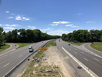
As of 2010, Westville had about 18.05 miles of roads. Key roads that pass through the borough include County Route 551, Route 45, Route 47, U.S. Route 130, and Interstate 295.
Public Bus Services
NJ Transit provides bus service to Westville. Several routes connect Westville to other towns and cities, including Philadelphia. These routes include the 401, 402, 408, 410, 412, 455, and 463.
Future Rail Transportation
There are plans for a new light rail system called the Glassboro-Camden Line. This system would use existing train tracks and would include a stop in Westville at Crown Point Road.
Famous People from Westville
Many interesting people have lived in Westville. Here are a few:
- George Anastasia (born 1947), a writer and journalist known for his books about crime.
- Stephen Decatur (1779–1820), a brave U.S. Navy officer famous for his heroism in several wars.
- Milt Plum (born 1935), a professional football player who played for teams like the Cleveland Browns and Detroit Lions.
- Larry Sharpe (1951–2017), a professional wrestler.
See also
 In Spanish: Westville (Nueva Jersey) para niños
 | Roy Wilkins |
 | John Lewis |
 | Linda Carol Brown |


