Wheeler Peak (New Mexico) facts for kids
Quick facts for kids Wheeler Peak |
|
|---|---|

Wheeler Peak
|
|
| Highest point | |
| Elevation | 13,167 ft (4,013 m) NAVD 88 |
| Prominence | 3,409 ft (1,039 m) |
| Parent peak | Vermejo Peak |
| Listing |
|
| Geography | |
| Location | Taos County, New Mexico, U.S. |
| Parent range | Taos Mountains |
| Topo map | USGS Wheeler Peak |
| Climbing | |
| Easiest route | Williams Lake |

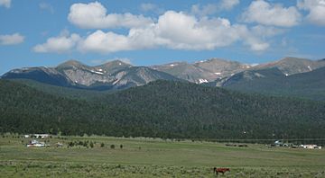
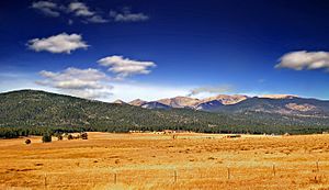
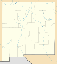
Wheeler Peak is the highest natural point in the state of New Mexico, U.S. It stands tall in the northern part of the state. You can find it northeast of Taos and south of Red River.
This impressive mountain is part of the Sangre de Cristo Mountains. These mountains are the southernmost part of the larger Rocky Mountains. Wheeler Peak reaches an elevation of 13,167 feet (4,013 m) (about 4,013 meters). It is also just 2 miles (3.2 km) southeast of the ski slopes at Taos Ski Valley.
Contents
The Name of Wheeler Peak
Wheeler Peak was not always known by its current name. It was first called Taos Peak. This name came from the nearby town of Taos, New Mexico.
In 1950, the mountain was renamed Wheeler Peak. A special plaque at the top of the mountain tells us why. It says the peak was named to honor Major George Montague Wheeler. He was a famous explorer and surveyor.
From 1832 to 1909, Major Wheeler led a team for ten years. His team collected important information about the land. They studied geology, plants, animals, and mapped out areas. They worked in New Mexico and six other states in the southwestern U.S.
Nearby Places and Features
Wheeler Peak is surrounded by other interesting places. Just north of Wheeler Peak is Mount Walter. It is the second-highest named peak in New Mexico. Mount Walter is 13,141 feet (4,005 m) tall. However, it is usually not seen as a separate mountain. This is because it rises only about 53 feet (16 m) above the land around it. People sometimes mistake Mount Walter for Wheeler Peak. This happens because it is on the main path to Wheeler Peak.
Another peak, Lake Fork Peak, is 12,881 feet (3,926 m) high. It sits across Williams Lake and west of Wheeler Mountain.
The popular Taos Ski Valley is to the northwest of Wheeler Peak. The town of Taos and Taos Pueblo are about 15 miles (24 km) to the southwest.
Much of Wheeler Peak is part of the Wheeler Peak Wilderness area. This protected area covers 19,661-acre (79.57 km2) within the Carson National Forest. Some of the land south of the peak belongs to the Taos Pueblo. In 1970, about 48,000 acres (190 km2) of land was given back to the pueblo from the Carson National Forest. Later, in 1996, another 764 acres (3.09 km2) was returned.
Climbing Wheeler Peak
Climbing Wheeler Peak is a popular adventure. There are a few different ways to reach the top.
The North Ridge Route
The most common way to climb Wheeler Peak is along its north ridge. This path starts at the parking lot for Taos Ski Valley. Hikers go east along an old road. This leads to a wide, flat area called Bull-of-the-Woods Meadow. From there, the trail turns south. It winds through smaller peaks and valleys. Eventually, it reaches Wheeler Peak from the north. This route also takes you over the top of Mount Walter. This path is good even in winter. It has a low risk of avalanches.
The Williams Lake Route
Another way to climb is to hike south from Taos Ski Valley to Williams Lake. From the lake, a new trail was built in 2011. This trail has many switchbacks, which are zig-zag turns that make the climb easier. A team from the Gallatin National Forest built this trail. Eight people worked 12 hours a day for 14 days. They used hand tools to build 4 miles (6.4 km) of new trail to the summit.
The Red River Route
You can also start your climb from the nearby ski resort of Red River. From the town, drive 6.4 miles (10.3 km) south on NM 578. Then, drive 1.3 miles (2.1 km) on FR 58 to the trailhead parking area. From there, Wheeler Peak is about 7 miles (11 km) away on Forest Trail 91. This route is special because it passes two beautiful alpine lakes: Lost Lake and Horseshoe Lake.
Many major peaks in the western U.S. have a special book at the top called a summit register. Wheeler Peak has one too! Climbers can sign their names and leave a message when they reach the summit.
See also
 In Spanish: Pico Wheeler para niños
 | Toni Morrison |
 | Barack Obama |
 | Martin Luther King Jr. |
 | Ralph Bunche |


