Red River, New Mexico facts for kids
Quick facts for kids
Red River, New Mexico
|
|
|---|---|
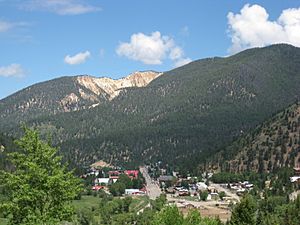
The town of Red River, New Mexico
|
|
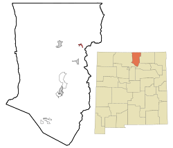
Location of Red River, New Mexico
|
|
| Country | United States |
| State | New Mexico |
| County | Taos |
| Date Established | 1895 |
| Area | |
| • Total | 1.02 sq mi (2.64 km2) |
| • Land | 1.01 sq mi (2.63 km2) |
| • Water | 0.00 sq mi (0.01 km2) |
| Elevation | 8,688 ft (2,648 m) |
| Population
(2020)
|
|
| • Total | 542 |
| • Density | 533.99/sq mi (206.13/km2) |
| Time zone | UTC-7 (Mountain (MST)) |
| • Summer (DST) | UTC-6 (MDT) |
| ZIP code |
87558
|
| Area code(s) | 575 |
| FIPS code | 35-62200 |
| GNIS feature ID | 2412537 |
| Website | www.redriver.org |
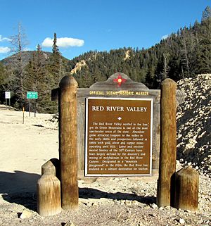
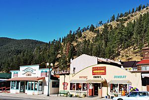
Red River is a fun resort town located in Taos County, New Mexico, USA. It sits high up in the beautiful Sangre de Cristo Mountains. In 2020, about 542 people lived there. Red River is part of the scenic Enchanted Circle Scenic Byway and is about 36 miles (58 km) from Taos.
Contents
History of Red River
Long ago, before European settlers arrived, the area where Red River is now was a summer hunting ground. Native American tribes like the Jicarilla Apache and Utes hunted animals here. They looked for big horn sheep, mule deer, elk, and mallard ducks.
The town of Red River started in the late 1800s. Miners from a nearby town called Elizabethtown came looking for gold. Trappers also came to find game. The town got its name from the Red River, a stream that flows through it. This river starts on the northern slopes of Wheeler Peak.
By 1895, Red River was a busy mining town. Miners found gold, silver, and copper. About 3,000 people lived there! Mining was at its busiest in 1897. But by 1905, the mining slowed down, and fewer people lived there.
Even though mining decreased, the town survived. It became known as a great place to escape hot weather and enjoy trout fishing. The last big mining efforts ended in 1931. After that, tourism became the main way people made a living.
In 2019, the large Christmas tree displayed at the United States Capitol in Washington, D.C. came from Red River.
Geography and Location
Red River is located in the Sangre de Cristo Mountains. These mountains are part of the southern Rocky Mountains. The town is surrounded by the beautiful Carson National Forest.
The United States Census Bureau says the town covers about 1.0 square mile (2.6 square kilometers) of land.
The Enchanted Circle Scenic Byway, also known as New Mexico Route 38, is a famous road that goes right through Red River.
People of Red River
| Historical population | |||
|---|---|---|---|
| Census | Pop. | %± | |
| 1980 | 332 | — | |
| 1990 | 387 | 16.6% | |
| 2000 | 484 | 25.1% | |
| 2010 | 477 | −1.4% | |
| 2020 | 542 | 13.6% | |
| U.S. Decennial Census | |||
In 2000, there were 484 people living in Red River. Most people (about 92.56%) were White. About 9.30% of the population were Hispanic or Latino.
The average age of people in Red River in 2000 was 45 years old. About 16.7% of the population was under 18 years old.
Climate and Weather
Red River has a climate with four clear seasons. It's called a humid continental climate (Dfb). Summers are warm with cool nights, which is very refreshing. Winters are cold, but not extremely cold. Red River gets a lot of snow for New Mexico, averaging about 156.7 inches (398 cm) each year.
| Climate data for Red River, New Mexico, 1991–2020 normals, extremes 1906–2021 | |||||||||||||
|---|---|---|---|---|---|---|---|---|---|---|---|---|---|
| Month | Jan | Feb | Mar | Apr | May | Jun | Jul | Aug | Sep | Oct | Nov | Dec | Year |
| Record high °F (°C) | 58 (14) |
64 (18) |
74 (23) |
76 (24) |
88 (31) |
94 (34) |
92 (33) |
94 (34) |
87 (31) |
79 (26) |
74 (23) |
66 (19) |
94 (34) |
| Mean maximum °F (°C) | 49.2 (9.6) |
51.1 (10.6) |
58.7 (14.8) |
65.3 (18.5) |
74.8 (23.8) |
81.8 (27.7) |
83.0 (28.3) |
80.6 (27.0) |
76.9 (24.9) |
69.5 (20.8) |
57.8 (14.3) |
50.2 (10.1) |
84.5 (29.2) |
| Mean daily maximum °F (°C) | 35.2 (1.8) |
37.2 (2.9) |
44.8 (7.1) |
52.3 (11.3) |
62.0 (16.7) |
72.4 (22.4) |
74.6 (23.7) |
72.4 (22.4) |
67.7 (19.8) |
56.2 (13.4) |
43.7 (6.5) |
35.1 (1.7) |
54.5 (12.5) |
| Daily mean °F (°C) | 21.0 (−6.1) |
23.3 (−4.8) |
30.5 (−0.8) |
37.7 (3.2) |
45.8 (7.7) |
54.4 (12.4) |
58.1 (14.5) |
56.3 (13.5) |
50.7 (10.4) |
40.4 (4.7) |
29.6 (−1.3) |
21.6 (−5.8) |
39.1 (4.0) |
| Mean daily minimum °F (°C) | 6.8 (−14.0) |
9.4 (−12.6) |
16.2 (−8.8) |
23.0 (−5.0) |
29.6 (−1.3) |
36.3 (2.4) |
41.6 (5.3) |
40.2 (4.6) |
33.8 (1.0) |
24.7 (−4.1) |
15.5 (−9.2) |
8.1 (−13.3) |
23.8 (−4.6) |
| Mean minimum °F (°C) | −8.0 (−22.2) |
−5.0 (−20.6) |
−0.7 (−18.2) |
10.3 (−12.1) |
21.1 (−6.1) |
29.0 (−1.7) |
36.7 (2.6) |
35.1 (1.7) |
26.1 (−3.3) |
14.0 (−10.0) |
−0.6 (−18.1) |
−8.0 (−22.2) |
−11.4 (−24.1) |
| Record low °F (°C) | −40 (−40) |
−35 (−37) |
−23 (−31) |
−14 (−26) |
2 (−17) |
18 (−8) |
28 (−2) |
26 (−3) |
14 (−10) |
−2 (−19) |
−23 (−31) |
−34 (−37) |
−40 (−40) |
| Average precipitation inches (mm) | 1.05 (27) |
1.46 (37) |
1.85 (47) |
1.99 (51) |
1.79 (45) |
1.11 (28) |
3.14 (80) |
3.01 (76) |
2.03 (52) |
1.78 (45) |
1.59 (40) |
1.22 (31) |
22.02 (559) |
| Average snowfall inches (cm) | 19.1 (49) |
26.1 (66) |
31.4 (80) |
26.7 (68) |
6.2 (16) |
0.0 (0.0) |
0.0 (0.0) |
0.0 (0.0) |
0.0 (0.0) |
9.7 (25) |
19.0 (48) |
18.5 (47) |
156.7 (399) |
| Average extreme snow depth inches (cm) | 14.0 (36) |
15.4 (39) |
17.2 (44) |
7.7 (20) |
3.3 (8.4) |
0.0 (0.0) |
0.0 (0.0) |
0.0 (0.0) |
0.0 (0.0) |
5.3 (13) |
10.3 (26) |
12.0 (30) |
22.6 (57) |
| Average precipitation days (≥ 0.01 in) | 7.2 | 8.6 | 9.2 | 8.9 | 9.2 | 8.9 | 16.3 | 16.2 | 9.3 | 6.9 | 7.3 | 7.3 | 115.3 |
| Average snowy days (≥ 0.1 in) | 6.7 | 8.3 | 7.6 | 5.7 | 1.5 | 0.0 | 0.0 | 0.0 | 0.0 | 2.5 | 5.7 | 6.9 | 44.9 |
| Source 1: NOAA | |||||||||||||
| Source 2: National Weather Service | |||||||||||||
Fun Activities and Economy
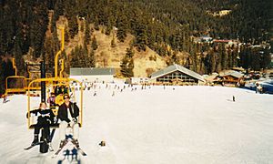
The main way people make a living in Red River is through tourism. Red River is at the bottom of the Red River Ski Area. This area is very high up, about 8,750 feet (2,667 meters) above sea level in the southern Rocky Mountains.
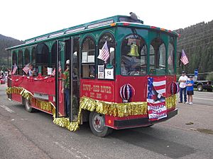
In winter, visitors can enjoy skiing, snowboarding, and snowmobiling. In summer, there are many outdoor activities. People can hike, bike, fish, and ride horseback in the mountains. The town has a bus system that helps visitors get around.
Every year, Red River hosts a big event called the Red River Memorial Motorcycle Rally. Tens of thousands of people attend this rally.
Education in Red River
Red River is part of the Questa Independent Schools school district. In 1983, some children from Red River went to schools in Questa. However, many other children attended different schools. For example, 32 students went to Taos Christian Academy. Another 32 went to Cimarron Municipal Schools, with some going to elementary school in Eagle Nest and others to secondary school in Cimarron.
Some parents felt that the schools in Questa were not strong enough academically. Because many Red River parents chose other schools, it was less likely that the Questa district would build a school in Red River itself.
See also
 In Spanish: Red River (Nuevo México) para niños
 | Ernest Everett Just |
 | Mary Jackson |
 | Emmett Chappelle |
 | Marie Maynard Daly |


