Wichita River facts for kids
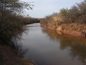
The Wichita River (pronounced WITCH-i-taw) is a river in north-central Texas. It's part of the larger Red River system, which means its waters eventually flow into the Red River. The Wichita River starts in northeastern Knox County, where its North and South Forks meet. From there, it flows about 90 miles (145 km) northeast. It passes through Baylor, Archer, Wichita, and Clay counties. Finally, it joins the Red River just west of Byers Bend in northern Clay County.
Contents
The River's Name and History
The Wichita River got its name from the Wichita Indian tribe. In 1841, a group called the Texan Santa Fe Expedition crossed the river. They found a large Wichita Indian village right where the city of Wichita Falls is today. Because of this, the river was later named after the tribe.
Wichita Falls and Its Waterfalls
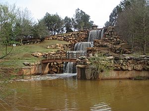
The biggest city along the Wichita River is Wichita Falls. This city was named after a five-foot waterfall that used to be on the river. However, a big flood in 1886 washed the original waterfall away.
For nearly 100 years, visitors came to the city hoping to see the falls, but they were gone. So, the city decided to build a new one! They created an artificial waterfall next to the river in Lucy Park. This new waterfall is 54 feet (16 meters) tall. It recycles 3,500 gallons of water every minute. You can easily see these recreated falls if you are driving south on Interstate 44.

Dams and Water Supply
The Wichita River is an important source of water for the area. It has several dams that create lakes and reservoirs. In Archer County, a dam forms Lake Diversion. In Baylor County, another dam creates Lake Kemp.
There are also two smaller reservoirs on the river in Wichita County. One of these reservoirs provides drinking water for the town of Iowa Park. The other reservoir supplies water for local irrigation, which is used to water crops and fields.
The River's Branches
The Wichita River actually starts from the joining of two main branches: the North Fork and the South Fork. But there's also a Middle Fork!
- The North Fork of the Wichita River is about 100 miles (161 km) long. It flows from northeastern Dickens County through King, Cottle, and Foard counties. It then joins the South Fork to form the main Wichita River.
- The Middle Fork is shorter, flowing for about 35 miles (56 km). It starts in north-central King County and meets the North Fork in southwestern Foard County.
- The South Fork also runs for about 100 miles (161 km). It begins in eastern Dickens County and flows through King and Knox Counties before joining the North Fork. The town of Guthrie, which is the county seat of King County, is located on the South Fork.
 | Emma Amos |
 | Edward Mitchell Bannister |
 | Larry D. Alexander |
 | Ernie Barnes |


