Geology and hydrology of the Wichita Falls, Texas area facts for kids
The land around Wichita Falls is made of layers of rock and dirt. These layers were formed a very long time ago. They were created by ancient rivers and streams. These rivers deposited sand, silt, and clay. Over time, these materials became rock or stayed as loose dirt.
Contents
- A Quick Look at Earth's History Here
- Permian Rocks: Ancient Rivers and Continents
- Pleistocene and Early Holocene Sediments: Ice Age Deposits
- Holocene Sediments: Modern River Deposits
- How the Land Was Shaped: Uplifts and Collisions
- Oil and Gas Resources: Black Gold
- Water Resources: Where Our Water Comes From
A Quick Look at Earth's History Here
The rocks you see near Wichita Falls were made during the Permian period. This was a time when rivers flowed southwest. They left behind sand in river channels. They also left silt and clay on the flat areas next to the rivers, called floodplains. The soil next to these rivers had a lot of calcium.
Later, these layers were buried by more dirt. They slowly turned into rock. Much later, during the Pleistocene Ice Age, erosion wore away younger rocks. This exposed the older Permian layers we see today. More recently, streams flowing northeast added new layers of silt, clay, sand, and gravel. Modern rivers and streams continue to shape the land today.
Permian Rocks: Ancient Rivers and Continents
During the Permian period, North-Central Texas was near the coast of a huge supercontinent called Pangea. Imagine all the continents we know today, but joined together! Mountains like the Wichita, Arbuckle, and Ouachita mountains had already formed. These mountains were to the north and east.
This high land caused rivers to flow from the northeast to the southwest. These rivers carried sediments. These sediments were mostly bits of older rocks from the mountains. They were deposited by the Permian rivers in North-Central Texas.
The main type of Permian rock here is called the Petrolia Formation. It's mostly soft mudstone. This is like hardened mud. It also has layers of sandstone, which is hardened sand. These sandstone layers often show "cross-bedding," which means the sand was laid down in slanted layers by flowing water.
The Petrolia Formation also contains fossils. These include ancient plants, animal bones, and even footprints! There are also hard lumps of calcium in the rock. The rocks here are not very hard. This might mean they were never buried very deeply by younger layers.
You can see several sandstone layers in the area. They are very clear near Seymour Highway. These layers are often buff-colored (a yellowish-tan). They are made of medium-sized sand grains. They also show a lot of cross-bedding. Some of these sandstones are crumbly, while others are well-cemented. These different layers create ledges and flat areas on the land. Sometimes, they even form mesa-like hills.
Pleistocene and Early Holocene Sediments: Ice Age Deposits
On top of the Permian rocks, you can find younger layers. These are up to 30 feet thick. They are made of loose gravel, sand, and silt. These were deposited by rivers during the Pleistocene Ice Age or the early Holocene period (which is our current time).
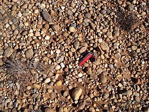
The gravels are different sizes, from small pebbles to larger stones. They include smooth, rounded pieces of quartzite, quartz, and chert. These came from far away. There are also smaller pieces of local rocks. The sands are orange-brown to tan. They also have old soil layers within them.
Holocene Sediments: Modern River Deposits
The most recent layers are up to 30 feet thick. They are made of sand, silt, clay, and gravel. These come from today's rivers and streams. This includes deposits on floodplains and in river channels. It also includes dirt that slides down hillsides (colluvium) and local sand and silt blown by the wind.
How the Land Was Shaped: Uplifts and Collisions
The rock layers in this area generally tilt slightly to the west. But deep underground, just north of Wichita Falls, there's a large block of land that was pushed up. This is called the Red River uplift. It might be connected to another uplift called the Muenster Arch.
These uplifts happened when huge continents collided. This was part of the Ouachita Orogeny and Ancestral Rocky Mountains building events. These happened during the Pennsylvanian period. They were caused by the Iapetus Ocean closing as the continents of Gondwana and Laurentia crashed together to form Pangea.
Oil and Gas Resources: Black Gold
People found oil and gas in this region in the early 1900s. Even today, companies are still looking for and producing oil and gas here.
Water Resources: Where Our Water Comes From
Groundwater: Water Underground
Some water in Wichita Falls comes from underground. This is called groundwater. It's found in the Seymour aquifer or in aquifers near local streams. An aquifer is like an underground sponge that holds water.
Most groundwater is used by individual property owners. It doesn't supply the main city water. However, the nearby city of Burkburnett uses this aquifer for some of its city water.
The Seymour aquifer can be trapped under clay layers in some places. In the southern part of the city, the water is found in sand and gravel that were deposited by ancient rivers. The water is usually about 14 feet below the surface. But the amount of water can change a lot from one spot to another. Some wells might be dry, even next to a well with plenty of water.
Cedar Springs Pools: A Cool Dip in the Past
Groundwater from the Seymour aquifer used to fill the Cedar Springs Pools. These were popular public swimming pools in the 1930s and 40s. They were known for their very cold water!
Surface Water: Rivers and Lakes
The Wichita River: Dividing the City
Wichita Falls is located along the Wichita River. The river flows through the middle of the city, dividing it into north and south parts. The Wichita River is a "meandering stream." This means it has many curves and bends. Lucy Park, a large city park, is located in one of these big bends. You can also see an "oxbow lake" nearby. This is a U-shaped lake formed when a river bend gets cut off.
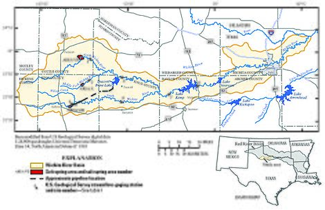
The Wichita River's water is held back by dams upstream. These dams help control floods and create reservoirs for water storage.
Lake Diversion: Water for Farms
Lake Diversion was built in 1924. It's about 71 miles upstream from Wichita Falls. This lake helps prevent floods. It also provides water for a fish hatchery and for irrigation. It feeds a 135-mile network of canals that bring water to farms east of Wichita Falls.
Lake Kemp: Drinking Water and Power
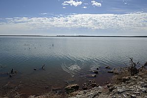
Lake Kemp was also built in 1924. It's about 40 miles upstream from Wichita Falls. Its main jobs are to stop floods and provide water for drinking and farming. The lake holds a lot of water, about 80 billion gallons! It has 100 miles of shoreline, with some homes and recreation areas.
Lake Kemp was used for drinking water until the 1950s. But people didn't like its gypsum taste. In 2008, Wichita Falls started using a special process called reverse osmosis to clean the water from Lake Kemp. This process removes the salt and makes the water drinkable. Lake Kemp also provides water to a power company. The lake is named after a businessman named Joseph A. Kemp.
Truscott Brine Lake: Stopping the Salt
Truscott Brine Lake was finished in 1987. It covers a large area and holds a lot of water. Its main purpose is to control salt in the Wichita River. There are natural salt springs in the area. These springs happen because groundwater flows through rocks that have a lot of salt minerals.
To stop this salty water from getting into the river, a special inflatable dam was built. During times when the river flow is low, this salty water is piped 23 miles to Truscott Brine Lake. There, the water is held and eventually evaporates, leaving the salt behind.
Holliday Creek: Feeding Lake Wichita
Holliday Creek is a smaller stream that flows into the Wichita River. It starts south of Dundee and flows to the edge of Wichita Falls. It is dammed at the southern edge of the city to form Lake Wichita.
Lake Wichita: A Place for Fun
Lake Wichita is on the southern edge of the city. It was built in 1901 by businessmen Frank Kell and Joseph Kemp. Its original goals were to stop floods and provide water for farms and the city. The lake gets its water from Holliday Creek and from canals connected to Lake Diversion.
The lake was originally larger. But in 1995, a new spillway was built as part of a flood control project. This made the lake smaller and shallower. Now, Lake Wichita is only used for fun activities like boating and fishing, not for city drinking water.
The Little Wichita River: Another Water Source
The Little Wichita River flows south of the Wichita River. It also empties into the Red River. The Little Wichita River drains the areas south and east of Wichita Falls. Its water is held in two lakes that supply Wichita Falls' drinking water.
Lake Arrowhead: The Newest Big Lake
Lake Arrowhead is located southeast of Wichita Falls. It's the newest large reservoir in the area, built in 1965. Before it was built, a whole town called Halsell, Texas had to be moved, including its residents and cemetery! The lake is very large and holds about 74 billion gallons of water. Wichita Falls is allowed to use a lot of this water for its city needs each year.
Lake Kickapoo: An Older Reservoir
Lake Kickapoo is located southwest of Wichita Falls. It was built in 1945. This lake is also very large and holds about 35 billion gallons of water.
Lake Ringgold: A Future Water Plan
Lake Ringgold is a proposed new reservoir on the Little Wichita River. If built, it would provide even more water storage for the future.
 | Madam C. J. Walker |
 | Janet Emerson Bashen |
 | Annie Turnbo Malone |
 | Maggie L. Walker |


