Witta, Queensland facts for kids
Quick facts for kids WittaQueensland |
|||||||||||||||
|---|---|---|---|---|---|---|---|---|---|---|---|---|---|---|---|
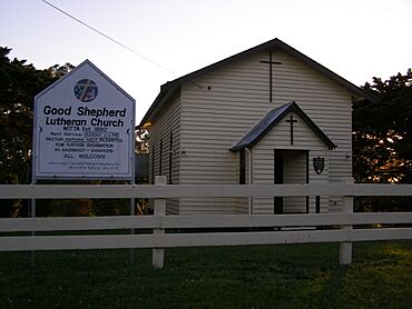
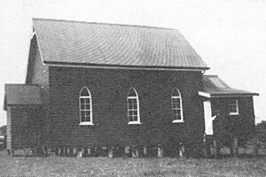
Good Shepherd Lutheran Church, 2006
|
|||||||||||||||
| Population | 1,296 (2021 census) | ||||||||||||||
| • Density | 36.71/km2 (95.1/sq mi) | ||||||||||||||
| Postcode(s) | 4552 | ||||||||||||||
| Area | 35.3 km2 (13.6 sq mi) | ||||||||||||||
| Time zone | AEST (UTC+10:00) | ||||||||||||||
| Location | |||||||||||||||
| LGA(s) | Sunshine Coast Region | ||||||||||||||
| State electorate(s) | Glass House | ||||||||||||||
| Federal Division(s) | Fisher | ||||||||||||||
|
|||||||||||||||
Witta is a small town and area in the Sunshine Coast Region of Queensland, Australia. It's a rural place, meaning it's mostly countryside with farms and natural areas. In 2021, about 1,296 people lived in Witta.
Contents
Exploring Witta's Landscape
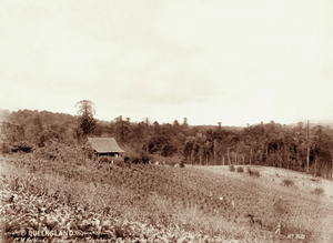
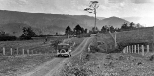
Witta is located within the beautiful Blackall Ranges. The lower parts of the land are mostly clear. People use these areas for homes and farms. Higher up, you'll find lots of natural bushland. This means there are many native trees and plants.
A Look Back at Witta's History
Witta was first settled around 1887. German families were among the first to move here. They named the area Teutoberg, possibly after a forest in Germany.
How Witta Got Its Name
The town's name changed in 1916 during World War I. This was because of strong feelings against Germany at the time. The new name, Witta, comes from the Kabi language. It's a changed version of the word wetya, which means dingo.
Schools in Witta's Past
A school first opened in the area on October 1, 1892. It was first called Maleny Provisional School. In 1893, its name changed to Teutoberg Provisional School. It became Teutoberg State School in 1909. Then, in 1926, it was renamed Witta State School. This school closed its doors on August 23, 1974. It was located at 316 Witta Road.
The Story of Good Shepherd Lutheran Church
The first Lutheran church, called Teutoburg Lutheran Church, was built in 1893. In 1911, this church was taken down. A new timber church was built in its place. The new Good Shepherd Lutheran Church opened on January 22, 1911.
The School of Arts Building
In 1907, land was set aside for a "School of Arts." These places were like community centers. They often had libraries and offered classes. The Witta School of Arts opened on October 7, 1908. A local politician named Harry Frederick Walker helped open it.
Education Opportunities
There are no schools directly in Witta today. Students usually go to schools in the nearby town of Maleny. Maleny State School is the closest primary school. Maleny State High School is the nearest high school. Both are located to the south-west of Witta.
Places to Visit and Things to Do
Local Amenities
Good Shepherd Lutheran Church is still an active church in Witta. You can find it at 295 Witta Road.
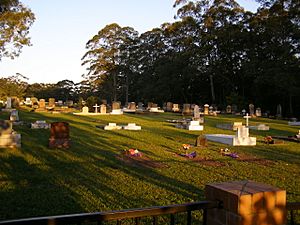
There is also a small cemetery located on Witta Road.
Scenic Views at Obi Lookout
If you like great views, you can visit Obi Lookout. It's located on Schultz Road. From there, you can see the beautiful surrounding area.
Famous People from Witta
- Otto Nothling: He was born in Witta. Otto was a talented athlete who played both cricket and rugby union for Australia.
 | Aaron Henry |
 | T. R. M. Howard |
 | Jesse Jackson |


