Wye Valley, Derbyshire facts for kids
Quick facts for kids Wye Valley, Derbyshire |
|
|---|---|
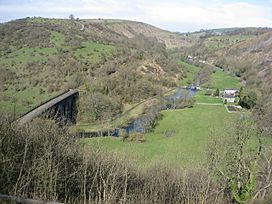
Monsal Head Viaduct and River Wye
|
|
| Length | 15 miles (24.1 km) West-East |
| Width | 100 metres (328 ft) to 500 metres (1,640 ft) |
| Depth | 100 metres (328 ft) |
| Geography | |
| Location | Derbyshire, England |
| Rivers | River Wye |
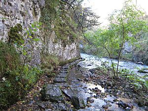
The Wye Valley is a beautiful valley in Derbyshire, England. It's carved out by the River Wye, which flows through the White Peak area. The River Wye starts near Buxton on Axe Edge Moor. Part of it even flows underground through Poole's Cavern! The river then goes through Buxton Pavilion Gardens. After leaving Buxton, the Wye Valley becomes a deep, narrow gorge. It runs east for about 10 miles (16 km) before getting wider near Ashford-in-the-Water.
The A6 road from Buxton to Bakewell follows the Wye Valley for most of its journey. A railway line, the Manchester, Buxton, Matlock and Midland Junction Railway, used to run through the valley. It connected Manchester to London through the Peak District. This railway was open from the 1860s until 1968.
Contents
How the Wye Valley Was Formed
The White Peak area of the Peak District is known for its light-colored limestone landscape. This area is often called the 'Derbyshire Dome'. The land here is usually between 200 and 300 meters (650-1000 feet) above sea level.
The limestone rocks you see in the Wye Valley were made about 350 million years ago. Back then, this area was covered by a warm, tropical sea. Shells and other sea creatures settled on the seabed. Over millions of years, these layers were pressed into hard rock. Later, the land was pushed up and folded into a dome shape. Rain and ice then wore away the softer rocks on top. This exposed the older limestone layers below. The valleys and gorges were then shaped by melting ice from the last Ice Age, about 20,000 years ago.
Exploring the Wye Valley Dales
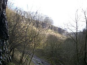
Beyond Buxton, the Wye Valley is known for its many "dales." These are like deep, narrow gorges, often with smaller valleys joining them.
Ashwood Dale
After leaving Buxton, the river enters Ashwood Dale. This is a steep-sided valley. A famous artist, J. M. W. Turner, sketched a spot here called Lovers' Leap around 1831. The story says a couple trying to elope jumped across a gap on horseback to escape their parents!
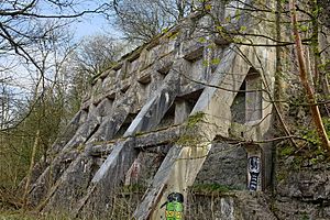
Two smaller valleys, Cunning Dale and Cow Dale, join Ashwood Dale. You can still see the remains of old lime kilns at Cowdale quarry. These were used in the 1800s to heat limestone and make lime. This site is now a protected historical place.
Wye Dale
Woo Dale is a dry valley that joins Wye Dale from the north. A special type of limestone, called 'Woo Dale Limestone', is dug up nearby. This happens at Tunstead Quarry, which is the biggest limestone quarry in the UK!
Another valley, Deep Dale, joins from the south. Inside Deep Dale, there's a cave called Thirst House Cave. It's 58 meters (190 feet) long. In the late 1800s, people found a bear's skull and old Roman items inside it. A walking path called the Peak District Boundary Walk goes through Deep Dale and Wye Dale.
Chee Dale
The Monsal Trail is a popular path for walking, cycling, and horse riding. It runs for about 8.5 miles (13.7 km) through Chee Dale and beyond. This trail follows an old railway line that is no longer used. It goes through two tunnels under Chee Tor hill.
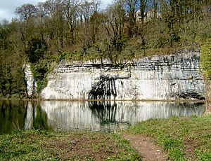
The cliffs in Chee Dale are made of 'Chee Tor Limestone', which is a very strong type of limestone. These cliffs are popular for rock climbing. The village of Wormhill is close by on the north side of the valley.
Miller's Dale
In Miller's Dale, you'll see two large railway bridges, called viaducts. They were built in 1866 and 1905 to carry four railway lines. Millers Dale railway station used to be a very busy place for trains. Now, it's a main visitor center for the Monsal Trail.
Monk's Dale is a quiet, steep valley on the north side. It's named after a farm that was set up there by monks a long time ago. The Limestone Way footpath crosses Miller's Dale and goes up Monk's Dale. Further downstream, you'll find Tideswell Dale. Ravenstor cliff, at the end of Tideswell Dale, is another favorite spot for rock climbers.
Beyond Tideswell Dale is Litton Mill, an old cotton factory from 1782. The Wye Valley then becomes Water-cum-Jolly Dale. Here, Cressbrook Dale joins the main valley. Another cotton factory, Cressbrook Mill, built in 1815, stands out by the river. The valley then turns into Upperdale before the river reaches Monsal Head.
Monsal Dale
The Monsal Trail crosses the famous Monsal Head stone viaduct. This bridge was built in 1863 for the railway. It is 90 meters (295 feet) long and up to 20 meters (66 feet) high. Fin Cop hill overlooks Monsal Dale. It has an Iron Age hillfort, which is a very old fort from ancient times. This hillfort is now a protected historical site.
The A6 road goes down Taddington Dale and then follows the river again. Deep Dale joins the valley on the south side here. Kirk Dale is also on the south side near Ashford-in-the-Water. After Ashford-in-the-Water, the valley gets wider. The River Wye then flows into the River Derwent near Bakewell at Rowsley.
Wye Valley Nature and Wildlife
The Wye Valley is a very special place for nature. It's called a Site of Special Scientific Interest (SSSI) for over 9 miles (14.5 km) east of Buxton. This protected area includes many dales like Cunning Dale, Woo Dale, Chee Dale, and Monsal Dale.
These dales have old woodlands with trees like ash and wych elm. You can also find yew and rock whitebeam trees. The valley is home to many different kinds of wildflowers. If you're lucky, you might spot dippers. These birds dart low over the river and bob on rocks in the water.
Several parts of the Wye Valley are protected nature reserves. These include Deep Dale and Topley Pike, Chee Dale, and Miller's Dale quarry. The Derbyshire Wildlife Trust helps look after these areas. Monk's Dale and Cressbrook Dale are also part of the Derbyshire Dales National Nature Reserve. They are especially important for the tiny plants called lichens that grow on the limestone rocks.
 | Bayard Rustin |
 | Jeannette Carter |
 | Jeremiah A. Brown |


