Yarraman, Queensland facts for kids
Quick facts for kids YarramanQueensland |
|||||||||||||||
|---|---|---|---|---|---|---|---|---|---|---|---|---|---|---|---|
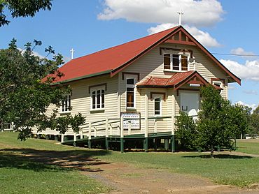
Our Lady of Dolours Roman Catholic church in Yarraman
|
|||||||||||||||
| Population | 1,127 (2021 census) | ||||||||||||||
| • Density | 8.764/km2 (22.70/sq mi) | ||||||||||||||
| Postcode(s) | 4614 | ||||||||||||||
| Elevation | 407 m (1,335 ft) | ||||||||||||||
| Area | 128.6 km2 (49.7 sq mi) | ||||||||||||||
| Time zone | AEST (UTC+10:00) | ||||||||||||||
| Location | |||||||||||||||
| LGA(s) | Toowoomba Region | ||||||||||||||
| County | Cavendish | ||||||||||||||
| Parish | Cooyar | ||||||||||||||
| State electorate(s) | Nanango | ||||||||||||||
| Federal Division(s) | Maranoa | ||||||||||||||
|
|||||||||||||||
Yarraman is a small town and area in the Toowoomba Region of Queensland, Australia. In 2021, about 1,127 people lived in Yarraman.
Contents
Where is Yarraman Located?
Yarraman is about 181 kilometers (112 miles) northwest of Brisbane, the capital city of Queensland. It sits where the New England Highway and D'Aguilar Highway meet.
The town is in a rich valley. It produces things like timber, grain, beef, and dairy products. These goods are then sent to bigger cities.
Yarraman is surrounded by parts of the Bunya Mountains and Yarraman Important Bird Area. This area is home to the largest group of the rare black-breasted button-quail. In the far west, the Meandu Mine digs up coal for a nearby power station.
What is the History of Yarraman?
The name Yarraman means horse in an old language used by Aboriginal stockmen in eastern Australia. It might come from the word yira or yera, which means large teeth.
In the 1870s, the creek at Yarraman was a meeting place for local farmers and stockmen. They would meet there to trade cattle. The town itself started in the late 1870s.
How Did Schools Start in Yarraman?
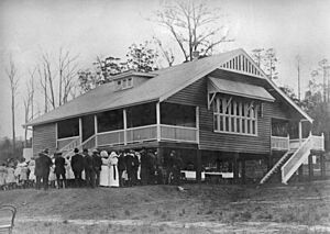
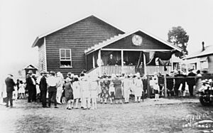
Yarraman Creek Provisional School opened on July 17, 1901. It started with 10 students. On January 1, 1909, it became Yarraman Creek State School. A new school building was built on a different site in 1914. In 1935, its name changed to Yarraman State School.
In 1963, the school added a high school section for older students. It began with 47 students. A pre-school for younger children was added in 1980.
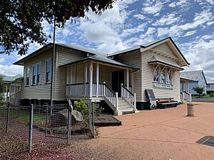
Rocky Hill Provisional School opened on October 30, 1924. It became Rocky Hill State School in 1929. This school closed in 1963. Its building was moved to Yarraman and used for community events. In 2016, it was moved again to the Yarraman Heritage House. It will be fixed up to show old classrooms and school displays.
Timber and Trains in Yarraman
Because there were many large hoop pine forests nearby, a timber mill was built in 1910. This mill helped the town grow.
The town was connected to Brisbane and Ipswich by the Brisbane Valley railway line in 1913. This railway line helped transport goods and people. However, the Brisbane Valley Railway Line closed in 1988.
Community Groups and War Time
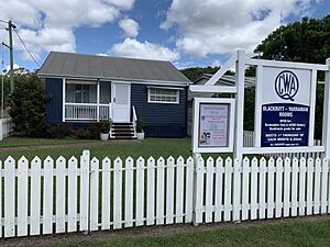
The Queensland Country Women's Association (QCWA) started a group in Yarraman in 1923. They raised money and opened a new QCWA Hall in 1928. The Yarraman QCWA building was later removed and sold. In 2014, a new Blackbutt and Yarraman QCWA branch was formed.
During World War II, Yarraman was home to a special fuel depot for aircraft. This depot was built in 1942 and closed in 1944. It was one of 31 such depots across Australia. They stored fuel for the RAAF (Royal Australian Air Force) and the US Army Air Forces.
The Sacred Heart Convent was finished in 1945. The Sisters of Mercy opened a boarding school for boys there in 1946. This school closed in 1966. Today, the building is used as the Yarraman Heritage House.
Yarraman Today
The Yarraman Library opened in 1982. It was updated in 2016 with new furniture and paint. The Toowoomba Regional Council now runs the library.
Between 2002 and 2018, the old Brisbane Valley railway line was turned into the Brisbane Valley Rail Trail. This is the longest rail trail in Australia, stretching 161 kilometers (100 miles). It is used for walking, cycling, and horse riding.
How Many People Live in Yarraman?
The number of people living in Yarraman has changed over the years, as shown in the table below.
| Year | Number of people | Census data link |
|---|---|---|
| 2001 census | 897 | |
| 2006 census | 945 | |
| 2011 census | 1,230 | |
| 2016 census | 1,064 | |
| 2021 census | 1,127 |
What Schools are in Yarraman?
Yarraman State School is a government school for students from Prep (the first year of school) to Year 9. It is located at 17 John Street. In 2022, the school had 187 students.
For students in Years 10 to 12, the closest high school is Nanango State High School in Nanango.
What Services and Attractions Does Yarraman Have?
The Yarraman Library and Post Office are on the corner of Toomey and Douglas Streets. They offer free wireless internet access. The library was updated in 2016.
The Yarraman Memorial Pool is on Margaret Street, along the New England Highway. It's a great place to cool off.
The Blackbutt Yarraman branch of the Queensland Country Women's Association meets at the QCWA Hall in Blackbutt.
Yarraman also has its own community radio station, Wild Horse FM 99.7.
There are three churches in Yarraman: St Philip's Anglican Church, Our Lady of Dolours Catholic Church, and Calvary Lutheran Church.
What Can You Do in Yarraman?
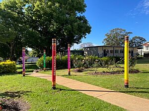
Yarraman is the northern end of the Brisbane Valley Rail Trail. This trail is perfect for walking, cycling, and horse riding. It starts at Yarraman Station Park on McNeil Street.
 | Toni Morrison |
 | Barack Obama |
 | Martin Luther King Jr. |
 | Ralph Bunche |


