Yeerongpilly, Queensland facts for kids
Quick facts for kids YeerongpillyBrisbane, Queensland |
|||||||||||||||
|---|---|---|---|---|---|---|---|---|---|---|---|---|---|---|---|
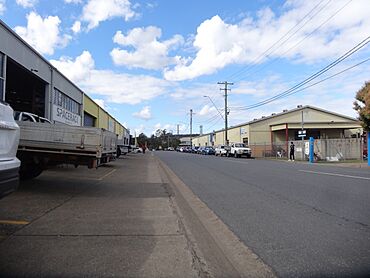
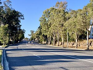
Station Road Industrial Area
|
|||||||||||||||
| Population | 2,033 (2021 census) | ||||||||||||||
| • Density | 1,070/km2 (2,800/sq mi) | ||||||||||||||
| Postcode(s) | 4105 | ||||||||||||||
| Area | 1.9 km2 (0.7 sq mi) | ||||||||||||||
| Time zone | AEST (UTC+10:00) | ||||||||||||||
| Location | 8.5 km (5 mi) SW of Brisbane CBD | ||||||||||||||
| LGA(s) | City of Brisbane (Tennyson Ward) |
||||||||||||||
| State electorate(s) | Miller | ||||||||||||||
| Federal Division(s) | Moreton | ||||||||||||||
|
|||||||||||||||
Yeerongpilly is a suburb located in the southern part of Brisbane, Queensland, Australia. It is part of the City of Brisbane area. In 2021, about 2,033 people lived in Yeerongpilly.
Contents
Exploring Yeerongpilly's Location
Yeerongpilly is about 8.5 kilometers (5.3 miles) south-west of the main post office in Brisbane City. A small part of its north-eastern border follows Ipswich Road.
The Brisbane River forms a very small part of Yeerongpilly's northern edge. Also, a small section of its western edge follows Oxley Creek.
A Look Back: Yeerongpilly's History
The name Yeerongpilly comes from an Aboriginal word. Some say it means "rain coming." Others believe it comes from words meaning "rain" or "sandy/gravelly," with "pilly" meaning a gully or watercourse.
Yeerongpilly first grew from an area called Boggo. This area was important for cutting timber that was used in Brisbane.
In the late 1800s, several new areas for homes were advertised for sale. These included "Lathorn Estate" in 1885, "Ortive Estate" in 1887, and "Grand View Estate" in 1890. These sales helped the suburb grow.
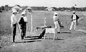
The Brisbane Golf Club was started in Yeerongpilly in 1896. This club is still a big part of the area today.
From 1909 to 2011, a special research center called the Animal Research Institute was located next to Fairfield Road. Scientists there studied animals.
Parts of Yeerongpilly were affected by the big floods in Queensland during 2010 and 2011. The damage from these floods was very high for the area.
Who Lives in Yeerongpilly?
In 2021, Yeerongpilly had a population of 2,033 people. Most people living here were born in Australia. Other common countries of birth include New Zealand, England, and India. Most residents speak English at home.
Historic Places in Yeerongpilly
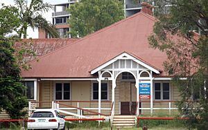
Yeerongpilly has several places that are listed for their historical importance. These "heritage-listed" sites include:
- 740 Fairfield Road: Trainmen's Quarters
- 681 Fairfield Road & 41 Godiva Street: Animal Research Institute Buildings
- 14 Grosvenor Street: Craigilea (a house)
- 53 Nathan Terrace: Former St Giles Uniting Church
- 12 Tees Street: Revoncourt (a house)
- 70 Tennyson Memorial Avenue: Brisbane Golf Club Clubhouse
- 32 Wingarra Street: Warra (a house)
Schools Near Yeerongpilly
Yeerongpilly itself does not have any schools. Children living in the suburb usually go to schools in nearby Yeronga. The closest primary school is Yeronga State School, and the closest high school is Yeronga State High School.
Getting Around Yeerongpilly
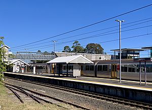
The Yeerongpilly railway station helps people travel around. You can catch regular trains from here to Brisbane, Beenleigh, and Ferny Grove.
There are also plans for a new train tunnel project called Cross River Rail. The southern entrance to this tunnel will be located near Dutton Park, which is close to Yeerongpilly.
Sports and Recreation
The Brisbane Golf Club is a large private golf club in Yeerongpilly. It has 36 holes and offers facilities like a driving range and a pro shop for golfers.
Famous People from Yeerongpilly
- Ken Archer: An Australian cricketer who was born in Yeerongpilly in 1928.
- Marty Mayberry: A Paralympic alpine skier who was born in 1986. He is a double leg amputee.
 | James Van Der Zee |
 | Alma Thomas |
 | Ellis Wilson |
 | Margaret Taylor-Burroughs |


