Yeronga, Queensland facts for kids
Quick facts for kids YerongaBrisbane, Queensland |
|||||||||||||||
|---|---|---|---|---|---|---|---|---|---|---|---|---|---|---|---|
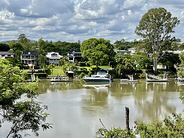
Looking across the Brisbane River towards Yeronga
|
|||||||||||||||
| Population | 7,062 (2021 census) | ||||||||||||||
| • Density | 2,018/km2 (5,230/sq mi) | ||||||||||||||
| Postcode(s) | 4104 | ||||||||||||||
| Area | 3.5 km2 (1.4 sq mi) | ||||||||||||||
| Time zone | AEST (UTC+10:00) | ||||||||||||||
| Location | 8.3 km (5 mi) S of Brisbane CBD | ||||||||||||||
| LGA(s) | City of Brisbane (Tennyson Ward) |
||||||||||||||
| State electorate(s) | Miller | ||||||||||||||
| Federal Division(s) | Moreton | ||||||||||||||
|
|||||||||||||||
Yeronga is a suburb located on the southern side of the Brisbane River in Brisbane, Queensland, Australia. It's a lovely place with a mix of homes and green spaces. In 2021, about 7,062 people called Yeronga home.
Contents
Exploring Yeronga's Geography
Yeronga is bordered by the Brisbane River to the west and north. To the south-east, you'll find Ipswich Road.
The "O Zone" Streets
Did you know that 16 streets in Yeronga West start with the letter 'O'? This area is even known as the 'O zone'! Many of these streets are named after old ships and passenger liners from a company called Orient Line. For example, you'll find Orvieto Road, Orsova Road, and Oriana Crescent. Some ship names were even used for more than one ship over time!
Streets Named After Architects
Four streets in Yeronga are named after famous architects. These include Dalton St, Grounds St, Seidler St, and Utzon St. It's a cool way to remember important designers!
Parks and Green Spaces
Yeronga has many parks and sports fields, especially near the river. This is because, a long time ago, there were lagoons here that were filled in and turned into green spaces. So, what were once water bodies are now places for everyone to enjoy!
A Look Back at Yeronga's History
The name Yeronga might come from Aboriginal words. Yarung means sandy or gravelly, and ba means place. Another idea is that it came from a house called Yerong-lea.
First People of Yeronga
The first people to live in the Yeronga area were the Jagera people. Their traditional land was on the south side of the Brisbane River.
Early European Visitors
In 1823, some of the first Europeans, including Thomas Pamphlett, John Finnigan, and Richard Parsons, passed through the Brisbane region. They were timber getters who got lost in a cyclone. They followed the Brisbane River through Yeronga. Later that year, explorer John Oxley also explored the river, guided by Finnigan.
How Yeronga Grew
After Brisbane became a settlement in 1825, more people started to move into the area. The first official land sale in Yeronga happened in 1854. Yeronga was first used for farming, with dairy farms and crops like cotton and sugar. Over time, it slowly changed into a residential area, especially after the railway opened.
A small coal mine was once here, but it didn't last long.
Schools and Churches Open
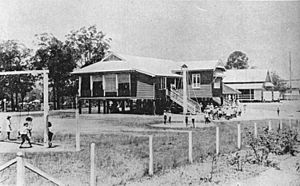
- Boggo National School opened in 1867 or 1871. It was later renamed Yeronga State School in 1886.
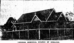
- On May 6, 1923, the Yeronga Memorial Church of England (now Christ Church Anglican) opened. It was built to remember 15 local men who died in World War I.
- St Joseph's Catholic Primary School opened in 1937 with 38 students. It is now known as St Sebastian's Catholic Primary School.
- Yeronga Infants State School opened in 1941 but later joined back with Yeronga State School in 1979.
- Yeronga State High School opened on January 25, 1960. It started with a principal, 12 teachers, and 217 students.
Changing Industries
The last farm in Yeronga was divided up for houses in the mid-1950s. Some areas became light industrial, with factories making paint and electrical appliances. These factories have now closed, and the area might become residential in the future.
Dealing with Floods
Parts of Yeronga have experienced floods from the Brisbane River, especially in 1974 and 2011. During these major floods, some roads were blocked, and only a few main streets remained open for access.
Who Lives in Yeronga?
In 2021, Yeronga had a population of 7,062 people. Most people living in Yeronga were born in Australia. Other common birthplaces include England and New Zealand. Most residents speak only English at home, but other languages like Greek and Mandarin are also spoken.
Historic Places in Yeronga
Yeronga has several places that are listed for their historical importance.
These include:
- Wyetah (a house) at 25 Belfast Street.
- Christ Church, Church Hall & Rectory at 12 Cork Street.
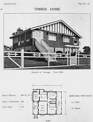
- Several historic houses on Dublin Street, like Knowle and Shottesbrooke.
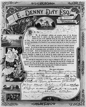
- Avoca (a house) at 36 Feez Street.
- Yeronga Memorial Park on Ipswich Road.
- The former Yeronga Fire Station at 785 Ipswich Road.
- Rhyndarra (a house) at 23 Riverview Place.
- Historic villas like Como and Astolat on Kadumba Street.
- John Mills' residence at 107 Kadumba Street.
- The former St Sebastian's Church School at 141 Kadumba Street.
- Killarney (a house) at 10 Killarney Street.
- The Yeronga Railway Station footbridge at 21A Park Road.
- Yeronga State School at 122–150 Park Road.
- The former Yeronga Congregational Church and Hall at 156 School Road.
- Yeronga Bowls Club at 171 School Road.
Learning in Yeronga
Yeronga has several schools for different age groups:
- Yeronga State School is a primary school for students from Early Childhood to Year 6. It's located at 122 Park Road.
- St Sebastian's Primary School is a Catholic primary school for Prep to Year 6 students at 141 Kadumba Street.
- Yeronga State High School is a secondary school for students in Years 7 to 12. You can find it at 159 Villa Street. It also has special programs for students needing extra support or learning English.
Community Facilities
The Fairfield Wastewater Treatment Plant is located in Yeronga, near the Brisbane River. It cleans wastewater before it goes back into the river.
Shops and Services in Yeronga
Yeronga has a main shopping area on Fairfield Road, right across from the railway station. Here you can find a post office, grocery stores, a butcher, bakeries, cafes, and medical services. There's also a smaller group of shops on Hyde Road with cafes and beauty salons. Yeronga's coffee shops are very popular!
Some older shopping areas have changed over time. For example, the shops on Orsova Road now have a jewellers and an Italian restaurant.
The former Strophair's auction complex has been turned into a retirement village. The Annerley-Yeronga branch of the Queensland Country Women's Association (QCWA) meets at the Annerley Yeronga Hall. Christ Church Anglican is also a community hub at 2-10A Cork Street.
Sports and Recreation
Yeronga is a great place for sports!
- The Stephens Croquet Club is in Yeronga Memorial Park.
- Souths Rugby plays rugby at Chipsy Wood Oval.
- Olympic FC plays soccer at Goodwin Park.
- The Yeronga Devils Australian Football team is based at Leyshon Park.
Getting Around Yeronga
Train Travel
Yeronga railway station is on the Beenleigh railway line. You can catch a train south to Beenleigh (and the Gold Coast) or north to Ferny Grove, passing through the Brisbane central business district. The railway opened in 1884, making it easier for people to travel to the city. Since 2014, trains run every 15 minutes, which is very convenient!
Bus Services
Yeronga also has two bus services. Route 107 goes to the city, and Route 105 goes to Indooroopilly. The first bus service to Yeronga started in 1940.
Famous People from Yeronga
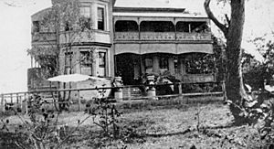
- Charles Hardie Buzacott (1835-1918) was a Post Master General for Queensland and owned the house Yerong-lea.
- Thomas Joseph Byrnes (1860-1898), who was Premier of Queensland, later bought Yerong-lea.
- Thomas Lodge Murray-Prior was another Post Master General and one of the first people to buy land in Yeronga.
- Lloyd Rees (1895-1988), a famous artist, was born in Yeronga. He wrote about playing by the Brisbane River when he was a boy.
 | Georgia Louise Harris Brown |
 | Julian Abele |
 | Norma Merrick Sklarek |
 | William Sidney Pittman |


