Yumbel facts for kids
Quick facts for kids
Yumbel
|
||||||
|---|---|---|---|---|---|---|

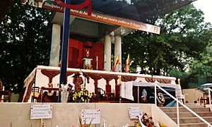
Traditional religious holiday of St. Sebastián of Yumbel.
|
||||||
|
||||||
| Country | Chile | |||||
| Region | Bío Bío | |||||
| Province | Bío Bío | |||||
| Government | ||||||
| • Type | City | |||||
| Area | ||||||
| • Total | 727.0 km2 (280.7 sq mi) | |||||
| Elevation | 87 m (285 ft) | |||||
| Population
(2012 Census)
|
||||||
| • Total | 20,034 | |||||
| • Density | 27.5571/km2 (71.373/sq mi) | |||||
| • Urban | 10,935 | |||||
| • Rural | 9,563 | |||||
| Sex | ||||||
| • Men | 10,442 | |||||
| • Women | 10,056 | |||||
| Time zone | UTC−4 (CLT) | |||||
| • Summer (DST) | UTC−3 (CLST) | |||||
| Area code(s) | 56 + 43 | |||||
| Website | Municipality of Yumbel | |||||
Yumbel is a city and a commune (like a local district) in the Bío Bío Province of Chile. It is located in the Bío Bío Region.
History of Yumbel
Yumbel started as a small fort called San Felipe de Austria. This fort was built in 1585 by Governor Alonso de Sotomayor. It was on a hill known as Cerro del Centinela.
The Mapuche people destroyed this fort. But in 1603, a new fort was built by Governor Alonso de Ribera. It was named Santa Lucia de Yumbel. This fort was also destroyed in 1621 but rebuilt in the same year.
The fort was used until 1648. Then, the soldiers moved to another fort. In 1663, Governor Ángel de Peredo built it again, calling it Nuestra Señora de Almudena. Three years later, Francisco de Meneses Brito helped people settle there. He renamed it San Carlos de Austria de Yumbel.
Later, during the time of Diego González Montero Justiniano, the growing settlement was called Santa Lucia de Yumbel. In 1766, Governor Antonio de Guill y Gonzaga officially recognized it as a town.
Yumbel did not grow much until the Chilean War of Independence. During this war, both sides took control of the town at different times. In late 1820, a Spanish fighter named Juan Manuel Picó burned the town.
The town was badly damaged by a big earthquake on February 20, 1835. It was rebuilt north of its old spot on August 29, 1836. For a while, Yumbel shared the role of capital with another town, San Luis Gonzaga. But on June 2, 1853, Yumbel was officially confirmed as the capital. On March 19, 1871, Yumbel became a city.
Geography of Yumbel
Yumbel is located a few kilometers northeast of where two important rivers meet. These rivers are the Laja and the Biobío River.
The Biobío River forms a natural border. It separates two main natural areas of Chile. To the north is the Central Zone. To the south is the Southern Zone.
People of Yumbel
A census is a count of people. According to the 2002 census, Yumbel covers an area of 727 square kilometers. It had 20,498 people living there. This included 10,442 men and 10,056 women.
More than half of the people, 10,935 (53.3%), lived in urban areas. These are city or town areas. The rest, 9,563 (46.7%), lived in rural areas, which are countryside areas. The population of Yumbel grew slightly by 0.2% between 1992 and 2002.
How Yumbel is Governed
Yumbel is a commune, which is a local government area. It is a third-level administrative division of Chile. This means it's a smaller part of the country's government system.
A municipal council manages the commune. The leader of this council is an alcalde (mayor). The alcalde is chosen directly by the people every four years. From 2008 to 2012, the alcalde was Camilo Cabezas Vega.
Yumbel is also part of larger electoral divisions of Chile. These divisions help choose people for the country's parliament. In the Chamber of Deputies, Yumbel is represented by certain members. These include Jorge Sabag and Frank Sauerbaum. They represent Yumbel and many other communes in their district.
In the Senate, Yumbel is represented by Alejandro Navarro Brain and Hosain Sabag Castillo. They represent a larger area called the Biobío-Cordillera senatorial constituency.
See also
 In Spanish: Yumbel para niños
 | James Van Der Zee |
 | Alma Thomas |
 | Ellis Wilson |
 | Margaret Taylor-Burroughs |


