Zuni Mountains facts for kids
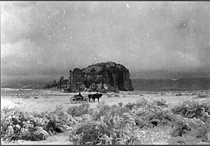
The Zuni Mountains are a mountain range mostly found in Cibola County, in the northwest part of New Mexico. A small part of the mountains also reaches into McKinley County. These mountains are largely within the Cibola National Forest. You can find them south of Interstate 40, stretching from southeast of Gallup to southwest of Grants.
The Zuni Mountains are about sixty miles (97 km) long and forty miles (64 km) wide. The highest point in the range is Mount Sedgwick, which stands tall at 9,256 feet (2,821 meters). The lowest parts of the mountains are around 6,400 feet (1,950 meters) high.
Contents
Where are the Zuni Mountains?
The Zuni Mountains are located at 35°10′4″N 108°19′0″W / 35.16778°N 108.31667°W. They are surrounded by several important areas:
- The Zuni Indian Reservation
- The Ramah Navajo Indian Reservation
- El Morro National Monument (to the southwest)
- El Malpais National Monument (to the south)
- Acoma Pueblo (to the east)
- The Navajo Nation (to the north)
The towns of Grants, Gallup, and Ramah are also near the mountains. Grants is to the northeast, Gallup to the northwest, and Ramah to the southwest. The Zuni Mountains are part of the Continental Divide, which is like a big line across North America where water flows to different oceans. They also form part of the southeastern edge of the Colorado Plateau.
A Look at Zuni Mountain History
The Zuni Mountains have a rich history, especially with the local Native American peoples. Groups like the Zuni, Acoma, and Navajo have used these mountains for a very long time.
In the early 1900s, there was a lot of logging (cutting down trees) in the mountains. Later, in the mid-1900s, people also used the land for farming and mining. They mined for materials like copper and fluorspar.
How the Zuni Mountains Were Formed
The Zuni Mountains are an "uplift," which means a part of the Earth's crust that has been pushed up. At their center, you'll find very old rocks called Precambrian granite and metamorphic rocks. These are surrounded by younger layers of rock from the Late Permian, Triassic, and Jurassic periods.
Over time, about 20,000 feet (6,100 meters) of rock layers that used to cover the mountains have worn away. These older layers can still be seen in areas to the west and northeast, like in the San Juan Basin.
The Precambrian rocks in the Zuni Mountains were first pushed up during a mountain-building event called the Ancestral Rocky Mountains orogeny, which happened during the Pennsylvanian Period. The mountains you see today were mainly formed by another big uplift event called the Laramide Orogeny. This happened about 80 to 40 million years ago, during the Cretaceous and Paleogene periods.
See also
 In Spanish: Sierra de Zuñi para niños
 | Toni Morrison |
 | Barack Obama |
 | Martin Luther King Jr. |
 | Ralph Bunche |


