Arizona City, Arizona facts for kids
Quick facts for kids
Arizona City, Arizona
|
|
|---|---|
 |
|
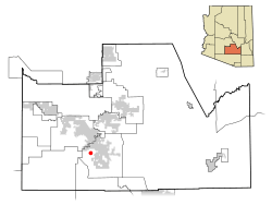
Location in Pinal County and Arizona
|
|
| Country | United States |
| State | Arizona |
| County | Pinal |
| Established | 1959 |
| Area | |
| • Total | 6.21 sq mi (16.08 km2) |
| • Land | 6.13 sq mi (15.88 km2) |
| • Water | 0.08 sq mi (0.20 km2) |
| Elevation | 1,509 ft (460 m) |
| Population
(2020)
|
|
| • Total | 9,868 |
| • Density | 1,609.00/sq mi (621.23/km2) |
| Time zone | UTC-7 (MST (no daylight saving time)) |
| ZIP code |
85123
|
| Area code(s) | 520 |
| FIPS code | 04-03530 |
| GNIS feature ID | 0000770 |
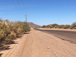
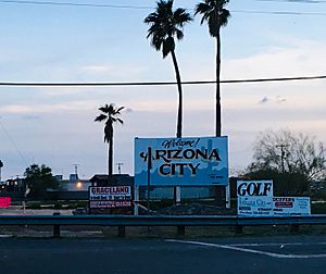
Arizona City is a community in Pinal County, Arizona, United States. It is a census-designated place (CDP), which means it's a special area defined for gathering census data.
Arizona City is located between Phoenix and Tucson. It's about 60 miles (97 km) from both big cities. In 2020, about 9,868 people lived there.
This community is mostly a quiet place where people live. It has a 48-acre (19-hectare) man-made lake. Many "snowbirds" (people who move to warmer places for winter) visit Arizona City. This makes the population grow a lot during the colder months.
Contents
History of Arizona City
The area where Arizona City is now was once a resting spot. This was for Juan Bautista de Anza's group in 1775. They were on a long journey. This spot is part of the Juan Bautista de Anza National Historic Trail. This trail goes from Mexico to California.
Arizona City was founded in 1959 by Jack McRae. He bought land in the Santa Cruz Valley. He chose this spot because of the clean, deep water from the Santa Cruz River. The water was known for being very pure.
The community grew over time. Arizona City started appearing on maps in 1963. The name of the town is still a mystery.
During the Cold War, the area had special concrete targets. These were used to test cameras on Corona satellites. These satellites helped the U.S. spy on the Soviet Union and China. Many targets are gone, but one still exists today.
Geography of Arizona City
Arizona City is located at about 32.75 degrees North and 111.68 degrees West. It covers about 6.2 square miles (16.1 square kilometers). Most of this area is land, with a small part being water.
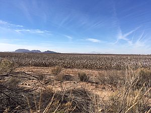
The community is about 1,509 feet (460 meters) above sea level. It sits in a flat area called the Santa Cruz Flats. The ground here has sunk over 20 feet (6 meters) in 50 years. This is because a lot of underground water has been used. Sometimes, new cracks in the ground, called earth fissures, can appear because of this.
Arizona City is mostly flat. It is surrounded by three low mountain ranges. These are the Sawtooth Mountains, Picacho Mountains, and Casa Grande Mountains. Picacho Peak, a tall mountain, is about 20 miles (32 km) to the southeast. To the west is the large Tohono O'odham Indian Reservation.
 |
Casa Grande | Casa Grande | Eloy |  |
| Chuichu | Eloy | |||
| Tohono O'odham Indian Reservation | Tohono O'odham Indian Reservation | Eloy |
Climate in Arizona City
| Weather chart for Arizona City | |||||||||||||||||||||||||||||||||||||||||||||||
|---|---|---|---|---|---|---|---|---|---|---|---|---|---|---|---|---|---|---|---|---|---|---|---|---|---|---|---|---|---|---|---|---|---|---|---|---|---|---|---|---|---|---|---|---|---|---|---|
| J | F | M | A | M | J | J | A | S | O | N | D | ||||||||||||||||||||||||||||||||||||
|
0.2
69
37
|
0.8
72
40
|
0.3
79
45
|
0.1
87
51
|
0.1
96
59
|
0.1
105
68
|
0.8
106
76
|
0.8
104
75
|
0.6
100
68
|
0.6
90
55
|
0.5
77
43
|
0.6
67
36
|
||||||||||||||||||||||||||||||||||||
| temperatures in °F precipitation totals in inches |
|||||||||||||||||||||||||||||||||||||||||||||||
|
Metric conversion
|
|||||||||||||||||||||||||||||||||||||||||||||||
Arizona City has a hot desert climate. This is typical for the Sonoran Desert. Summers are very long and extremely hot. Winters are mild and pleasant.
The area gets only about 5.28 inches (134 mm) of rain each year. Winter days are usually sunny and mild, around 65 to 75°F (18 to 24°C). Nights get much cooler, averaging 35 to 45°F (2 to 7°C). Temperatures can sometimes drop below freezing. The coldest temperature ever recorded was 13°F (-11°C).
In summer, high temperatures are usually between 100 and 110°F (38 and 43°C). Sometimes, heat waves push temperatures above 115°F (46°C). The hottest temperature ever recorded was 119°F (48°C).
During summer, the North American Monsoon brings strong winds and heavy rain. Many parts of Arizona City are in a floodplain. This means they can experience flash flooding during heavy monsoon storms. The area also gets many dust storms due to nearby farmlands. These can happen any time of year when it's windy.
| Climate data for Arizona City, Arizona | |||||||||||||
|---|---|---|---|---|---|---|---|---|---|---|---|---|---|
| Month | Jan | Feb | Mar | Apr | May | Jun | Jul | Aug | Sep | Oct | Nov | Dec | Year |
| Record high °F (°C) | 87 (31) |
91 (33) |
98 (37) |
103 (39) |
114 (46) |
119 (48) |
118 (48) |
116 (47) |
113 (45) |
107 (42) |
94 (34) |
85 (29) |
119 (48) |
| Mean daily maximum °F (°C) | 68.5 (20.3) |
72.0 (22.2) |
78.5 (25.8) |
87.4 (30.8) |
96.4 (35.8) |
105.1 (40.6) |
106.4 (41.3) |
104.2 (40.1) |
100.3 (37.9) |
90.0 (32.2) |
77.4 (25.2) |
67.4 (19.7) |
87.8 (31.0) |
| Mean daily minimum °F (°C) | 36.7 (2.6) |
40.0 (4.4) |
44.5 (6.9) |
50.8 (10.4) |
59.2 (15.1) |
67.7 (19.8) |
75.5 (24.2) |
74.9 (23.8) |
67.8 (19.9) |
55.1 (12.8) |
43.1 (6.2) |
36.0 (2.2) |
54.3 (12.4) |
| Record low °F (°C) | 13 (−11) |
19 (−7) |
23 (−5) |
27 (−3) |
29 (−2) |
44 (7) |
58 (14) |
54 (12) |
38 (3) |
30 (−1) |
22 (−6) |
15 (−9) |
13 (−11) |
| Average precipitation inches (mm) | 0.22 (5.6) |
0.79 (20) |
0.25 (6.4) |
0.05 (1.3) |
0.06 (1.5) |
0.07 (1.8) |
0.76 (19) |
0.84 (21) |
0.61 (15) |
0.59 (15) |
0.46 (12) |
0.58 (15) |
5.28 (134) |
People in Arizona City
| Historical population | |||
|---|---|---|---|
| Census | Pop. | %± | |
| 1990 | 1,940 | — | |
| 2000 | 4,385 | 126.0% | |
| 2010 | 10,475 | 138.9% | |
| 2020 | 9,868 | −5.8% | |
| U.S. Decennial Census | |||
Arizona City was first counted as a CDP in the 1990 U.S. Census. In 2010, the population was 10,475 people. This was a big jump from 4,385 people in 2000.
About 7.5% of the people were under 5 years old. About 26.5% were between 5 and 18 years old. About 18.8% of the population was 65 or older.
Most homes were owned by the people living in them. The average household had about 2.56 people. About 83.4% of people had at least a high school diploma.
Economy of Arizona City
For a long time, the main jobs in Arizona City were on farms. There were also a few service jobs in town. But this might change soon.
Arizona City is in a growing area called the Arizona Sun Corridor. Several big projects are planned nearby. These could bring many new jobs and visitors.
One project is Dreamport Villages. This huge resort will be north of Arizona City. It plans to have extreme sports, water parks, and an amusement park. Another project is the Attesa Motorsports Park. This will be a large complex for motorsports. It is expected to create over 10,000 jobs.
A company called Lucid Motors is building an electric car factory nearby. This factory will be in Casa Grande and will hire 2,000 workers. These new businesses could help Arizona City's economy grow a lot.
Getting Around and Things to Do
Transportation in Arizona City
 Interstate 8
 Interstate 10
Two major highways, Interstate 8 and Interstate 10, meet just 3 miles (4.8 km) north of Arizona City. These highways connect the community to big cities like Phoenix, Tucson, and Yuma. They also lead to San Diego and Los Angeles in California. You can get to both highways from Sunland Gin Road.
The main roads in Arizona City are Battaglia Drive (east-west) and Sunland Gin Road (north-south). The only traffic light in town is where these two roads meet.
The closest major airports are Phoenix Sky Harbor International Airport and Tucson International Airport. There are shuttle services to Sky Harbor.
Attractions in Arizona City
- Arizona City Golf Course: This 18-hole golf course opened in 1963. It has a clubhouse and restaurant. It reopened in November 2021.
- Paradise Lake: This is a 48-acre (19-hectare) man-made lake. It's in the southern part of Arizona City. You can go sailing and fishing here.
- Skydive Arizona: This is the world's largest skydiving center. It's about 9 miles (14 km) northeast of Arizona City.
- Picacho Peak State Park: Located about 20 miles (32 km) east, this park has hiking trails, camping, and picnic areas.
- Casa Grande Ruins National Monument: About 20 miles (32 km) north, you can see old Hohokam ruins here. They offer public tours at certain times.
Events in Arizona City
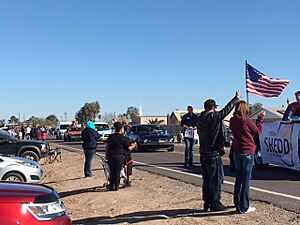
Every February, Arizona City hosts the Arizona City Daze. This is a fun street festival. It has food and merchandise vendors, a car show, a parade, and carnival rides. There is also live entertainment. This event usually happens on the last weekend of February.
Education in Arizona City
The only school in Arizona City is Arizona City Elementary School. It is part of the Toltec School District. Students from this school usually go to high schools in Casa Grande.
- Arizona City Elementary School: This school serves students from kindergarten to 8th grade. It is in the western part of Arizona City.
- Casa Grande Union High School: This high school is about 16 miles (26 km) north in Casa Grande.
- Vista Grande High School: This high school is about 11 miles (18 km) north in Casa Grande.
See also
 In Spanish: Arizona City para niños
 | James Van Der Zee |
 | Alma Thomas |
 | Ellis Wilson |
 | Margaret Taylor-Burroughs |


