
Arlington, Tennessee facts for kids
Quick facts for kids
Arlington, Tennessee
|
|||
|---|---|---|---|
|
|||

Location of Arlington in Shelby County, Tennessee.
|
|||

Arlington, Tennessee
Location in Tennessee

Arlington, Tennessee
Location in the United States

Arlington, Tennessee
Location in North America
|
|||
| Country | |||
| State | |||
| County | Shelby | ||
| First settled | 1830 | ||
| Incorporated (as Haysville) | 1878 | ||
| Incorporated (as Arlington) | 1900 | ||
| Area | |||
| • Total | 23.16 sq mi (59.99 km2) | ||
| • Land | 23.15 sq mi (59.96 km2) | ||
| • Water | 0.01 sq mi (0.03 km2) | ||
| Elevation | 282 ft (86 m) | ||
| Population
(2020)
|
|||
| • Total | 14,549 | ||
| • Density | 628.47/sq mi (242.65/km2) | ||
| Time zone | UTC-6 (Central (CST)) | ||
| • Summer (DST) | UTC-5 (CDT) | ||
| ZIP code |
38002, 38028
|
||
| Area code(s) | 901 | ||
| FIPS code | 47-01740 | ||
| GNIS feature ID | 1304869 | ||
| Website | www.townofarlington.org | ||


Arlington is a town in the U.S. state of Tennessee. It is one of seven towns in Shelby County. The town was first called Haysville when it became official in 1878. It was then renamed Arlington and became official again in 1900.
In 2000, about 2,569 people lived there. By 2010, the population grew to 11,517. In 2020, 14,549 people called Arlington home. This means the town grew by over 26% between 2010 and 2020!
Contents
History of Arlington
Early Days and First Settlers
The land where Arlington is today was once home to the Chickasaw Nation. Later, this area became part of the United States. In 1819, Shelby County was created. It was named after Isaac Shelby, a hero from the American Revolutionary War. By the 1830s, fewer than 20 people had settled in this new community.
The Railroad Arrives
By 1856, about 200 people lived in the area. Most people were cotton farmers. They needed a way to ship their crops. So, a train station called Withe Depot was built. General Samuel J. Hays, a relative of President Andrew Jackson, gave the land for the depot.
The depot became a very important place for shipping cotton. Because General Hays donated the land, the community was named Haysville.
The railroad helped Haysville grow and connect with other places. A local train, called "The Accommodation," took people to Memphis for work and school. People say the train crew knew the daily passengers. Sometimes, they would even slow down the train for people running late!
After the Civil War
The American Civil War caused many changes in Haysville. Many local men went to fight, and some never came home. This affected the town's growth.
After the war, in 1872, General Hays's land was divided and sold. New streets were named after important people like Bishop Charles Quintard and General Nathan Bedford Forrest. The first house was built by Captain Henry Munger Pitman, who worked at the train depot.
Becoming Arlington
In 1883, the town needed its own post office. But there was already a "Haysville" post office in Tennessee! So, Captain Henry Pitman suggested a new name: "Arlington." He got the idea from Arlington National Cemetery in Virginia.
The first school, Memphis District High School, opened in 1884. It was built by the Methodist Church and is now Hughes-College Hill Park. By this time, about 500 people lived in Arlington. The town had many businesses, like a sawmill, a gristmill (for grinding grain), a cotton gin, and several churches. By the late 1800s, Arlington also had a post office, a doctor's office, a druggist (pharmacy), a lumber store, a meat market, and an undertaker.
Arlington officially became a town again in December 1900. About 600 people lived there then. Early mayors included Will Taylor and Charles McAuley, who helped guide the town's growth.
Keeping History Alive
Arlington works hard to save its history. You can visit places like the Rachel H.K. Burrows Museum and the S.Y. Wilson & Company building. There's also a Blacksmith Shop and the Historic Post Office. In 2003, a new building was made to look like the old train depot. It is now the Arlington Senior Citizens Center. Many old houses from that time are still standing too.
Geography
Arlington covers about 23.16 square miles (59.99 square kilometers). Most of this area is land, with a very small amount of water.
Demographics
| Historical population | |||
|---|---|---|---|
| Census | Pop. | %± | |
| 1890 | 343 | — | |
| 1910 | 477 | — | |
| 1920 | 494 | 3.6% | |
| 1930 | 446 | −9.7% | |
| 1940 | 440 | −1.3% | |
| 1950 | 463 | 5.2% | |
| 1960 | 620 | 33.9% | |
| 1970 | 1,349 | 117.6% | |
| 1980 | 1,778 | 31.8% | |
| 1990 | 1,541 | −13.3% | |
| 2000 | 2,569 | 66.7% | |
| 2010 | 11,517 | 348.3% | |
| 2020 | 14,549 | 26.3% | |
| Sources: | |||
Population in 2020
In 2020, Arlington had 14,549 people living in 3,560 households. Many different groups of people live in Arlington. About 73% of the people were White, and about 13% were Black or African American. There were also people who were Asian, Native American, and from other backgrounds. About 5% of the population was Hispanic or Latino.
Population in 2010
In 2010, there were 11,517 people living in Arlington. The town was made up of many different people. About 81% were White, and about 13% were African American. There were also people who were Asian, Native American, and from other backgrounds. About 3% of the people were Hispanic or Latino.
The average age of people in Arlington was about 32 years old. Many young people lived there, with over 37% of the population being under 18.
Arts and Culture
Fun Events and Traditions
Depot Square has always been a central spot for community events in Arlington. For many years, people gathered for a "Brunswick Stew" reunion.
Today, Arlington hosts several popular events. These include "Arlington in April," "Music on the Square," and "Harvest Gathering." The town also has an annual Christmas Parade. These events help bring the community together and celebrate Arlington's history and culture.
Education
Arlington has its own school system called Arlington Community Schools. In 2013, there was about one teacher for every 18 students.
There are four schools in Arlington:
- Arlington Elementary School (Kindergarten to 5th grade)
- Donelson Elementary School (Kindergarten to 5th grade)
- Arlington Middle School (6th to 8th grade)
- Arlington High School (9th to 12th grade)
Arlington Community Schools started in 2014 with 4,907 students.
Notable People
- Jonathan Bowlan (born 1996), a baseball pitcher
- Latasha Byears (born 1973), a professional basketball player
- Clay Crosse (born 1967), a Christian music singer
- Cody Fowler (1892–1978), a lawyer
- James Ernest Karnes (1889–1966), a U.S. Army Sergeant
- Kenneth Walker III (born 2000), a professional football player
Images for kids
-
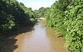
Loosahatchie River in Arlington

See also
 In Spanish: Arlington (Tennessee) para niños
