Austinville, Queensland facts for kids
Quick facts for kids AustinvilleGold Coast, Queensland |
|||||||||||||||
|---|---|---|---|---|---|---|---|---|---|---|---|---|---|---|---|

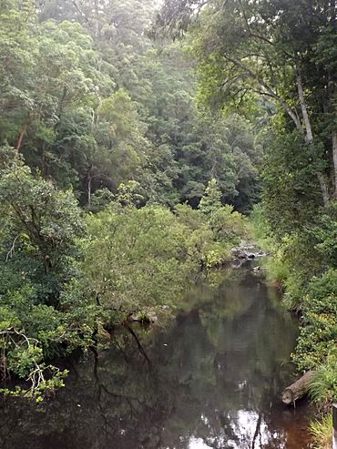
Mudgeeraba Creek, 2016
|
|||||||||||||||
| Population | 403 (2021 census) | ||||||||||||||
| • Density | 18.92/km2 (49.0/sq mi) | ||||||||||||||
| Postcode(s) | 4213 | ||||||||||||||
| Area | 21.3 km2 (8.2 sq mi) | ||||||||||||||
| Time zone | AEST (UTC+10:00) | ||||||||||||||
| LGA(s) | City of Gold Coast | ||||||||||||||
| State electorate(s) | Mudgeeraba | ||||||||||||||
| Federal Division(s) | McPherson | ||||||||||||||
|
|||||||||||||||
Austinville is a small place located in the beautiful Gold Coast Hinterland in Queensland, Australia. It's like a quiet neighbourhood surrounded by nature. In 2021, about 403 people lived there.
Where is Austinville?
Austinville is found in the green Gold Coast Hinterland. It sits between the towns of Mudgeeraba and Springbrook.
This area is in a valley, which is like a low area between hills. A creek called Mudgeeraba Creek flows through this valley. The tall, rocky Nimmel Range mountains can be seen nearby.
You'll find lots of amazing rainforest here. Some parts of Austinville, especially in the south, are protected as part of Springbrook National Park. This means the nature there is kept safe. Besides the national park, the land is used for homes and for animals to graze on the natural plants.
A Quick Look at Austinville's Past
Austinville started as a banana farm area in 1934. This makes it one of the oldest settled places in the Gold Coast. It was created to help people who didn't have jobs during a tough time called the Great Depression. The idea was to give them land to farm and help the economy.
The area was named after William Henry Austin. He was an important government official who helped set up many farms like this across Queensland.
Workers cleared the land and divided it into blocks. About 50 small homes were built for families. Mudgeeraba Creek flowed behind these homes, and the rugged Nimmel Range was on the western side.
However, this settlement didn't last very long. By 1939, just five years later, most families had moved away. The rainforest has now grown back over much of the land where bananas once grew. The area is still surrounded by protected nature.
Austinville also had its own school, Austinville State School. It opened on 25 June 1934 but closed a few years later on 9 June 1939.
Schools Near Austinville
There are no schools directly in Austinville. The closest primary school is Mudgeeraba Creek State School. It is located in the nearby area of Mudgeeraba. For high school students, the nearest government secondary school is Robina State High School. This school is in Robina, which is also close by.
 | Laphonza Butler |
 | Daisy Bates |
 | Elizabeth Piper Ensley |


