Bajool, Queensland facts for kids
Quick facts for kids BajoolQueensland |
|||||||||||||||
|---|---|---|---|---|---|---|---|---|---|---|---|---|---|---|---|

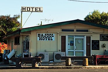
Bajool Hotel, 2022
|
|||||||||||||||
| Population | 447 (2021 census) | ||||||||||||||
| • Density | 0.7597/km2 (1.968/sq mi) | ||||||||||||||
| Postcode(s) | 4699 | ||||||||||||||
| Area | 588.4 km2 (227.2 sq mi) | ||||||||||||||
| Time zone | AEST (UTC+10:00) | ||||||||||||||
| Location |
|
||||||||||||||
| LGA(s) | Rockhampton Region | ||||||||||||||
| State electorate(s) | Mirani | ||||||||||||||
| Federal Division(s) | Flynn | ||||||||||||||
|
|||||||||||||||
Bajool is a small rural town and area in the Rockhampton Region of Queensland, Australia. It's a quiet place with lots of countryside around it. In 2021, about 447 people lived in Bajool.
Contents
Where is Bajool?
Bajool is located in Queensland, Australia. It's about 35 kilometers (22 miles) south of a bigger city called Rockhampton. If you travel north, you'll find Gladstone, which is about 74 kilometers (46 miles) away.
Roads and Railways
The main road that goes through Bajool is the Bruce Highway. This highway runs almost next to the railway line. The North Coast railway line also passes through Bajool. There are two railway stations in the area:
- Archer railway station
- Bajool railway station (which serves the town itself)
Mountains in the Area
Bajool is surrounded by several mountains. These include:
- Beschs Hill, which is 528 meters (1,732 feet) high.
- Mount Gindiwarra, standing at 398 meters (1,306 feet).
- Mount Helen, the tallest at 633 meters (2,077 feet).
- Mount Hopeful, almost as tall at 634 meters (2,080 feet).
- Mount Kelly, which is 310 meters (1,017 feet) high.
- Mount Mccamley, standing at 319 meters (1,047 feet).
History of Bajool
The name "Bajool" comes from the railway station, which was named in 1903. It's an Aboriginal name for a lagoon (a small lake) on a nearby property. Some people think the name means "Big Fella water hole" or "stop here."
Early Schools
Education has been important in Bajool for a long time.
- A school first opened in 1888 at Eight Mile Creek but closed a few times.
- In 1900, a small school started in a private home for just 10 students.
- By 1903, these small schools combined to form Bajool Provisional School.
- The school had to move because of the railway line being built.
- In 1904, it reopened on Mill Street, and by 1909, it became Bajool State School.
- Other schools, like Ulam Upper Provisional School and Ulam South Provisional School, also existed in the area but closed many years ago.
People in Bajool
The number of people living in Bajool has changed over the years.
- In 2011, there were 543 people.
- In 2016, the population was 455 people.
- In the most recent count in 2021, 447 people lived in the Bajool area.
Education Today
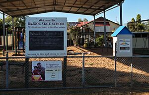
Bajool State School is the main school in the town. It's a government primary school for students from Prep (the first year of school) up to Year 6. It teaches both boys and girls.
- The school is located at 54-60 Toonda Street.
- In 2018, about 40 students were enrolled there.
There isn't a high school in Bajool itself. Older students usually travel to nearby towns for secondary education. The closest high schools are:
- Mount Larcom State School (up to Year 10) in Mount Larcom.
- Mount Morgan State High School (up to Year 12) in Mount Morgan.
- Rockhampton State High School (up to Year 12) in Wandal, Rockhampton.
What's in Bajool?
Bajool has a few important facilities.
Explosives Reserve
Bajool is home to one of Queensland's special government sites. This site is an "explosives reserve," also known as a "magazine." It's a safe place where explosives are stored. It's about 29 kilometers (18 miles) by road from the shipping area at Port Alma. For many years, from 1912 to 1986, there was a railway line that connected Bajool directly to Port Alma.
Other Facilities
- Bajool also has a cemetery, which is a burial ground. It's located at 18 School Road.
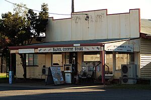
- You can also find the Bajool Country Store, which is a local shop.
 | Georgia Louise Harris Brown |
 | Julian Abele |
 | Norma Merrick Sklarek |
 | William Sidney Pittman |


