Bartle Frere, Queensland facts for kids
Quick facts for kids Bartle FrereQueensland |
|||||||||||||||
|---|---|---|---|---|---|---|---|---|---|---|---|---|---|---|---|

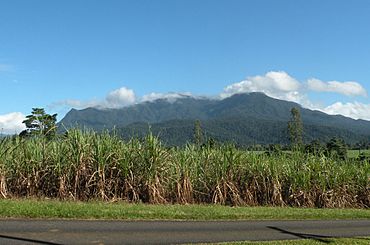
View across the canefields of Bartle Frere with Mount Bartle Frere in the distance, 2014
|
|||||||||||||||
| Population | 169 (2021 census) | ||||||||||||||
| • Density | 10.18/km2 (26.4/sq mi) | ||||||||||||||
| Postcode(s) | 4861 | ||||||||||||||
| Area | 16.6 km2 (6.4 sq mi) | ||||||||||||||
| Time zone | AEST (UTC+10:00) | ||||||||||||||
| Location | |||||||||||||||
| LGA(s) | Cairns Region | ||||||||||||||
| State electorate(s) | Hill | ||||||||||||||
| Federal Division(s) | Kennedy | ||||||||||||||
|
|||||||||||||||
Bartle Frere is a small country area in Queensland, Australia. It is located in the Cairns Region. In 2021, about 169 people lived there.
Contents
Exploring Bartle Frere's Geography
Bartle Frere is found south of a big mountain called Mount Bartle Frere. The land here is mostly flat and low, only about 10 to 20 metres above sea level. This land is used for farming.
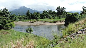
Farmers in Bartle Frere mostly grow sugarcane. The Russell River flows along the southern and eastern edges of the area.
The main road, the Bruce Highway, runs along the northern border of Bartle Frere. Right next to it is the North Coast railway line. This railway is just outside Bartle Frere, in a nearby place called Eubenangee.
A Look at Bartle Frere's History
The name "Bartle Frere" comes from the nearby Mount Bartle Frere. The mountain was named by an explorer named George Elphinstone Dalrymple. He named it on September 30, 1873.
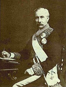
He chose the name to honour Sir Henry Bartle Frere. Sir Henry was the president of the Royal Geographical Society.
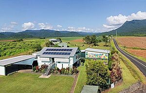
Bartle Frere State School first opened its doors on January 30, 1922. This school has been an important part of the community for many years.
Who Lives in Bartle Frere?
The number of people living in Bartle Frere changes over time.
- In 2011, there were 361 people living here.
- By 2016, the population was 137 people.
- In 2021, the number of people living in Bartle Frere was 169.
Education in Bartle Frere
Bartle Frere State School is a government primary school. It teaches students from Prep (the first year of school) up to Year 6. The school is located at 29 Price Road.
In 2018, the school had 11 students. It had 2 teachers and 4 other staff members helping out.
There are no high schools directly in Bartle Frere. Students who want to go to secondary school usually attend Babinda State School. This school is in Babinda, which is a town nearby. It offers education up to Year 12.
 | Aurelia Browder |
 | Nannie Helen Burroughs |
 | Michelle Alexander |


