Innisfail, Queensland facts for kids
Quick facts for kids InnisfailQueensland |
|||||||||||||||
|---|---|---|---|---|---|---|---|---|---|---|---|---|---|---|---|
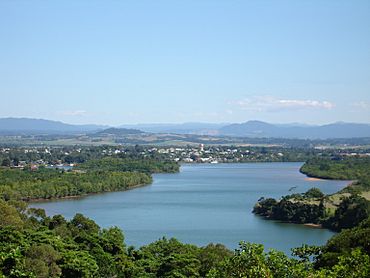
The township of Innisfail, as seen from Coquette Point
|
|||||||||||||||
| Population |
|
||||||||||||||
| • Density | 696/km2 (1,800/sq mi) | ||||||||||||||
| Established | 1882/83 | ||||||||||||||
| Postcode(s) | 4860 | ||||||||||||||
| Elevation | 10 m (33 ft) | ||||||||||||||
| Area | 10.3 km2 (4.0 sq mi) | ||||||||||||||
| Time zone | AEST (UTC+10:00) | ||||||||||||||
| Location |
|
||||||||||||||
| LGA(s) | Cassowary Coast Region | ||||||||||||||
| State electorate(s) | Hill | ||||||||||||||
| Federal Division(s) | Kennedy | ||||||||||||||
|
|||||||||||||||
|
|||||||||||||||
Innisfail is a town in Queensland, Australia. It is part of the Cassowary Coast Region. The town was first called Geraldton until 1910.
Innisfail is the biggest town in the Cassowary Coast Region. It is famous for its sugar and banana farms. It is also one of the wettest towns in Australia. In March 2006, a very strong storm called Tropical Cyclone Larry hit Innisfail. It caused a lot of damage.
In 2021, the town of Innisfail had 7,173 people. The town's centre had 1,091 people.
Contents
Exploring Innisfail's Location
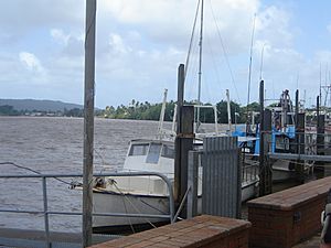
Innisfail's town centre is where the Johnstone River and South Johnstone River meet. This is about 5 km (3 mi) from the coast.
The town is surrounded by old tropical rainforests. There are also huge farmlands nearby. Queensland's tallest mountain, Mount Bartle Frere, is 15 kilometres (9 mi) to the north. It is part of Australia's Great Dividing Range.
The main shopping area is around Edith Street and Rankin Street.
Innisfail's Weather: A Tropical Climate
Innisfail has a tropical rainforest climate. This means it's always warm and wet. No month has an average temperature below 18 °C (64.4 °F). Also, no month gets less than 60 millimetres (2.4 in) of rain.
Innisfail is known for being one of the wettest towns in Australia. Another town, Babinda, which is 30 kilometres (19 mi) north, is usually considered the wettest.
Even in the drier winter months, there are still frequent showers. This is because of moist easterly winds. However, there is much less rain than in summer. From January to April, it can rain over 1,000 mm (39 in) in a month. Some months might not have a single dry day if the monsoon is very strong. The town gets about 63.5 clear days each year.
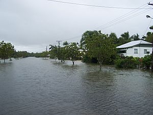
During the summer, which is "cyclone season," Innisfail is often threatened by tropical cyclones. These storms form in the Coral Sea. The heavy rain from these storms, plus Innisfail's location by the river, often causes flooding.
Weather information comes from the Innisfail weather station. It has recorded rain since 1881 and temperature since 1908. Sun data comes from the South Johnstone EXP weather station, which is 9.7 kilometres (6.0 mi) away.
| Climate data for Innisfail (17º31'12"S, 146º01'48"E, 10 m AMSL) (1881-2020 normals, 1957-2020 extremes and sun 1965-1999) | |||||||||||||
|---|---|---|---|---|---|---|---|---|---|---|---|---|---|
| Month | Jan | Feb | Mar | Apr | May | Jun | Jul | Aug | Sep | Oct | Nov | Dec | Year |
| Record high °C (°F) | 40.1 (104.2) |
40.8 (105.4) |
37.8 (100.0) |
34.2 (93.6) |
31.2 (88.2) |
29.5 (85.1) |
30.0 (86.0) |
30.4 (86.7) |
32.2 (90.0) |
35.6 (96.1) |
41.0 (105.8) |
40.3 (104.5) |
41.0 (105.8) |
| Mean daily maximum °C (°F) | 30.9 (87.6) |
30.7 (87.3) |
29.8 (85.6) |
28.3 (82.9) |
26.4 (79.5) |
24.6 (76.3) |
24.1 (75.4) |
25.1 (77.2) |
26.7 (80.1) |
28.4 (83.1) |
29.8 (85.6) |
30.8 (87.4) |
28.0 (82.3) |
| Mean daily minimum °C (°F) | 22.9 (73.2) |
22.9 (73.2) |
22.2 (72.0) |
20.6 (69.1) |
18.4 (65.1) |
16.3 (61.3) |
15.3 (59.5) |
15.5 (59.9) |
17.0 (62.6) |
19.0 (66.2) |
20.9 (69.6) |
22.1 (71.8) |
19.4 (67.0) |
| Record low °C (°F) | 17.2 (63.0) |
18.0 (64.4) |
17.2 (63.0) |
10.5 (50.9) |
9.4 (48.9) |
6.5 (43.7) |
6.2 (43.2) |
8.2 (46.8) |
10.1 (50.2) |
12.2 (54.0) |
16.0 (60.8) |
17.2 (63.0) |
6.2 (43.2) |
| Average precipitation mm (inches) | 512.3 (20.17) |
583.5 (22.97) |
663.2 (26.11) |
450.8 (17.75) |
302.6 (11.91) |
188.5 (7.42) |
137.5 (5.41) |
115.1 (4.53) |
85.3 (3.36) |
88.9 (3.50) |
156.0 (6.14) |
263.7 (10.38) |
3,549.5 (139.74) |
| Average precipitation days (≥ 1.0 mm) | 14.7 | 15.3 | 17.6 | 16.8 | 15.0 | 11.5 | 10.3 | 8.5 | 7.0 | 6.6 | 8.3 | 10.5 | 142.1 |
| Average afternoon relative humidity (%) | 72 | 74 | 73 | 73 | 72 | 70 | 69 | 66 | 65 | 65 | 67 | 69 | 70 |
| Average dew point °C (°F) | 23.6 (74.5) |
23.9 (75.0) |
22.8 (73.0) |
21.5 (70.7) |
19.5 (67.1) |
17.2 (63.0) |
16.3 (61.3) |
16.8 (62.2) |
18.3 (64.9) |
20.1 (68.2) |
21.7 (71.1) |
22.8 (73.0) |
20.4 (68.7) |
| Mean monthly sunshine hours | 201.5 | 155.4 | 170.5 | 165.0 | 142.6 | 165.0 | 173.6 | 198.4 | 222.0 | 254.2 | 240.0 | 229.4 | 2,317.6 |
| Percent possible sunshine | 50 | 43 | 45 | 47 | 41 | 50 | 50 | 55 | 62 | 66 | 62 | 56 | 52 |
| Source: Bureau of Meteorology (1881-2020 normals, extremes 1957-2020), (1965-1999 sun, sourced from South Johnstone EXP weather station, 9.7 km away) | |||||||||||||
Innisfail's Early History
Before Europeans arrived, the Innisfail area was home to five groups of the Mamu people. These Aboriginal people lived in the rainforest. They traveled the rivers in special canoes made from tree bark.
European Arrival and Early Settlement
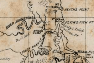
The first Europeans came in January 1872. They were survivors of a shipwreck called the "Maria." They landed near what is now the Johnstone River. Sub-Inspector Robert Arthur Johnstone came to rescue survivors. He also dealt with Aboriginal people thought to have harmed some crew members.
In mid-1873, Johnstone returned. He explored further upriver. He wrote that the area was beautiful. He saw a wide, fresh river with many Aboriginal people in canoes.
In October 1873, Johnstone came back with an expedition led by George Elphinstone Dalrymple. British settlement began on October 5, 1873. It was at the meeting point of the north and south branches of the Johnstone River. This first camp was named Nind's Camp after Philip Henry Nind.
Naming the Town: From Geraldton to Innisfail
In 1879, an Irishman named Thomas Henry Fitzgerald came to the area. He wanted to start a sugar industry. He brought many Kanaka South Sea Islander workers. There were also some Irish workers.
Fitzgerald built the first house, calling it Innisfallen. This name came from a large island in Ireland. Inis Fáil is an old Irish name for Ireland itself.
From 1879, the settlement was called Geraldton. This became official in July 1883. But on August 20, 1910, it was renamed "Innisfail." This was to avoid confusion with another town called Geraldton in Western Australia. Margaret-Mary Noone, a local resident, suggested the name Innisfail. It honored Fitzgerald's efforts and Ireland.
The Johnstone River Post Office opened in 1882. It was renamed Geraldton two months later. Then it became Innisfail in 1910.
Diverse Settlers and Early Services
From 1889, many different groups of people moved to Innisfail.
- The first main group was Anglo-Celtic.
- They were joined by many "Kanaka" South Sea Islanders.
- Aboriginal and Torres Strait Islander workers also came.
- Chinese miners helped develop the banana industry and opened shops.
- French merchants and German timber and sugar producers also settled here.
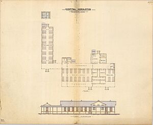
In May 1885, the Queensland Government asked for bids to build the Geraldton Hospital. It would replace a tent hospital. The new hospital was built for £1527.
Geraldton Provisional School opened on July 18, 1887. It had 15 boys and 13 girls. It became Geraldton State School in 1894. In 1908, the school moved to Emily Street. On April 8, 1913, its name changed to Innisfail State School. This was because the town's name had changed.
The Catholic Church established the Innisfail Parish in 1898.
Sacred Heart Catholic School opened on November 2, 1902. It had 42 students. Nuns from the Sisters of the Good Samaritan ran it. In 1975, it was renamed Good Counsel Catholic Primary School.
In 1906, Patrick Leahy started the Johnstone River Advocate newspaper. It is still published today as the Innisfail Advocate.
Community Growth and Challenges
In June 1912, the Johnstone River Agricultural Association was formed. They wanted to hold an agricultural show. The first show was held in October 1912. It took place in Callender Park. In 1935, the show moved to new, larger showgrounds. The show happens every year, except during World War II.
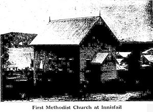
The first Methodist church in Innisfail was finished around October 1913.
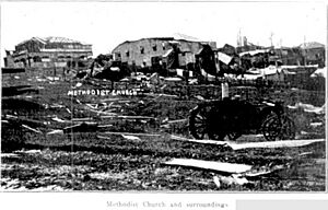
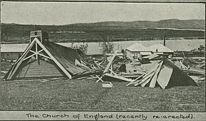
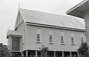
On March 10, 1918, a huge cyclone hit Innisfail. It caused massive damage and many deaths. The Anglican and Methodist churches were destroyed. So many buildings were damaged that new ones were built using concrete. This was stronger than wood and tin. Many new buildings were in the Art Deco style. Because of this, Innisfail is now known for its beautiful Art Deco buildings.
In the 1920s and 1930s, many Italian immigrants came to Innisfail. People from Greece and Malta also settled there. Later, people from Yugoslavia, India, and the Philippines arrived.
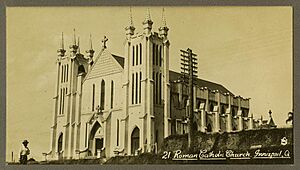
On July 1, 1928, a new Catholic presbytery (priest's house) was opened. It was made of reinforced concrete to protect it from cyclones. The old church had been destroyed in the 1918 cyclone. A new Mother of Good Counsel Catholic Church was also built. It cost £20,000 and was the largest Catholic church in Queensland outside of Brisbane.
On March 31, 1931, a special event was held for an international Cricket Team. Palm trees were planted to remember their visit. Famous cricketer Sir Donald Bradman was part of this team. These palm trees are still in the town centre today.
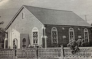
On November 10, 1935, a Greek Orthodox Church was opened. It was dedicated to the Assumption of the Blessed Virgin. It was the second Greek Orthodox Church in Queensland. It was also the first one built outside a capital city in Australia. The brick church cost £1,000. It was rebuilt in 1970 by Mick Kremastos.
Innisfail East State School opened on February 3, 1936.
Innisfail State High School opened in 1955. In 2010, it joined with other schools to form Innisfail State College.
In 1970, Innisfail State School started special education classes. In 1980, Innisfail Special School opened. In 2003, it was renamed Innisfail Inclusive Education Centre. In 2010, it became part of Innisfail State College.
Radiant Life Christian College was open from 1982 to 1991.
In 2001, the band Sugar Ray filmed part of their music DVD in Innisfail.
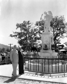
The Innisfail War Memorial was dedicated on April 16, 2005. It honors those who served in all wars.
Innisfail and Cyclones
Innisfail was badly damaged by Cyclone Larry on March 20, 2006. This was a very strong storm. It brought over 100mm of rain in three hours. The center of the storm passed right over the town.
Many houses lost their roofs and windows. Power was cut off, and clean drinking water was hard to find. The Australian Defence Force helped a lot with the cleanup. Power and water were back within three weeks.
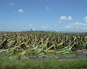
The cyclone caused huge damage to banana farms. This had a big effect on the local economy. Banana prices in Australia went up a lot after the cyclone. Innisfail's community spirit grew stronger after everyone worked together to rebuild.
On February 3, 2011, Cyclone Yasi also hit the Innisfail area. The damage was not as bad as Cyclone Larry, but it still brought very strong winds.
Darlinga Forest School opened in February 2021 but closed in mid-2023.
Who Lives in Innisfail?
In 2016, the town of Innisfail had 7,236 people. This includes people from nearby areas like Cullinane and East Innisfail.
- 17.3% of the people were Aboriginal and Torres Strait Islander.
- 72.1% were born in Australia.
- Other common birthplaces were India (4.0%), Italy (1.9%), and England (1.8%).
- 74.8% spoke only English at home.
- Other languages included Punjabi (4.4%) and Italian (2.8%).
- The most common religions were Catholic (27.0%), No Religion (20.5%), and Anglican (13.9%).
In 2021, the town had 7,173 people. The town's centre had 1,091 people.
Learning in Innisfail
- Innisfail State School is a government primary school for kids from Prep to Year 6. It is at 7 Emily Street. It also has a special education program.
- Good Counsel Primary School is a Catholic primary school for Prep to Year 6. It is at 96 Rankin Street.
- Good Counsel College is a Catholic secondary school for Years 7 to 12. It is at 66 Owen Street.
There is no government secondary school right in Innisfail town. The town's government secondary school, Innisfail State College, is in Innisfail Estate. This is just across the river.
Places to Visit and Services
- The Cassowary Coast Regional Council has a public library at 49 Rankin Street. It opened in 2015.
- The Innisfail branch of the Queensland Country Women's Association meets at 1 McGowan Drive.
- Chinese Australians built the Innisfail Temple/Lit Sing Gung in Owen Street. It is now open to all people and religions.
- The Sikh community built the Sikh Temple / Guru Nanak Sikh Education Centre in East Innisfail.
- Mother of Good Counsel Catholic Church is at 90 Rankin Street.
- The Dormition of Our Lady Greek Orthodox Church is at 133 Ernest Street. Their special day is August 15.
Innisfail's Economy
The main industries in Innisfail are still banana and sugar cane farming. Some areas also grow tea, pawpaws, and other special fruits.
Innisfail is a popular place for backpackers to find work picking fruit. Tourism is also important for the town. Innisfail tries to attract visitors traveling along the Bruce Highway. The town's unique Art Deco buildings are a big draw for tourists.
Historic Places in Innisfail
Innisfail has several places listed for their history. These include:
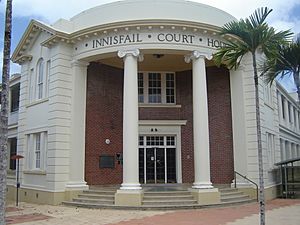
- 10 Edith Street: Innisfail Courthouse
- 134 Edith Street: See Poy House
- Fitzgerald Esplanade: Canecutters Memorial
- 70 Rankin Street: Johnstone Shire Hall
- 90 Rankin Street: Mother of Good Counsel Catholic Church
- 114 Rankin Street: St Andrew's Presbyterian Memorial Church
Fun Events in Innisfail
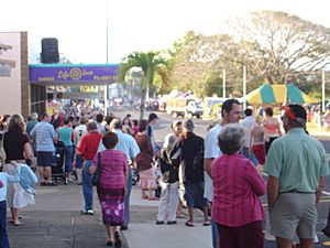
Innisfail celebrates its diverse community with popular yearly events:
- Kulture Karnival
- Festival Innisfail
- Feast of the Senses
- Feast of the Three Saints
- Tropical Art Deco Festival
Other important community events include:
- The Innisfail Rodeo
- Harvest Festival
- Innisfail Agricultural Show
Famous People from Innisfail
Many notable people have connections to Innisfail:
- Natarsha Williams: A BMX rider who grew up in Innisfail. She started racing BMX at age 5 and had a very successful career. She won 2 European Titles, 2 Pro girl Titles in the US, 3 World Cup Titles, and 2 World Championships.
- Scott Bolton: A rugby league player for the North Queensland Cowboys. He grew up in Innisfail and won a championship in 2015.
- Kerry Boustead: A famous rugby league player for Queensland and Australia. He was the first player from Queensland to score a try in State of Origin.
- Jessica-Rose Clark: A mixed martial artist who fights in the UFC.
- Steve Corica: A retired footballer who played for Australia. He also played for clubs in England and Australia.
- Brent Cockbain: A former international rugby player for Wales. He grew up in Innisfail.
- Joseph Costa: A BMX rider who grew up in Innisfail and is a consistent competitor.
- Ben Dunk: Born in 1987, he is an Australian T20 and ODI cricket player.
- Shannon McCann: An Australian 100m Hurdler who competed at the 2014 Commonwealth Games. She grew up in Innisfail.
- Billy Slater: A rugby league player who grew up in Innisfail. He played for the Melbourne Storm for 16 seasons and is considered one of the best fullbacks in the game.
- Norman Stevens: An Australian boxer who competed at the 1980 Moscow Olympics.
- Ty Williams: A former professional rugby league footballer for the North Queensland Cowboys and Queensland. He returned to Innisfail to coach a local team.
 | Valerie Thomas |
 | Frederick McKinley Jones |
 | George Edward Alcorn Jr. |
 | Thomas Mensah |


