Woopen Creek, Queensland facts for kids
Quick facts for kids Woopen CreekQueensland |
|||||||||||||||
|---|---|---|---|---|---|---|---|---|---|---|---|---|---|---|---|

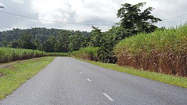
Woopen Creek Road, Woopen Creek, 2018
|
|||||||||||||||
| Population | 135 (2021 census) | ||||||||||||||
| • Density | 5.056/km2 (13.09/sq mi) | ||||||||||||||
| Postcode(s) | 4871 | ||||||||||||||
| Elevation | 10–404 m (33–1,325 ft) | ||||||||||||||
| Area | 26.7 km2 (10.3 sq mi) | ||||||||||||||
| Time zone | AEST (UTC+10:00) | ||||||||||||||
| Location |
|
||||||||||||||
| LGA(s) | Cairns Region | ||||||||||||||
| State electorate(s) | Hill | ||||||||||||||
| Federal Division(s) | Kennedy | ||||||||||||||
|
|||||||||||||||
Woopen Creek is a small country area, also known as a locality, in the Cairns Region of Queensland, Australia. It's a quiet place with a small community. In 2021, about 135 people lived there.
Contents
Geography of Woopen Creek
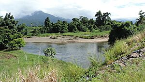
The Russell River forms the northern edge of Woopen Creek. Mountains create the other borders around the area. Inside Woopen Creek, there are two flatter areas, or valleys. These valleys were created by Woopen Creek and Vorris Creek.
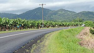
Most of the land in Woopen Creek is privately owned. The flatter valleys are used for farming. The mountainous parts of the area are not developed. The main crops grown here are sugarcane and bananas.
Even though the main Bruce Highway doesn't go through Woopen Creek, it's still connected. Mount Mirinjo is a mountain in the Francis Range located in the southern part of Woopen Creek. It stands about 404 meters (1,325 feet) above sea level. The lowest parts of Woopen Creek are about 10 meters (33 feet) above sea level.
History of Woopen Creek
Early School Efforts
Back in 1940, the people living in Woopen Creek really wanted a school for their children. They kept asking the government for one for several years. In November 1941, the government asked companies to bid on building the school.
However, the school wasn't built then. This was probably because people were worried about a possible Japanese invasion in 1942 during World War II. Many schools in coastal areas closed, and all building materials were saved for military use.
School Opening and Closing
In March 1951, the residents tried again to get a school. The Queensland Government decided to move an old school building from Nerada State School (which had closed in 1945) to Woopen Creek. The new Woopen Creek State School opened its doors on February 4, 1952. It served the community for several years before closing on December 8, 1967.
New Farming Trends
In 2005, a farm called Broken Nose Vanilla was started in Woopen Creek. This was part of a bigger trend in the Cairns region. Farmers began growing different types of crops, not just the usual ones like sugarcane and bananas. This helped them try new things and make their farms more diverse.
Population Information
Woopen Creek is a small community. In 2016, there were 141 people living there. By 2021, the population was 135 people.
Education in Woopen Creek
There are no schools directly in Woopen Creek today. Students living in the area usually go to schools in nearby towns. The closest primary schools are Bartle Frere State School in Bartle Frere (to the north) and Mirriwinni State School in Mirriwinni (to the north-east). For high school, students attend Babinda State School, which teaches students from Prep to Year 12, located in Babinda (to the north-east).
 | Georgia Louise Harris Brown |
 | Julian Abele |
 | Norma Merrick Sklarek |
 | William Sidney Pittman |


