Mirriwinni, Queensland facts for kids
Quick facts for kids MirriwinniQueensland |
|||||||||||||||
|---|---|---|---|---|---|---|---|---|---|---|---|---|---|---|---|

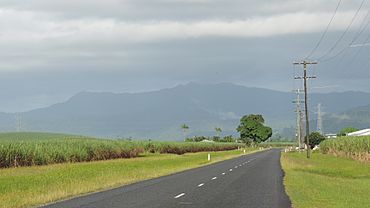
Looking south-west along Buckland Road, 2018
|
|||||||||||||||
| Population | 492 (2021 census) | ||||||||||||||
| • Density | 10.513/km2 (27.23/sq mi) | ||||||||||||||
| Postcode(s) | 4871 | ||||||||||||||
| Area | 46.8 km2 (18.1 sq mi) | ||||||||||||||
| Time zone | AEST (UTC+10:00) | ||||||||||||||
| Location | |||||||||||||||
| LGA(s) | Cairns Region | ||||||||||||||
| State electorate(s) | Hill | ||||||||||||||
| Federal Division(s) | Kennedy | ||||||||||||||
|
|||||||||||||||
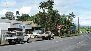
Mirriwinni is a small town and area in Queensland, Australia. It is part of the Cairns Region. The name Mirriwinni became official in 2010. Before that, it was sometimes spelled Miriwinni. In 2021, about 492 people lived in Mirriwinni.
Contents
Mirriwinni's Location and Land
Mirriwinni is located south of the center of its area. The Russell River flows along its eastern and southeastern sides. Babinda Creek forms part of the northern border. To the west, you can see the foothills of Mount Bartle Frere.
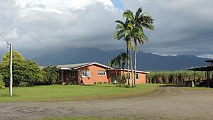
Most of the land here is flat and low, about 10 meters above sea level. This flat land is mostly used for farming. Farmers mainly grow sugarcane here. However, in the western part, the land rises to about 150 meters. This area leads up to the peaks of Mount Bartle Frere.
Roads and Railways in Mirriwinni
The Bruce Highway and the North Coast railway line both pass through Mirriwinni. They go from the south to the west, right through the town.
There isn't a train station in Mirriwinni anymore. But in the past, there were two stations:
- Miriwinni railway station, located in the town.
- Pawngilly railway station, which was south of the town.
Farmers use a special network of small railways called tramways. These tramways help transport the harvested sugarcane to the local sugar mill.
Mirriwinni's Past
The town's name, Mirriwinni, comes from its old railway station. The railway department first used this name in 1915. It is said to be an Aboriginal word meaning mountain rock.
Another railway station, Mooliba, opened in 1912. Its name changed to Moolaba in 1917, and then to Pawngilly in 1926. The name Pawngilly is an Aboriginal word meaning big hill.
The Cane Beetles March
On April 20, 1916, a special event called the Cane Beetles March started in Mooliba. This was a march to encourage men to join the Australian army during World War I. At that time, fewer men wanted to join after many soldiers were lost in the Gallipoli campaign.
The march began with only 4 men in Mooliba. As they walked through towns like Babinda and Cairns, more men joined them. By the time they reached Cairns, 60 kilometers away, there were 29 new recruits.
School and Post Office History
Miriwinni Provisional School opened on October 16, 1916. It became Miriwinni State School in 1918. On July 9, 2012, its name was officially changed to Mirriwinni State School.
The Miriwinni Post Office opened on July 1, 1925. Before that, there was a smaller mail office since 1915.
People Living in Mirriwinni
In 2016, about 447 people lived in Mirriwinni. By 2021, the number of people living in Mirriwinni had grown to 492.
Education in Mirriwinni
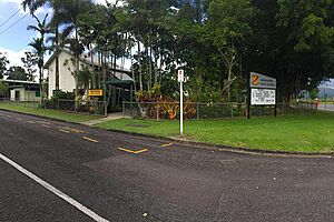
Mirriwinni State School is a government primary school. It teaches boys and girls from Prep (the first year of school) to Year 6. The school is located at 3 Whitman Street. In 2018, about 49 students attended the school.
There isn't a high school in Mirriwinni itself. Students who want to go to secondary school usually attend Babinda State School. This school is in the nearby town of Babinda and teaches students up to Year 12.
Famous People from Mirriwinni
- Brad Beven is a well-known triathlete who comes from Mirriwinni. A triathlete is someone who competes in a race that includes swimming, cycling, and running.
 | George Robert Carruthers |
 | Patricia Bath |
 | Jan Ernst Matzeliger |
 | Alexander Miles |


