Beinn Bhàn (Arkaig) facts for kids
Quick facts for kids Beinn Bhàn |
|
|---|---|

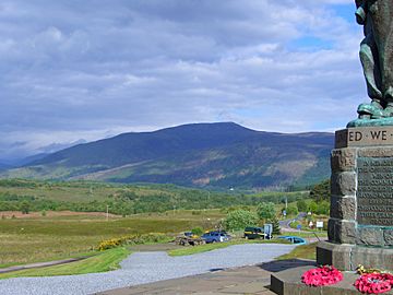
Seen from the Commando Memorial at Spean Bridge.
|
|
| Highest point | |
| Elevation | 796 m (2,612 ft) |
| Prominence | 495 m (1,624 ft) |
| Listing | Corbett, Marilyn |
| Naming | |
| English translation | White Hill |
| Language of name | Gaelic |
| Geography | |
| Parent range | Northwest Highlands |
| OS grid | NN140857 |
| Topo map | OS Landranger 34, 41 OS Explorer 399 |
| Climbing | |
| Easiest route | From Glen Loy |
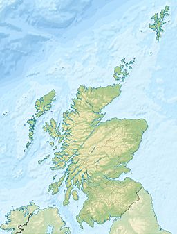
Beinn Bhàn is a mountain in Scotland. It is found in the Lochaber area of the Highland Council. The mountain stands about 10 kilometers (6 miles) north-west of Spean Bridge. It's important not to confuse this mountain with another Beinn Bhàn on the Applecross peninsula.
About Beinn Bhàn
Beinn Bhàn is 796 meters (2612 feet) tall. This height makes it a Corbett and a Marilyn. A Corbett is a Scottish mountain between 762 and 914 meters high. A Marilyn is a hill in the British Isles with a prominence of at least 150 meters.
The mountain is located in Glen Loy. This is a smaller valley near the Great Glen. Hikers sometimes climb Beinn Bhàn and another nearby Corbett, Meall a' Phubuill, in one day.
The name Beinn Bhàn comes from Scottish Gaelic. It means "White Hill". There are no natural features that look white on the hill itself. Local people say it gets its name because snow often falls on Beinn Bhàn earlier than on other hills nearby. This makes it look very white.
During World War II, the area around Beinn Bhàn was used for training. British Commandos and United States Army Rangers trained here. Their training base was at Achnacarry Castle.
Mountain Features
Beinn Bhàn is in a region with some of the highest mountains in the United Kingdom. So, it can sometimes be overlooked. However, you can see it clearly from the Commando Memorial at Spean Bridge. From there, you can see its long north-west ridge. This ridge rises from Glen Mallie up to the summit.
The mountain has three interesting corries (bowl-shaped hollows).
- Coire Mhuilinn faces south. It is smooth and covered in grass.
- Coire Bhotrais and Coire Dubh face north. These are rockier and steeper.
All three corries cut deeply into the mountain. They create a long, narrow, curving ridge at the top. This ridge is about two kilometers long. Its entire length is above 750 meters.
The highest point of Beinn Bhàn is at the eastern end of this ridge. There are also two other tops, both 771 meters high. One is in the middle of the ridge, and the other is at the western end. About 200 meters west of the main summit, there are several springs. These are where a stream begins, flowing down Coire Mhuilinn.
Summit Views
The very top of Beinn Bhàn has a trig point and a large pile of stones called a cairn. A trig point is a marker used by mapmakers. Because the mountain has a prominence of 495 meters, it offers great views.
Looking north, you can see Loch Arkaig and the mountains around it. But the best view is to the south. You can see the Ben Nevis range. This includes Ben Nevis itself, which is Britain's highest mountain. You can also see Càrn Mòr Dearg and Aonach Mòr.
How to Climb Beinn Bhàn
The most popular way to climb Beinn Bhàn starts from the south. You begin at the Inverskilavulin holiday area in Glen Loy. This route uses the ridges on both sides of Coire Mhuilinn for going up and down.
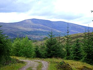
You can also climb Beinn Bhàn from the north. This route starts near Loch Arkaig. You could even use Invermallie bothy as a base. This way can be a bit harder because of forestry plantations and thick heather at the bottom. Once you get past these, you can reach the summit ridge. You can do this by following the stream up Coire Dubh or by using the ridges on either side.
 | James B. Knighten |
 | Azellia White |
 | Willa Brown |


