Ben Ledi facts for kids
Quick facts for kids Ben Ledi |
|
|---|---|
| Beinn Leitir | |

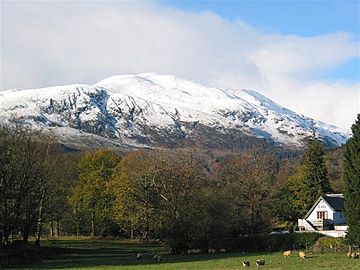
Ben Ledi seen from Kilmahog
|
|
| Highest point | |
| Elevation | 879 m (2,884 ft) |
| Prominence | c. 528 m |
| Parent peak | None |
| Listing | Corbett, Marilyn |
| Naming | |
| English translation | Hill of the long shoulder |
| Language of name | Gaelic |
| Geography | |
| Location | Stirling, Scotland |
| Parent range | Trossachs |
| OS grid | NN562098 |
| Topo map | OS Landranger 57 |
Ben Ledi is a beautiful mountain in Stirling, Scotland. Its name in Scottish Gaelic is Beinn Leitir. It stands 879 meters (2,884 feet) high. This makes it a Corbett mountain. Ben Ledi is about 6.4 kilometers (4 miles) north-west of Callander. It is also close to the village of Kilmahog. The mountain is part of the Trossachs area. This region is known for its stunning and romantic scenery.
Contents
Ben Ledi's History
Ben Ledi has a long and interesting past. It is even mentioned in Walter Scott's famous poem, Lady of the Lake.
Ancient Traditions
Long ago, people might have held special ceremonies on the mountain's summit. These were called Beltane rites. They celebrated the start of summer with fires. Some old Gaelic names on the mountain might refer to these fires. For example, 'Creag Ghorn' means 'Rock of Embers'. 'Creag Loisgte' means 'Burned Rock'.
What's in a Name?
For a while, people thought Ben Ledi meant 'hill of god'. This was a mistake. The name actually comes from Beinn Leitir. This means 'the Hill of the Slope'. This name fits the mountain well. It has a long, gentle slope on its south side. This slope is often used to reach the top.
In 1887, a cairn (a pile of stones) was built on the summit. This cairn celebrates Queen Victoria's jubilee.
The Little Loch of the Dead
There is a small lochan (a little lake) near the summit. It is called Lochan nan Corp. This name means "the little loch of the dead". It is located 655 meters above sea level. This lochan is on an old path. This path was once used to carry coffins. It went from Glen Finlas to St Bride's chapel. The path itself is called Bealach nan Corp, or 'Pass of the Dead'. The lochan is named after this pass.
Exploring Ben Ledi
Many people enjoy hiking and exploring Ben Ledi. It offers great views and different paths.
Popular Hiking Routes
The eastern slopes of Ben Ledi are part of the Queen Elizabeth Forest Park. A clear path starts from a car park. This car park is on the A84 road, south of Loch Lubnaig. This path leads to a rough track. The track then goes up the south slope to the summit. This walk is just over 3 kilometers long.
Another way to the top is through Stank Glen. This route starts near Loch Lubnaig. It joins the main path closer to the summit. You can combine these two routes for a circular walk. This loop is about 9 kilometers long.
A Special Memorial
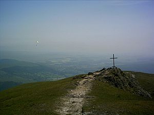
Near the summit, there is an iron cross. This cross remembers Sergeant Harry Lawrie. He was part of the Killin Scottish Mountain Rescue team. He sadly died in 1987 during a rescue. This happened on Ben More mountain.
Other Activities
Besides hiking, Ben Ledi is sometimes used for paragliding. People launch from the mountain and fly through the air.
The Ben Ledi ridge continues north. It drops down before climbing again to the top of Benvane. Benvane is another Corbett mountain. It is important not to confuse it with Ben Vane. That mountain is a Munro on the west side of Loch Lomond.
 | Mary Eliza Mahoney |
 | Susie King Taylor |
 | Ida Gray |
 | Eliza Ann Grier |


