Ben More (Mull) facts for kids
Quick facts for kids Ben More |
|
|---|---|
| Beinn Mòr | |

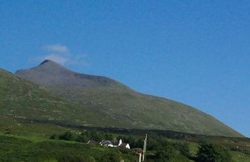
Ben More from the shores of Loch na Keal
|
|
| Highest point | |
| Elevation | 966 m (3,169 ft) |
| Prominence | 966 m (3,169 ft) Ranked 7th in British Isles |
| Parent peak | none - HP Mull |
| Listing | Marilyn, Munro |
| Naming | |
| English translation | Big mountain |
| Language of name | Gaelic |
| Geography | |
| OS grid | NM525330 |
| Topo map | OS Landranger 47, 48 |
Ben More is a famous mountain in Scotland. Its name comes from the Gaelic words Beinn Mhòr, which mean "great mountain." It is the tallest mountain on the Isle of Mull. Ben More is also the only Munro on the island. A Munro is a Scottish mountain that is at least 3,000 feet (about 914 meters) high.
This amazing peak is the highest in the Inner Hebrides islands. Only mountains on the Isle of Skye are taller. Ben More is located in the southern part of Mull. It rises proudly above the beautiful waters of Loch na Keal.
Contents
How to Climb Ben More
Climbing Ben More can be a fun adventure. There are a few ways to reach the top. Each route offers different challenges and views.
The Easier Path from Loch na Keal
The simplest way to climb Ben More starts from Loch na Keal. You can follow farm tracks from the B8035 road. The path goes alongside a stream called Abhainn Dhiseig. Eventually, you will climb up slopes made of loose rocks, known as scree. This path leads you right to the summit.
From the top, on a clear day, you can see far and wide. You might spot the Sound of Mull, Staffa, Ulva, and even Iona in the distance. This walk from the sea loch to the summit usually takes about four hours.
The Challenging Route: A' Chìoch and Beinn Fhada
For a more exciting climb, you can take a different route. This path is tougher but offers great rewards. It starts on the B8035 road as well. You will follow a muddy trail along the banks of Abhainn na h-Uamha. This leads to a mountain pass, or bealach, between two peaks. These peaks are called A' Chìoch and Beinn Fhada.
From the bealach, the path becomes steep and rocky. You will follow a ridge southwest. First, you reach the peak of A' Chìoch. Then you continue climbing up to Ben More itself. At the very top, there is a circular stone shelter. It offers a nice place to rest and enjoy the view. This challenging route takes about six hours. It involves both walking and some scrambling (climbing over rocks using your hands).
Important Safety Tip for Climbers
If you are climbing in foggy conditions, be careful with your compass. Some rocks on Ben More are magnetic. This is especially true near the summit. Magnetic rocks can make your compass give wrong readings. Always be aware of your surroundings and use other navigation methods if needed.
The Amazing History of Ben More's Rocks
Ben More has a fascinating past that goes back millions of years. It tells a story of fiery volcanoes and ancient landscapes.
When Volcanoes Ruled the Land
About 60 million years ago, the area around Ben More was very active. It was a time when many volcanoes were erupting. Ben More itself is actually what's left of an old volcano! During this period, amazing rock formations were created. These include the famous basalt columns on Staffa and "The Castles" on Ulva.
The Special Lava of Mull
The lava flows from these ancient volcanoes are unique. They are known as the "Staffa Magma Type member." You can see these special rocks in other places on Mull too. They are found at Carsaig, Ardtum, and near Tobermory. These rocks are very rich in silica. This is a common mineral found in many rocks.
 | Bayard Rustin |
 | Jeannette Carter |
 | Jeremiah A. Brown |


