Bencollaghduff facts for kids
Quick facts for kids Bencollaghduff |
|
|---|---|
| Binn Dubh | |
|
|
| Highest point | |
| Elevation | 696 m (2,283 ft) |
| Prominence | 191 m (627 ft) |
| Listing | 100 Highest Irish Mountains, Marilyn, Hewitt, Arderin, Simm, Vandeleur-Lynam |
| Naming | |
| English translation | black mountain or peak of hags [cormorants] |
| Language of name | Irish |
| Geography | |
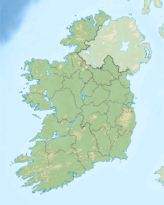
| Location | Galway, Ireland |
| Parent range | Twelve Bens |
| OSI/OSNI grid | L7978252992 |
| Topo map | OSi Discovery 37 |
| Geology | |
| Type of rock | Pale quartzites, grits, graphitic Bedrock |
Bencollaghduff (which means "black mountain" or "peak of hags" in Irish) is a mountain in Ireland. It stands at 696 metres (2,283 feet) tall. This makes it one of the highest peaks in Ireland.
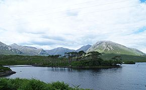
Bencollaghduff is located in the middle of the Twelve Bens mountain range. This range is found within the Connemara National Park in Galway, Ireland. It is the third tallest mountain in the Twelve Bens. Only Benbaun (729 metres) and Bencorr (711 metres) are taller.
The mountain's height above the surrounding land is 191 metres (627 feet). This measurement is called its "prominence." Because its prominence is over 100 metres, Bencollaghduff is known as a Marilyn. It is also ranked as the 56th highest mountain in Ireland.
What's in a Name?
The name "Bencollaghduff" likely means "peak of the black hags." But don't worry, these "hags" are not witches! They are actually cormorant birds. Cormorants are large, dark birds that dive for fish.
The official Irish name for the mountain is "Binn Dhubh." However, some maps use "Binn Dubh." This shows how local people in Connemara say the name.
Hiking Adventures
Bencollaghduff is a popular spot for hikers. Many people climb it as part of the Glencoaghan Horseshoe walk. This walk is about 16 kilometres (10 miles) long. It usually takes 8 to 9 hours to complete. It is known as one of Ireland's best mountain walks.
There is an even longer route called the Owenglin Horseshoe. This walk is 20 kilometres (12 miles) long. It takes 10 to 12 hours and goes over more than twelve mountain tops.
In Books
The famous Irish writer Joseph O'Connor mentioned Bencollaghduff in his book Star of the Sea. He wrote about the "quartzite shale on the slopes of Bencollaghduff." Quartzite shale is a type of rock found on the mountain.
Gallery
-
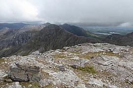
View from the south ridge of Benbaun looking towards Bencollaghduff, with the ridge to Bencorr and Derryclare behind.
-
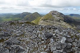
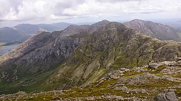
View of (right to left) Benbaun, Muckanaght, and Bencullagh from the top of Bencollaghduff.
-
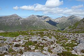
View of (left to right) Bengower, Benbreen, and Bencollaghduff from the top of Derryclare.
 | Frances Mary Albrier |
 | Whitney Young |
 | Muhammad Ali |


