Black Pine Mountains High Point facts for kids
Quick facts for kids Black Pine Mtns. HP |
|
|---|---|
| Highest point | |
| Elevation | 9,389 ft (2,862 m) |
| Prominence | 4,069 ft (1,240 m) |
| Geography | |
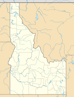
| Location | Cassia County, Idaho, U.S. |
| Parent range | Black Pine Mountains |
| Topo map | USGS Sweetzer Canyon |
Black Pine Mountains High Point is the tallest mountain peak in the Black Pine Mountains. It is located in Cassia County, in southern Idaho. This peak reaches about 9,289 feet (2,831 m) above sea level.
Sometimes people call it "Black Peak." This is because there is a special marker on the mountain that says "Black" on it.
Where is Black Pine Mountains High Point?
You can find Black Pine Mountains High Point in the north-central part of the mountain range. It is northwest of a town called Snowville in Utah. It is also southeast of Malta in Idaho. This area is part of the Sawtooth National Forest, specifically the Minidoka Ranger District.
Water and Views from the Peak
Water flowing from Black Pine Mountains High Point eventually reaches the Snake River. The Snake River is a large river that later joins the even bigger Columbia River.
From the top of the peak, you can see amazing views of several other mountain ranges. These include the Raft River, Albion, Sublett, and Wasatch mountains.
The peak is also part of something called the Great Basin Divide. This is a special line that separates where water flows. On one side, water flows to the ocean. On the other side, water stays in basins and does not reach the ocean. The peak is also part of the Basin and Range Province, which is a large area with many mountains and valleys. Interstate 84 is a major highway that passes to the east of the peak.
 | Chris Smalls |
 | Fred Hampton |
 | Ralph Abernathy |


