Boroughs and neighborhoods of Berlin facts for kids
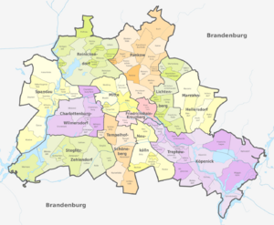
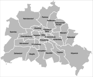
Berlin is a special place because it's both a big city and one of Germany's states at the same time! Think of it as a "city-state." Since 2001, Berlin has been divided into twelve main areas called districts (in German, these are Bezirke). Each district has its own local government team. However, these districts are not like independent towns or counties you might find in other countries. They are more like local offices that help run the city of Berlin, which acts as one big community.
Each district has a group of representatives, like a mini-parliament, chosen by the people living there. This group is called the district representatives' assembly. They also have a district board, which is like a local council. This board has a district mayor and several district councillors. This team handles many everyday things for the people in their district, like local parks or community services. But remember, the main Berlin government (called the Berlin Senate) can always change their decisions. Also, the districts don't collect their own taxes or own property; they get their money from the main city government. All the district mayors meet regularly in a "Council of Mayors" to give advice to the main city government.
Contents
- Berlin's History and Its Districts
- The Twelve Districts of Berlin
- How Berlin's Districts are Governed
- District Coats of Arms
- Localities within Districts
- Mitte Localities
- Friedrichshain-Kreuzberg Localities
- Pankow Localities
- Charlottenburg-Wilmersdorf Localities
- Spandau Localities
- Steglitz-Zehlendorf Localities
- Tempelhof-Schöneberg Localities
- Neukölln Localities
- Treptow-Köpenick Localities
- Marzahn-Hellersdorf Localities
- Lichtenberg Localities
- Reinickendorf Localities
- See also
Berlin's History and Its Districts
Berlin's districts are made up of smaller areas called neighborhoods (or Ortsteile in German). The number of neighborhoods in a district can be very different. For example, one district might have only two neighborhoods, while another has fifteen!
Many of these neighborhoods used to be separate towns or villages. They all came together in 1920 to form the "Greater Berlin" we know today. Even though neighborhoods don't have their own governments, people in Berlin often feel a stronger connection to their neighborhood than to their district. These neighborhoods are important for city planning and collecting information.
When Greater Berlin was first created in 1920, it had twenty districts. After World War II, Berlin was split into four parts, controlled by different countries. In 1961, the Berlin Wall was built, dividing the city into West Berlin and East Berlin. During this time, East Berlin created three new districts.
The Berlin Wall fell in 1989, and the city became one again. This was a huge moment for Berlin! After reunification, the city changed a lot, building new businesses and cultural places. By the year 2000, Berlin had twenty-three districts. But in 2001, the city decided to make things simpler. They combined many of the old districts, reducing the total number to the twelve districts we have today.
The Twelve Districts of Berlin
In 2001, Berlin changed its districts. Most of the old ones were merged to create the current 12 districts. Only three districts – Spandau, Reinickendorf, and Neukölln – stayed the same because they already had many people living in them.
Here are the twelve districts of Berlin:
| District | Bundestag constituency | Population 31 March 2010 |
Area in km2 |
Density per km2 |
Map |
|---|---|---|---|---|---|
| Charlottenburg-Wilmersdorf | Berlin-Charlottenburg-Wilmersdorf (excluding Charlottenburg-Nord and the neighbourhood of Kalowswerder) |
319,628 | 64.72 | 4,878 | 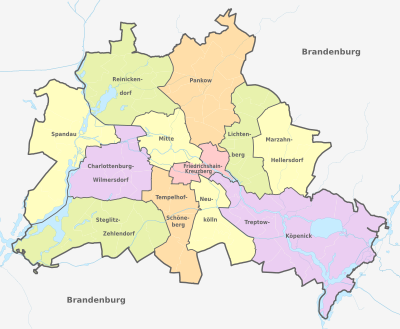 |
| Friedrichshain-Kreuzberg | Berlin-Friedrichshain-Kreuzberg – Prenzlauer Berg East | 268,225 | 20.16 | 13,187 | |
| Lichtenberg | Berlin-Lichtenberg | 259,881 | 52.29 | 4,952 | |
| Marzahn-Hellersdorf | Berlin-Marzahn-Hellersdorf | 248,264 | 61.74 | 4,046 | |
| Mitte | Berlin-Mitte | 332,919 | 39.47 | 8,272 | |
| Neukölln | Berlin-Neukölln | 310,283 | 44.93 | 6,804 | |
| Pankow | Berlin-Pankow (excluding Prenzlauer Berg east of Prenzlauer Allee) |
366,441 | 103.01 | 3,476 | |
| Reinickendorf | Berlin-Reinickendorf | 240,454 | 89.46 | 2,712 | |
| Spandau | Berlin-Spandau – Charlottenburg North | 223,962 | 91.91 | 2,441 | |
| Steglitz-Zehlendorf | Berlin-Steglitz-Zehlendorf | 293,989 | 102.50 | 2,818 | |
| Tempelhof-Schöneberg | Berlin-Tempelhof-Schöneberg | 335,060 | 53.09 | 6,256 | |
| Treptow-Köpenick | Berlin-Treptow-Köpenick | 241,335 | 168.42 | 1,406 |
How Berlin's Districts are Governed
The way Berlin's districts are run is part of a two-step system. The main Berlin government, called the Senate, is the first step. The districts are the second step. They have some freedom to make decisions, but they are not fully independent like towns in other parts of Germany. This is because Berlin itself is considered one big unified city-state.
The district governments have limited power. The main Berlin Senate watches over their work and can even change their decisions. Each of the twelve districts has its own elected assembly (the Bezirksverordnetenversammlung, or BVV). This assembly acts like a local parliament. It chooses the members of the district council, which includes the district mayor and four councillors. The BVV also checks how the district is run every day and can suggest new ideas.
The twelve district mayors meet regularly in the Council of Mayors. This council is led by Berlin's main mayor and gives advice to the Senate.
District Coats of Arms
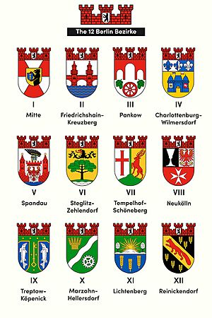
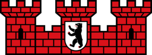
All the coats of arms for Berlin's districts have some things in common. They all have a special shape for the shield. Above the shield, they have a "mural crown," which looks like a wall with three towers made of red bricks. In the middle of this crown is the coat of arms of Berlin.
Many of the current district coats of arms have changed since the 2001 reform. Some of them mix ideas from the old districts that merged together. Others took their designs from just one of the old districts. Only the districts that didn't merge – Neukölln, Reinickendorf, and Spandau – kept their original designs. The district of Pankow even got a brand new design for its coat of arms in 2008!
 Charlottenburg-Wilmersdorf |
 Friedrichshain-Kreuzberg |
 Lichtenberg |
 Marzahn-Hellersdorf |
 Mitte |
 Neukölln |
 Pankow |
 Reinickendorf |
 Spandau |
 Steglitz-Zehlendorf |
 Tempelhof-Schöneberg |
 Treptow-Köpenick |
Localities within Districts
As of 2012, Berlin's twelve districts are divided into 97 official smaller areas called localities (Ortsteile). These localities are sometimes even broken down into smaller zones. The biggest locality is Köpenick, and the smallest is Hansaviertel. The most populated locality is Neukölln, while the least populated is Malchow.
The old coats of arms for these localities are no longer used officially since they became part of Greater Berlin or new districts. The coats of arms shown below are historical symbols.
Mitte Localities
- (01) Mitte
| Locality | Area in km2 |
Population as of 2008 |
Density inhabitants per km2 |
Map |
|---|---|---|---|---|
| 10.70 | 79,582 | 7,445 | 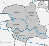 |
|
| 7.72 | 69,425 | 8,993 | ||
| 0.53 | 5,889 | 11,111 | ||
| 5.17 | 12,486 | 2,415 | ||
| 9.23 | 76,363 | 8,273 | ||
| 6.13 | 82,729 | 13,496 |
Friedrichshain-Kreuzberg Localities
| Locality | Area in km2 |
Population as of 2008 |
Density inhabitants per km2 |
Map |
|---|---|---|---|---|
| 9.78 | 114,050 | 11,662 | 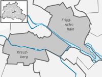 |
|
| 10.40 | 147,227 | 14,184 |
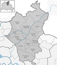
Pankow Localities
- (03) Pankow
Charlottenburg-Wilmersdorf Localities
| Locality | Area in km2 |
Population as of 2008 |
Density inhabitants per km2 |
Map |
|---|---|---|---|---|
| 10.60 | 118,704 | 11,198 | 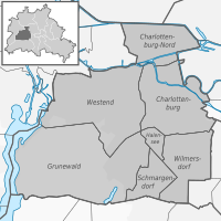 |
|
| 7.16 | 92,815 | 12,963 | ||
| 3.59 | 19,750 | 5,501 | ||
| 22.30 | 10,014 | 448 | ||
| 13.50 | 37,883 | 2,800 | ||
| 6.20 | 17,327 | 2,795 | ||
| 1.27 | 13,966 | 10,997 |
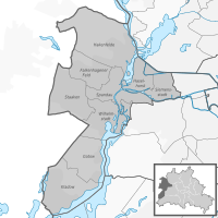
Spandau Localities
- (05) Spandau
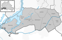
Steglitz-Zehlendorf Localities
- (06) Steglitz-Zehlendorf
Tempelhof-Schöneberg Localities
- (07) Tempelhof-Schöneberg
| Locality | Area in km2 |
Population as of 2008 |
Density inhabitants per km2 |
Map |
|---|---|---|---|---|
| 10.60 | 116,743 | 11,003 | 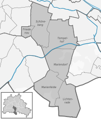 |
|
| 1.65 | 26,736 | 16,204 | ||
| 12.20 | 54,382 | 4,458 | ||
| 9.38 | 48,882 | 5,211 | ||
| 9.15 | 30,151 | 3,295 | ||
| 10.10 | 49,451 | 4,896 |
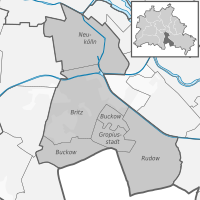
Neukölln Localities
- (08) Neukölln
Treptow-Köpenick Localities
- (09) Treptow-Köpenick
| Locality | Area in km2 |
Population as of 2008 |
Density inhabitants per km2 |
Map |
|---|---|---|---|---|
| 2.31 | 10,426 | 4,513 | 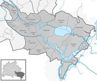 |
|
| 3.01 | 10,618 | 3,528 | ||
| 4.82 | 16,780 | 3,481 | ||
| 6.54 | 17,650 | 2,699 | ||
| 3.49 | 10,043 | 2,878 | ||
| 7.89 | 26,101 | 3,308 | ||
| 6.11 | 15,112 | 2,473 | ||
| 6.52 | 10,751 | 1,649 | ||
| 6.18 | 17,094 | 2,766 | ||
| 34.90 | 59,201 | 1,695 | ||
| 14.00 | 17,285 | 1,233 | ||
| 21.50 | 8,891 | 414 | ||
| 9.13 | 5,482 | 600 | ||
| 22.20 | 6,350 | 286 | ||
| 17.10 | 4,117 | 240 |
Marzahn-Hellersdorf Localities
- (10) Marzahn-Hellersdorf
| Locality | Area in km2 |
Population as of 2008 |
Density inhabitants per km2 |
Map |
|---|---|---|---|---|
| 19.50 | 102,398 | 5,240 | 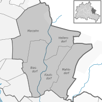 |
|
| 12.40 | 24,543 | 1,973 | ||
| 8.81 | 18,732 | 2,126 | ||
| 12.90 | 26,852 | 2,075 | ||
| 8.10 | 72,602 | 8,963 |
Lichtenberg Localities
- (11) Lichtenberg
- Codes 1105 and 1108 (this one to former Hohenschönhausen locality) are not assigned
Reinickendorf Localities
- (12) Reinickendorf
See also
 In Spanish: Distritos y localidades de Berlín para niños
- Politics of Berlin
- Berlin Police
 | Charles R. Drew |
 | Benjamin Banneker |
 | Jane C. Wright |
 | Roger Arliner Young |


