Brassall, Queensland facts for kids
Quick facts for kids BrassallIpswich, Queensland |
|||||||||||||||
|---|---|---|---|---|---|---|---|---|---|---|---|---|---|---|---|

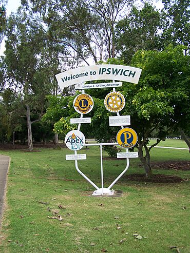
Signage on Pine Mountain Road, 2010
|
|||||||||||||||
| Population | 12,115 (2021 census) | ||||||||||||||
| • Density | 1,477/km2 (3,830/sq mi) | ||||||||||||||
| Postcode(s) | 4305 | ||||||||||||||
| Area | 8.2 km2 (3.2 sq mi) | ||||||||||||||
| Time zone | AEST (UTC+10:00) | ||||||||||||||
| Location |
|
||||||||||||||
| LGA(s) | City of Ipswich | ||||||||||||||
| State electorate(s) | Ipswich West | ||||||||||||||
| Federal Division(s) | Blair | ||||||||||||||
|
|||||||||||||||
Brassall is a busy suburb located in the city of Ipswich, Queensland, Australia. It's a great place to live, with lots of families and a growing community. In 2021, about 12,115 people called Brassall home.
Contents
Exploring Brassall's Location
Brassall is easy to find on a map. Its southern edge runs along the Bremer River. To the west, you'll find Ironpot Creek. The northern border follows the Warrego Highway, which is a major road.
The main road that goes through Brassall is the Ipswich–Warrego Highway Connection Road. It helps people travel from the east side of the suburb to the north. Brassall also includes a part of what used to be called Raymond Hill.
A Look Back at Brassall's History

The name "Brassall" first appeared on a map way back in 1851. No one is quite sure where the name came from! Long ago, this area was also known as "Hungry Flats." This was because it was a stopping point for bullock teams. These teams used to transport logs from Pine Mountain to a saw mill in North Ipswich.
Brassall's Early Government
For many years, Brassall was its own separate area with its own local government. This was called the "Shire of Brassall." It had its own council from 1860 until 1917. After that, it became part of the larger City of Ipswich.
The Railway and Bikepath
A railway line used to run through Brassall. It opened in 1884 and connected Ipswich to other towns. The line was used for many years but closed in 1993. Today, that old railway path has been turned into something new and fun! It's now the Brassall Bikepath, which is part of the longer Brisbane Valley Rail Trail. It's a great place for walking and cycling.
Schools and Churches in Brassall
Brassall has a long history of education. Brassall Provisional School opened in 1894. A few years later, in 1899, it became Brassall State School.
Several churches have also been important to the community. St George's Anglican Church was built in 1923. It closed in 1988 and is now used as a mosque and cultural center. St Mark's Lutheran Church was actually moved to Brassall in 1967 from another town. Ipswich State High School opened in 1951, and Ipswich Adventist School opened in 1968.
Modern Growth and Development
Since 2003, Brassall has grown a lot. What was once mostly bushland and farms has been developed into new housing areas. A big new estate called "Grammar Park Estate" started in 2002. It has grown quite a bit, with many new houses built for families. Today, Grammar Park Estate has over 1000 homes!
Who Lives in Brassall?
Brassall is a diverse place with people from many backgrounds. In 2021, the population was 12,115. Most residents, about 82.8%, were born in Australia. Other common birthplaces include New Zealand, England, and the Philippines.
Languages and Occupations
Most people in Brassall speak English at home. You might also hear languages like Samoan or Mandarin. People in Brassall work in many different jobs. Some common jobs include helping people in the community, working in trades, or being professionals. Many also work in offices, shops, or as labourers.
Important Heritage Sites

Brassall has some special places that are protected because of their history. These are called heritage-listed sites. They include:
- Mihi Junction: This area is home to the Mihi Creek Complex.
- Parker Lane: Here you can find the Klondyke Coke Ovens. These sites help us remember the past and how the area used to be.
Schools in Brassall
Brassall is home to several schools, offering education for different age groups:
- Brassall State School: This is a government primary school for students from Prep to Year 6. It's located on Pine Mountain Road. In 2018, it had over 800 students.
- Ipswich State High School: This is a government secondary school for students from Year 7 to Year 12. You can find it on Hunter Street. In 2018, it had over 1500 students.
- Ipswich Adventist School: This is a private primary school for students from Prep to Year 6. It's located on Hunter Street. In 2018, it had over 100 students.
All these schools help provide a great education for the young people in Brassall.
Community Services and Places
Brassall has several places that serve the community:
- Mobile Library: The Ipswich City Council runs a mobile library service that visits the local shopping centre every two weeks. It's a great way to borrow books and other materials.
- Churches: St Mark's Lutheran Church is on Hunter Street. The Ipswich North Uniting Church (also known as Brassall Uniting Church) is on Pommer Street.
- Mosque and Cultural Centre: The Islamic Society of Ipswich operates a mosque and cultural centre on Waterworks Road. This building used to be St George's Anglican Church.
These places help bring the community together and offer various services.
 | Precious Adams |
 | Lauren Anderson |
 | Janet Collins |


