2010–2011 Queensland floods facts for kids
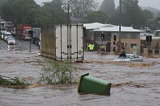
A woman trapped on the roof of her car awaits rescue during the Toowoomba flash flood
|
|
| Date | November 2010 – January 2011 |
|---|---|
| Location | Much of central and southern Queensland including Brisbane, Rockhampton, Gympie, Emerald, Bundaberg, Dalby, Toowoomba, Roma, and Ipswich |
| Deaths | 33 dead and 3 missing (presumed dead) |
| Property damage | A$2,389,225,876 200,000 people affected |
From November 2010 to January 2011, a series of big floods hit Queensland, Australia. These floods forced thousands of people to leave their homes. About 90 towns and over 200,000 people were affected. The damage was first thought to be A$1 billion, but it later grew to A$2.38 billion.
Three-quarters of Queensland's local areas were declared disaster zones. Towns along the Fitzroy and Burnett Rivers were hit very hard. Other rivers like the Condamine, Balonne, and Mary also had major flooding. A sudden flash flood caused by a thunderstorm rushed through Toowoomba's main shopping area. Heavy rain from the same storm also damaged towns in the Lockyer Valley.
Days later, thousands of homes in Ipswich and Brisbane were flooded. This happened as the Brisbane River rose. The Wivenhoe Dam used a lot of its ability to control floods. Many volunteers quickly helped out. The Australian Defence Force also sent a large number of people to assist. A special fund was set up to help those affected.
Contents
What Caused the Queensland Floods?
Brisbane had major floods before in 1893 and 1974. This happened when the Brisbane River overflowed. Towns like St. George and Theodore also had big floods in March 2010.
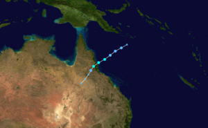
The 2010-2011 floods were caused by very heavy rain. This rain came from Tropical Cyclone Tasha. It also combined with a weather system called a trough. This happened during a strong La Niña event. The 2010 La Niña was the strongest since 1973. It brought a long period of heavy rain to Queensland's river areas.
December 2010 was Queensland's wettest December ever. Record rainfall was set in 107 places that month. The state's average rainfall was 209.45 mm (8.25 in). This was more than the old record of 200.1 mm (7.88 in) from 1975. Some scientists think climate change might have played a part. They say warmer ocean temperatures can cause more water vapor and stronger rain.
Some experts also suggested that the way the Wivenhoe Dam was managed might have made some flooding worse. This was especially true in the lower Brisbane valley. However, other experts disagreed. They said the dam was managed correctly during the storm.
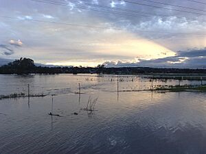
Isolated floods started in early December. On 23 December, a monsoon trough moved inland from the Coral Sea. It brought heavy rain from the Gulf of Carpentaria to the Gold Coast. The most intense rain fell on 27 December. By 30 December, large parts of Southern and Central Queensland were flooded. The conditions also led to many snakes and some crocodiles appearing in the Rockhampton area.
How Widespread Were the Floods?
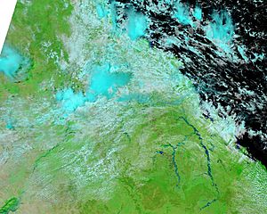
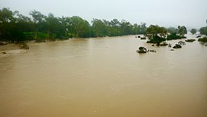
Flooding was widespread across Queensland and New South Wales. It lasted from late December 2010 to January 2011. Several rain events caused rivers to rise over a long time. Many places, like Condamine and Chinchilla, were flooded more than once. About 300 roads were closed, including nine major highways.
It was reported that more than three-quarters of Queensland was affected by the floods.
Flooding in the Fitzroy River Area
The floods first made 1,000 people leave Theodore and other towns. This was a first for Queensland. The military used helicopters to take people to a safe place in Moura. Major flooding in Theodore lasted for over two weeks.
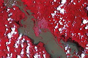
Emerald was cut off by roads on 29 December. This happened as the Nogoa River rose. The river went higher than its 2008 flood level of 15.36 m (50.4 ft). At its worst, 80% of Emerald was flooded. This was the worst flood the town had ever seen. Twelve hundred Emerald residents had to leave their homes.
Rockhampton had almost a week to get ready for the flood. The Fitzroy River flows through the city. The airport closed on 1 January. A metal barrier was put up around the airport to protect it. An evacuation center was set up at Central Queensland University. The Bruce Highway, which goes south from Rockhampton, was closed. The river peaked at 9.2 m (30 ft).
The Port of Gladstone had to reduce its exports. This was because coal piles at the port were wet. Also, no more coal could be brought in by train. The Goonyella railway line, which serves many coal mines, was closed for a week. Grain shipments were also delayed.
Flooding in the Burnett River Area
The towns of Gayndah and Mundubbera saw major flooding on 28–29 December. The Burnett River peaked at 18.25 m (59.9 ft) in Mundubbera. This was the highest since 1942. Over 20 houses were flooded. In Gayndah, the river peaked at 16.1 m (53 ft). Two houses were reached by floodwaters. Both towns were cut off for several days. Their drinking water and farm production were greatly affected.
Bundaberg had very bad flooding, the worst in 40 years. This happened after the Burnett River flooded the city. The Paradise Dam helped reduce some of the flood's impact. Still, 300 homes had to be evacuated. The Bundaberg Port, which exports sugar, closed in late December 2010. This was because the floods left mud in the port. It reopened in early March 2011 after the mud was removed.
Flooding in the Condamine/Balonne River Area
Chinchilla and Jericho were also flooded. At least 40 people had to leave Chinchilla.
Flooding in Dalby was the worst since 1981. The town's water cleaning system was flooded. This led to water restrictions, making clean-up hard. 112,500 L (24,700 imp gal; 29,700 US gal) of water were brought to the town of 14,000 people. Warwick was cut off when all roads into the town were closed.
The Condamine River reached 14.25 m (46.8 ft) on 30 December. This was its highest level ever. Everyone in Condamine had to leave on 30 December.
More rain on 9–10 January threatened Chinchilla and Condamine again. Residents in Chinchilla were asked to evacuate once more.
The Macintyre River, which is on the border of New South Wales and Queensland, started to threaten Goondiwindi on 13 January. The town is protected by an 11 m (36 ft) levee. Still, the local hospital and aged care home were moved as a safety step. A place for people to go was set up.
Flooding in the Mary River Area
Heavy rain in the Mary River area on 8–9 January 2011 caused flooding in Maryborough and Gympie. The Mary River in Maryborough was expected to reach 8.5 m (28 ft) on 9 January. Some houses and businesses were flooded.
Toowoomba and the Lockyer Valley Flash Flood
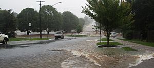
The city of Toowoomba was hit by a sudden flash flood. Over 160 mm (6.3 in) of rain fell in 36 hours up to 10 January 2011. This event caused four deaths in just a few hours. Cars were washed away. Toowoomba is on the Great Dividing Range. It is about 700 m (2,300 ft) above sea level. It had rained almost every day for three weeks. This made the soil around Toowoomba very wet. When storms hit on 10 January, the heavy rain quickly ran down streets and gullies.
The city's main business area is in a small valley. Two small creeks, East Creek and West Creek, meet there to form Gowrie Creek. The creeks could not handle all the water. They overflowed, sending a huge wall of water through the city center. This water then moved west.
The rush of water from the eastern side of the range went through Withcott in the Lockyer Valley. The water was so strong it pushed cars into shops. Hundreds of people had to leave. One person said it looked "like Cyclone Tracy has gone through it." Nearby Helidon had some homes and farms flooded. It was cut off from all sides by damaged roads. Grantham was also destroyed by the water surge. Houses were crumpled by what the Premier of Queensland, Anna Bligh, called an "inland tsunami". Local news said the floodwaters reached 7 or 8 m (23 or 26 ft) high in Grantham. At least 100 people went to the Helidon Community Hall for safety. Nine people were confirmed dead, and many more were feared dead among 66 missing. Nearby Gatton saw people leave voluntarily. This was as the Lockyer Creek rose to a record height of 18.92 m (62.1 ft). This was higher than the record set in the 1893 Queensland floods.
Flooding in the Brisbane River Area
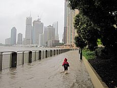
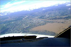
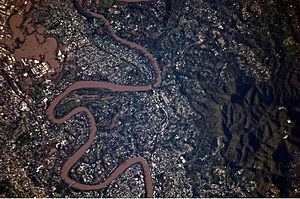
Flooding started to affect low-lying areas of Brisbane on the morning of 11 January 2011. By about 2:30 p.m., the Brisbane River overflowed. This led to people leaving the Brisbane CBD and the suburbs of Fortitude Valley and West End. A place for flood-affected people was set up at the RNA Showgrounds. Residents of 2,100 Brisbane streets were told to leave before the floods arrived on 12 January. The Lord Mayor Campbell Newman said that about 20,000 homes would be affected. He also said that Brisbane's river transport system was "substantially destroyed."
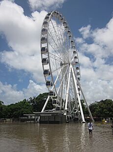
The Brisbane River peaked on 13 January at a lower level than expected. Still, 20,000 houses in Brisbane were flooded. Some of the worst-hit suburbs were St Lucia, West End, Rocklea, and Graceville. The floods damaged some of Brisbane's famous landmarks. The Brisbane Riverwalk, a floating path over the river, broke apart. A 300 m (980 ft) section became a "floating missile." It threatened the Sir Leo Hielscher Bridges. A tugboat safely guided the largest part of the boardwalk under the bridge. Brisbane's main Rugby league and Soccer stadium, Suncorp Stadium, filled with water up to 2 m (6.6 ft) deep.
The flood peaked at 4.46 m (14.6 ft) in Brisbane City. This was about the tenth-highest flood in the city's history. It was several meters below the floods of 1890 and 1893. Parts of Brisbane's western suburbs were cut off for three days. Residents of suburbs like Bellbowrie, Karana Downs, Moggill, and Pullenvale ran low on food. This was until the Australian Army brought supplies on 15 January.
The Bremer River at Ipswich, 30 km (19 mi) west of Brisbane, reached 19.4 m (64 ft) on 12 January. This flooded the city center and at least 3,000 houses. One-third of the city was underwater. Over 1,100 people went to safe centers. In Minden, a four-year-old boy was swept away by floodwaters. A man in his fifties died when he drove into floodwaters. The worst-hit areas of Ipswich were Goodna and Gailes. There were even reports of bull sharks swimming in two streets in Goodna's center.
Further upstream, Hubners Bridge and Richards Bridge near Kilcoy were washed away. Both bridges were rebuilt and reopened in 2012.
Other Affected Areas
In South East Queensland, the Wivenhoe Dam filled to 191% of its normal capacity on 11 January 2011. The dam can hold more water, but anything over 100% must be released. This is to make space for future floods. Brisbane had its wettest December since 1859. Wyaralong Dam, near Beaudesert, had just been finished. It helped reduce flooding in Logan downstream.
In North Queensland, the town of Ingham was cut off. This happened as the Herbert River peaked. Homes in Babinda and Gordonvale were also flooded.
Deaths from the Floods
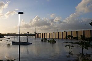
As of March 2012, 33 people died because of the floods. Three other people were still missing and were believed to have died.
Impact of the Floods
The heavy rainfall in Queensland caused the world's sea level to drop by as much as 7 mm (0.28 in). This drop lasted for about 18 months. It happened because Australia's dry basins soaked up water that would usually evaporate from the oceans.
Economic Impact of the Floods
The floods cost the Australian economy at least A$10 billion. By the end of January 2011, insurance companies received 38,460 claims. These claims were worth A$1.51 billion. Almost half of these claims were for damaged homes. More than half were from people living in Brisbane.
The price of food across Australia went up. Supermarket chains lost tens of millions of dollars. Some towns cut off by floods had food shortages. The cost of fruits and vegetables rose soon after. Food supplies to northern Queensland were stopped. Groceries had to be sent to Townsville by ship.
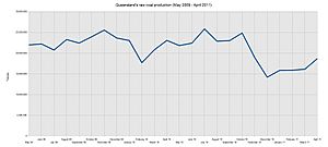
Coal railway lines were closed, and many mines were flooded. About 15% of Queensland's yearly coal production was lost. Four months after the floods, a major coal terminal was working at half its capacity. This was because open-cut mines were still dealing with water issues.
Swimming pool salt was hard to find. This was because salt mines near Rockhampton were flooded. Thousands of liters of milk had to be thrown away. It could not be transported for processing. The constant wet weather also caused health problems for farm animals. Roads in forest areas across the south of the state were badly damaged.
The Prime Minister, Julia Gillard, announced a special flood tax. It was between $1 and $5 a week for each household. The money was to pay for rebuilding. This tax was approved by the Parliament in March 2011.
 | Janet Taylor Pickett |
 | Synthia Saint James |
 | Howardena Pindell |
 | Faith Ringgold |


