Bromelton, Queensland facts for kids
Quick facts for kids BromeltonQueensland |
|||||||||||||||
|---|---|---|---|---|---|---|---|---|---|---|---|---|---|---|---|

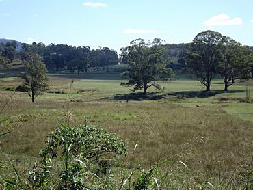
Paddocks, 2016
|
|||||||||||||||
| Population | 129 (2021 census) | ||||||||||||||
| • Density | 1.135/km2 (2.94/sq mi) | ||||||||||||||
| Postcode(s) | 4285 | ||||||||||||||
| Area | 113.7 km2 (43.9 sq mi) | ||||||||||||||
| Time zone | AEST (UTC+10:00) | ||||||||||||||
| Location |
|
||||||||||||||
| LGA(s) | Scenic Rim Region | ||||||||||||||
| State electorate(s) | Scenic Rim | ||||||||||||||
| Federal Division(s) | Wright | ||||||||||||||
|
|||||||||||||||
Bromelton is a rural area, also called a locality, in the Scenic Rim Region of Queensland, Australia. In 2021, Bromelton had a population of 129 people.
Contents
Where is Bromelton?
The main road, Beaudesert–Boonah Road (State Route 90), goes right through Bromelton. It runs from the east to the north of the area.
Bromelton's Past
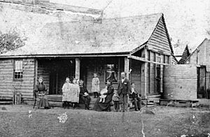
Bromelton has a long history. In 1842, a man named Hugh Henry Robertson was the first European to settle in the Logan River valley, right here in Bromelton.
The area used to have its own post office, which opened in 1927 and closed in 1938.
Schools in Bromelton's History
Bromelton also had a school called Bromelton Provisional School. It first opened its doors on 25 October 1880. Later, in 1909, it became Bromelton State School. This school taught local children until it closed in 1953. It was located on a 30-acre site near Sandy Creek Road.
Another school, Allen's Creek Provisional School, was open for a short time from 1927 to 1929. This was a special school for the children of workers who were building the railway line that connects Sydney and Brisbane.
Bromelton Railway Station
Bromelton used to have its own railway station. Trains called XPT services would stop there, going north to Brisbane and south to Sydney. However, these services stopped in 1994. The station is located north of Beaudesert-Boonah Road.
Bromelton State Development Area
In 2008, a large area of Bromelton was set aside as the Bromelton State Development Area (SDA). This huge area, about 15,000 hectares, is meant for important industrial projects. About 1,800 hectares of it are planned for big businesses and industries.
The main reason this area was chosen is because it has an existing railway line. This line connects Bromelton to the Port of Brisbane, which is a major port, and to other parts of Queensland and Australia. This makes it a great place for companies that need to move goods by train.
One big company, SCT Logistics, built a large transport hub here. It opened in January 2017. This hub helps move goods between trains and trucks. Another company, the Australian Rail Track Corporation, has also bought land in Bromelton.
People of Bromelton
In 2021, Bromelton had 129 residents. In 2016, there were 155 people living in Bromelton. The average age was 40 years old. Most people in Bromelton were born in Australia and spoke English at home.
Education Today
There are no schools in Bromelton itself today. Children living in Bromelton usually go to primary schools in nearby towns like Beaudesert, Gleneagle, or Boonah. For high school, students can attend Beaudesert State High School or Boonah State High School.
How to Get Around
Bromelton is an important place for transport. It has a special section on the railway line that allows trains to switch tracks.
SCT Logistics runs a big transport hub here. It's a place where goods are moved from trains to trucks, or from trucks to trains. You can find it at 2603 Beaudesert Boonah Road.
 | Delilah Pierce |
 | Gordon Parks |
 | Augusta Savage |
 | Charles Ethan Porter |


