Bruzella facts for kids
Quick facts for kids
Bruzella
|
||
|---|---|---|
|
||
| Country | Switzerland | |
| Canton | Ticino | |
| District | Mendrisio | |
| Area
Lua error in Module:Wd at line 1575: attempt to index field 'wikibase' (a nil value).
|
||
| • Total | Lua error in Module:Wd at line 1,575: attempt to index field 'wikibase' (a nil value). km2 (Formatting error: invalid input when rounding sq mi) | |
| Elevation | 593 m (1,946 ft) | |
| Population
(2018-12-31)Lua error in Module:Wd at line 1575: attempt to index field 'wikibase' (a nil value).
|
||
| • Total | Lua error in Module:Wd at line 1,575: attempt to index field 'wikibase' (a nil value). | |
| Time zone | UTC+01:00 (Central European Time) | |
| • Summer (DST) | UTC+02:00 (Central European Summer Time) | |
| Postal code(s) |
6837
|
|
| SFOS number | Lua error in Module:Wd at line 1575: attempt to index field 'wikibase' (a nil value). | |
| Surrounded by | Cabbio, Caneggio, Castel San Pietro, Moltrasio (IT-CO), Schignano (IT-CO) | |
| Website | SFSO statistics |
|
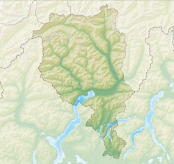
Bruzella was a small town, or municipality, located in the Mendrisio district within the canton of Ticino in Switzerland. It was a part of Switzerland until October 25, 2009. On that date, Bruzella joined with several other nearby towns like Cabbio, Caneggio, Morbio Superiore, Muggio, and Sagno. Together, they formed a new, larger municipality called Breggia.
Contents
History of Bruzella
Bruzella is a very old place! It was first mentioned in official records way back in the year 852. For a long time, until 1609, it was connected to a place called Monte. It was also part of the parish (a church district) of Caneggio until 1649.
The local church, S. Siro, was first mentioned in 1579. It was rebuilt in the 1700s and later fixed up in 1973.
For many years, the main ways people made a living in Bruzella were by making cheese and working in the forests. This meant cutting down trees for timber and making charcoal. Sometimes, people would also leave Bruzella to find work elsewhere. By 1985, only a few people still worked in farming. In the early 2000s, many people living in Bruzella were retired or traveled to other towns for work.
Bruzella's Coat of Arms
A blazon is a special description of a coat of arms. Bruzella's coat of arms has four parts. The first part is silver with two blue stripes. The second part is red with a silver cross. The third part is red and shows a golden oak branch with an acorn. The fourth part has six diagonal stripes, alternating silver and blue.
Geography of Bruzella
Bruzella covered an area of about 3.44 square kilometers (about 1.33 square miles) in 1997. Most of this land, about 87%, was covered by forests. About 10% of the land was used for farming. A small part, less than 2%, had buildings or roads.
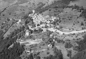
The village itself is located on a flat area, like a natural shelf, on the left side of the Valle di Muggio (Muggio Valley).
Population of Bruzella
In December 2004, Bruzella had a population of 185 people.
In 2008, the number of Swiss citizens in Bruzella stayed about the same. The number of non-Swiss residents decreased slightly. Overall, the population of Bruzella went down by about 2.2% in 2008.
In 2000, most people in Bruzella spoke Italian (164 people). A smaller number spoke German (13 people) or French (2 people). A few others spoke different languages.
Notable People from Bruzella
- Giovanni Pietro Magni (1655 – 1722 or 1724) was a famous German stuccoist. He was born in Bruzella. A stuccoist is an artist who works with stucco, a type of plaster used for decorating walls and ceilings. Giovanni decorated many buildings in central Germany in the late 1600s and early 1700s.
Historic Population Trends
This chart shows how Bruzella's population changed over many years:

Education in Bruzella
In 2000, 29 students who lived in Bruzella went to schools outside of the village.
Economy of Bruzella
There were 88 people living in Bruzella who had jobs. About 38.6% of these workers were women. In 2000, 79 workers traveled outside the village for their jobs.
Religion in Bruzella
Based on the 2000 census, most people in Bruzella were Roman Catholic (about 83%). A smaller group (about 5.5%) belonged to the Swiss Reformed Church. Some people belonged to other churches, and a very small number did not answer the question.
Housing in Bruzella
In 2000, there were 88 buildings where people lived in Bruzella. Most of these (about 80%) were single-family homes. There were also some buildings with multiple apartments.
Out of 106 apartments in the village, about 70% were lived in all the time. About 27% were used seasonally, like vacation homes. A small number (less than 3%) were empty.
Weather in Bruzella
Bruzella typically has rain or snow on about 104 days each year. On average, it receives about 1680 millimeters (66 inches) of precipitation annually.
The wettest month is May, with an average of 213 millimeters (8.4 inches) of rain or snow over about 13 days. The driest month is December, with about 74 millimeters (2.9 inches) of precipitation over nearly 6 days.
 | Delilah Pierce |
 | Gordon Parks |
 | Augusta Savage |
 | Charles Ethan Porter |


