Caerau, Cardiff facts for kids
Quick facts for kids Caerau |
|
|---|---|
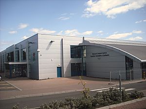
 Western Leisure Centre |
|
| Population | 11,318 (2011) |
| Community |
|
| Principal area | |
| Ceremonial county | |
| Country | Wales |
| Sovereign state | United Kingdom |
| Post town | CARDIFF |
| Postcode district | CF5 |
| Dialling code | 029 |
| Police | South Wales |
| Fire | South Wales |
| Ambulance | Welsh |
| EU Parliament | Wales |
| UK Parliament |
|
| Welsh Assembly |
|
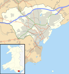
Caerau is a community located in the western part of Cardiff. Cardiff is the capital city of Wales. This area is mostly made up of homes. It also has a Western Leisure Centre, supermarkets, schools, and churches. The main road here is Heol Trelai, which has many large trees.
Contents
History of Caerau
Caerau gets its name from a Welsh word meaning 'Forts'. It is found at the bottom of a hill on the edge of Cardiff.
Ancient Discoveries in Caerau
In 2012, a TV show called Time Team dug up Caerau Hillfort. They found that this Iron Age site was a large hilltop. It was surrounded by many banks and ditches. These were cut through by a big road on one side. The dig also showed that Caerau was probably a main place for the Silures. The Silures were strong local people. They fought hard against the Romans coming into their land. The team found old pottery and weapons. These items were from about 1,000 B.C.
In 1894, a Roman villa was found in the area. More digging happened in 1922. This showed that there used to be several buildings and bathing areas there.
Caerau Joins Cardiff
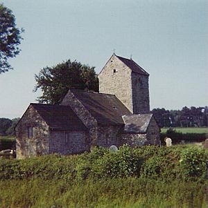
The old village of Caerau officially became part of Cardiff in 1922. Many houses and schools were built on the land of the old Ely Racecourse. However, enough of the racecourse was saved to become Trelai Park. The old parish church of St. Mary is now mostly in ruins.
What You Can Find in Caerau
Caerau has many places to shop. You can find two large supermarkets, Aldi and Farmfoods, near Cowbridge Road West. There is also a big Lidl store and a small Lloyds Pharmacy on Careau Lane. Other shops include a laundrette, a pet supply store, and newsagents.
Sports in Caerau
Caerau Rugby Football Club won the Mallet Cup in 2000 and 2007. Caerau Football Club started in 1955.
Schools in Caerau
Caerau has several schools for young people.
Primary Schools
- Millbank Primary School
- Pencaerau Primary School
- Trelai Primary School
- Ysgol Gymraeg Nant Caerau (a Welsh-language school)
Secondary Schools
- Cardiff West Community High School
- Mary Immaculate High School
Getting Around Caerau
The area is served by Cardiff Bus routes. Electric buses run often on routes 17 and 18 through Caerau. These routes connect to Ely, Canton, and Wood Street. Route 13 also runs along Cowbridge Road West (A48). This is the main road for the area. It links Caerau to Culverhouse Cross in the west and to Ely, Canton, and the city centre in the east.
Famous People from Caerau
- Noel Sullivan: A singer from the pop group Hear'Say in the early 2000s.
- Jason Mohammad: A newsreader for BBC Wales.
- Nicky Piper: A professional boxer who was very successful in the 1990s.
- Henry Morgan: A famous pirate from the 16th century.
- David Cotterill: A Welsh Footballer.
- Steve Robinson: A world champion boxer.
 | James Van Der Zee |
 | Alma Thomas |
 | Ellis Wilson |
 | Margaret Taylor-Burroughs |


