
Calabazas Creek (Santa Clara County) facts for kids
Quick facts for kids Calabazas Creek |
|
|---|---|

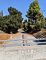
Creek bank restored by SCVWD with timber cribs and native plants next to Calabazas Park north of Rainbow Drive, San Jose, California.
|
|

Location of the mouth of Calabazas Creek in California
|
|
| Country | United States |
| State | California |
| Region | Santa Clara County |
| Cities | Saratoga, San Jose, Cupertino, Santa Clara, Sunnyvale |
| Physical characteristics | |
| Main source | Table Mountain in the Santa Cruz Mountains Saratoga, California 794 ft (242 m) 37°16′29″N 122°04′07″W / 37.27472°N 122.06861°W |
| River mouth | Southwest San Francisco Bay Sunnyvale, California 10 ft (3.0 m) 37°25′02″N 121°59′15″W / 37.41722°N 121.98750°W |
| Basin features | |
| Tributaries |
|
Calabazas Creek is a stream in Santa Clara County, California. It flows for about 13.3-mile-long (21.4 km). The creek starts on Table Mountain in Saratoga, California. It then flows through several cities. These include San Jose, Cupertino, Santa Clara, and Sunnyvale. Finally, it reaches the Guadalupe Slough in the southern part of San Francisco Bay.
Contents
What's in a Name?
The name Calabazas comes from the Spanish language. It means "squash," "pumpkins," or "gourds." This name was quite popular for places south of San Francisco Bay.
Where Does the Creek Flow?
Calabazas Creek begins high up on Table Mountain. This mountain is part of the Santa Cruz Mountains. The creek's water comes from an area of about 20.3 square miles (53 km2). This area is called its watershed.
Other smaller streams flow into Calabazas Creek. These are called tributaries. The main tributaries are Prospect Creek, Rodeo Creek, and Regnart Creek. Prospect Creek joins the creek first. Then Rodeo Creek and Regnart Creek add their waters.
Long ago, Calabazas Creek used to flow into Saratoga Creek. Saratoga Creek then joined the Guadalupe River. But things changed. The Guadalupe River was moved to a different path. So, Calabazas Creek was extended. Now, it flows directly into Guadalupe Slough. This is near Sunnyvale Baylands Park.
Some parts of Calabazas Creek have been changed by people. About 4.2 miles of the creek have a "hard bottom." This means the bottom is not natural soil. A section between Highway 101 and Lawrence Expressway is even lined with concrete. From Guadalupe Slough to Highway 101, the creek is wider. It has levees, which are walls built to prevent flooding.
Keeping the Creek Safe from Floods
In 2010, a big project started to help Calabazas Creek. It was called the Calabazas Creek Flood Control Project. The Santa Clara Valley Water District (SCVWD) led this work. The goal was to prevent floods. They made the culvert (a tunnel for water) under Saratoga-Sunnyvale Road wider. They also made the Union Pacific Railroad bridge bigger. A special area was built to hold extra water during heavy rains. This helps stop flooding. They also fixed many places along the creek where the banks were wearing away.
Animals and Plants in the Creek
Calabazas Creek is home to different kinds of fish. In the past, Steelhead trout lived here. These are a type of rainbow trout. However, they haven't been seen in the creek since the 1970s.
One reason the steelhead trout disappeared was because of barriers. These were obstacles that stopped fish from swimming upstream. For example, there was a 13 feet (4.0 m) dam at Comer Drive. There were also other structures at Bollinger Road and Rainbow Drive. Luckily, the obstacles at Bollinger Road and Rainbow Drive have been removed. The dam at Comer Drive was built to catch gravel. It made the creek level rise, which could cause flooding. This dam was also planned to be removed.
Today, you can find other native fish in Calabazas Creek. These include the California roach, Sacramento sucker, and Three-spined stickleback. Some non-native fish also live here. These are goldfish and Western mosquitofish.
Images for kids
-
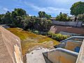
Calabazas Creek at Pruneridge Avenue, Santa Clara
-
Calabazas Creek at Lochinvar Avenue, Sunnyvale


