Cambourne facts for kids
Quick facts for kids Cambourne |
|
|---|---|
| Population | 12,081 (2021 Census) |
| OS grid reference | TL318598 |
| Civil parish |
|
| District |
|
| Shire county | |
| Region | |
| Country | England |
| Sovereign state | United Kingdom |
| Post town | CAMBRIDGE |
| Postcode district | CB23 |
| Dialling code | 01954 |
| Police | Cambridgeshire |
| Fire | Cambridgeshire |
| Ambulance | East of England |
| EU Parliament | East of England |
| UK Parliament |
|
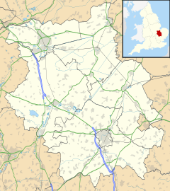
Cambourne is a town in Cambridgeshire, England. It's a new place that was built from scratch! It sits along the A428 road, about 9 miles (14 km) west of Cambridge. To its west are towns like St Neots and Bedford.
Cambourne is made up of three main areas: Great Cambourne, Lower Cambourne, and Upper Cambourne. It's also quite close to Bourn Airfield. With a population of 12,350 people in 2021, Cambourne is the biggest town in South Cambridgeshire.
Contents
History of Cambourne
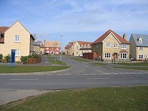
In the late 1980s, people started planning to build many new homes in southeast England. They looked at a large area of farmland, about 9 miles (14 km) west of Cambridge.
In 1994, important agreements were made to start building this new town. Three big home builders, Bovis Homes, Bryant Homes, and Taylor Wimpey, were chosen for the project. Building began in June 1998 on what used to be farmland.
The first plans allowed for 3,300 homes. In 2008, work started on Upper Cambourne. Later, in 2011, permission was given for 950 more homes. This meant building would continue until about 2016. In 2017, plans for another 2,350 homes were approved.
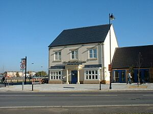
Cambourne was almost called Monkfield, after the original farm. You can still see this name in Monkfield Lane and The Monkfield Arms pub. But the name "Cambourne" was chosen by combining parts of "Cambridge" and "Bourn", a nearby village.
In 2004, Cambourne officially became its own civil parish. Then, in March 2019, the local council decided to call it a town, changing its name to Cambourne Town Council.
What's in Cambourne?
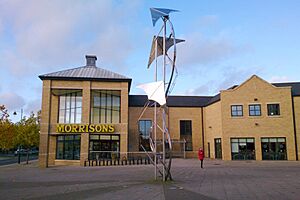
When Cambourne was first built, many useful places were included. These included a Morrisons supermarket and petrol station, a doctor's office, a dentist, and a vet. There were also places for gardening (allotments), a pub, and a hotel.
The High Street in Cambourne has grown a lot. Now you can find takeaways, restaurants, estate agents, a bookmaker, and a pharmacy. More shops are planned for the future, including larger stores and a convenience store.
In 2010, a new police station for Cambridgeshire Constabulary opened in Cambourne. This helps keep the town safe.
In 2011, Cambourne Fire Station was finished. It's next to the police station. While it doesn't have firefighters based there yet, it's used by fire service staff and stores important equipment like a High Volume Pump.
Cambourne Business Park is in Great Cambourne. It's home to the South Cambridgeshire District Council offices. The town also has an eco-park with lots of plants and animals, and a Country Park that opened in 2001.
Sports and Activities
Cambourne has many sports clubs for football, rugby, tennis, netball, and cricket. They all have their own playing fields.
Cambourne Cricket Club started in 2003. They began playing competitive games in 2006. The club has grown a lot and even has three adult teams and three junior teams. They have two cricket grounds now.
The main adult football club is Cambourne Rovers FC. They have a Saturday team and a reserve team. There's also a Sunday league team.
For younger players, Cambourne FC is the biggest junior football club. They have many teams for different age groups, from under 6s to under 13s.
Cambourne Exiles Rugby Club was formed in 2005. It started as a social group but quickly became a strong team. They joined the Greene King Merit League in 2006.
A new sports pavilion opened in 2011 in Great Cambourne. It has changing rooms for football and rugby. In November 2011, the Cambourne Sports and Social Club opened there.
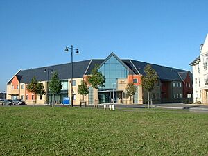
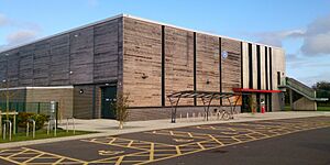
Cambourne Fitness and Sports Centre opened in 2011. Famous athletes like Darren Bent and Beth Tweddle were there for the opening. This center cost about £2 million and has a big sports hall, a dance studio, and a large gym.
Getting Around Cambourne
The roads around Cambourne have been improved a lot. The A428 now has a dual-carriageway bypass that opened in 2007. This helps traffic flow better towards Cambridge.
Buses run regularly between Cambourne and Cambridge. There are also less frequent services to places like St Neots and Huntingdon.
As of 2021, the closest train station is at St Neots. However, a new train station for Cambourne is planned! It will be part of the new East West Rail line, which will connect Oxford and Cambridge. This big project has received £5 billion in funding from the government.
In 2020, a new bus-only road was approved. This will make bus journeys shorter and faster within Cambourne.
Religion in Cambourne
In a 2006 survey, about 20% of people in Cambourne said they were part of a religious faith.
Christianity
From the very beginning of planning Cambourne, Christian church leaders wanted to be involved. They worked together to create a shared church called Cambourne Church. This church brings together the Church of England, Baptists, Methodists, and the United Reformed Church.
The church opened in late 1999, as the first homes were being lived in. Before the main church building was ready, an old portable classroom was used as a meeting place called The Ark. It opened in 2002 and became a popular community building.
The first part of the main church building was finished in 2009. It has a tall, barn-like design and is meant to be welcoming. The main hall can hold up to 150 people for worship and other events. In 2019, an extra space called the Annexe was opened. The Roman Catholic community also uses the church center for their meetings.
Other Christian churches in Cambourne include Peacehaven Baptist Church and Christ Church Cambourne.
Hinduism
After Christianity, Hinduism is the next most common religion in Cambourne.
Schools in Cambourne
Cambourne has a higher birth rate than many other places nearby. This means many children live here! Four primary schools and a secondary school have been built so that students don't have to travel far to other villages.
The first school was Monkfield Park Primary School. Then came The Vine Inter-Church School and Jeavons Wood Primary School. Jeavons Wood later moved to a new permanent building. Its old temporary building became a fourth primary school, which is now on Sheepfold Lane.
In 2011, plans for a secondary school were shown to the public. Cambourne Village College opened in September 2013 in Lower Cambourne. Before this, older students went to Comberton Village College. Some students also travel by coach to St Bede's Inter-Church School in Cambridge.
Youth Work
Cambourne has many young people, partly because many families with children have moved to the town. The Cambourne Youth Partnership was set up to help young people. They work from Cambourne Soul, a youth center in Great Cambourne. They offer different services and activities for young people in the town.
Local Media
For local news and TV shows, people in Cambourne can watch BBC East and ITV Anglia. Local radio stations include BBC Radio Cambridgeshire and Heart East. The local newspaper is the Cambridge Independent. There's also a free monthly magazine called Cambourne Crier that goes to all homes in the town.
Art, Hobbies, and Culture
Cambourne has many clubs and groups for different interests. These include painting, music, photography, and gardening.
Cambourne Cultural Society
The Cambourne Cultural Society (CCS) started in 2010. Its goal is to celebrate the culture, music, and dance from the Indian subcontinent. It has over 100 members, and anyone interested in these cultures can join. The society often holds gatherings to celebrate Indian festivals like Diwali, with dance, music, and food.
Cambourne Crescent
Cambourne Crescent is a local charity that started in 2011. This charity works with the community to help local food banks and other charities. They also run a Science and Technology Club.
Geography
 |
Elsworth | Knapwell | Boxworth |  |
| Caxton | Bourn | |||
| Caxton | Bourn | Bourn |
See also
 In Spanish: Cambourne para niños
 | John T. Biggers |
 | Thomas Blackshear |
 | Mark Bradford |
 | Beverly Buchanan |


