
Canby, Oregon facts for kids
Quick facts for kids
Canby
|
||
|---|---|---|
| Canby, Oregon | ||

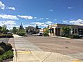
Shops in downtown Canby
|
||
|
||
| Nickname(s):
Oregon's Garden Spot
|
||
| Motto(s):
Home of the Good Earth
|
||

Location in Oregon
|
||
| Country | United States | |
| State | Oregon | |
| County | Clackamas | |
| Incorporated | 1893 | |
| Area | ||
| • Total | 4.73 sq mi (12.26 km2) | |
| • Land | 4.70 sq mi (12.17 km2) | |
| • Water | 0.04 sq mi (0.09 km2) | |
| Elevation | 148 ft (45 m) | |
| Population
(2020)
|
||
| • Total | 18,171 | |
| • Density | 3,867.82/sq mi (1,493.50/km2) | |
| Time zone | UTC−8 (Pacific) | |
| • Summer (DST) | UTC−7 (Pacific) | |
| ZIP code |
97013
|
|
| Area code(s) | 503 971 | |
| FIPS code | 41-10750 | |
| GNIS feature ID | 2409974 | |
| Website | City of Canby | |

Canby is a city located in Clackamas County, Oregon, in the United States. In 2020, about 18,171 people lived there. It is found along Oregon Route 99E, which is about 2 kilometers (1.2 miles) northeast of Barlow.
Contents
Canby's History
Canby got its name from Edward Richard Sprigg Canby. He was a general during the American Civil War. Later, he was killed during the Modoc War by a group of warriors.
The area where Canby now stands was first known as Baker Prairie. This community was started in 1857. Canby was officially planned out in 1870. The city became an official town on February 15, 1893, by the Oregon Legislative Assembly.
Canby's Geography and Climate
Canby covers a total area of about 9.8 square kilometers (3.79 square miles). Most of this area is land, with a small part being water.
When you enter Canby from the north, you will pass by the Willamette River. If you come from the south, you will go through the historic town of Aurora. The Molalla River flows along the southern and western edges of the city.
Canby's Weather Patterns
Canby has warm and dry summers. The average monthly temperature does not go above 22 degrees Celsius (71.6 degrees Fahrenheit). Canby's climate is known as a warm-summer Mediterranean climate. This means it has mild, wet winters and warm, dry summers.
Canby's Population Information
| Historical population | |||
|---|---|---|---|
| Census | Pop. | %± | |
| 1880 | 29 | — | |
| 1900 | 378 | — | |
| 1910 | 587 | 55.3% | |
| 1920 | 852 | 45.1% | |
| 1930 | 744 | −12.7% | |
| 1940 | 988 | 32.8% | |
| 1950 | 1,671 | 69.1% | |
| 1960 | 2,168 | 29.7% | |
| 1970 | 3,813 | 75.9% | |
| 1980 | 7,659 | 100.9% | |
| 1990 | 8,983 | 17.3% | |
| 2000 | 12,790 | 42.4% | |
| 2010 | 15,829 | 23.8% | |
| 2020 | 18,171 | 14.8% | |
| Sources: | |||
Population in 2020
In 2020, the city of Canby had 18,171 people living there. There were 6,498 households. On average, each household had about 2.73 people.
About 25.4% of the population was under 18 years old. Also, 15.3% of the people were 65 years old or older. The population was almost evenly split between males (47.2%) and females (52.8%).
Population in 2010
In 2010, Canby had 15,829 residents. There were 5,647 households in the city. The average household size was 2.79 people.
About 28.3% of the residents were under 18 years old. About 14.2% were 65 years old or older. The median age in Canby was 36.3 years.
Arts and Fun in Canby


The city has a public library called the Canby Public Library. It is part of a larger library system in Clackamas County.
Canby is also home to the Clackamas County Fairgrounds. This is where the yearly Clackamas County Fair and Rodeo has been held since 1907. The fairgrounds are used for the fair in August and for other events all year round.
You can also visit the Canby Depot Museum and Hart's Reptile World in Canby.
Learning and Education
Students in Canby attend schools within the Canby School District. This district includes Canby High School.
Canby News and Media
The local newspaper for Canby is called the Canby Herald. It comes out every week. There is also a digital news source called The Canby Current. It also has a podcast that comes out twice a week.
Getting Around Canby

Train Travel
A train line, used for both freight and passenger trains, runs through downtown Canby. This line is operated by Union Pacific. While Amtrak passenger trains used to stop here, they no longer do. The Amtrak Cascades train stops in nearby Oregon City.
Public Buses
Since 2002, Canby has had its own bus system called Canby Area Transit (CAT). CAT buses run on weekdays but not on weekends or major holidays. This bus service connects with the Portland area's TriMet system in Oregon City. It also connects with the Salem-Keizer Transit (Cherriots) bus system in Woodburn.
Driving in Canby
Oregon Route 99E is a main highway that goes through Canby. It runs generally east to west within the city. The city is divided into four sections by the train line and Ivy Street.
The streets that run east to west are mostly numbered avenues. The streets that run north to south are named streets. Many of these are named after types of trees.
River Travel
The historic Canby Ferry helps people cross the Willamette River all year. This ferry connects Canby with Wilsonville, as long as river conditions are safe.
Airports Near Canby
Canby is close to two airports: the Aurora State Airport and the Portland-Mulino Airport. These airports are used for smaller, private planes, not large commercial flights.
Walking and Biking
Canby has a paved road called the Molalla Forest Road. This road is closed to cars. It used to be a private road for logging trucks. Now, it is mainly used by people who enjoy biking and walking.
Famous People from Canby
- Jay Baller, baseball player
- Howard C. Belton, Oregon State Treasurer
- Ed Coleman, baseball player
- Ralph Coleman, baseball coach
- McKayla Fricker, middle-distance runner
- Tom Gorman, baseball pitcher
- Joni Harms, country musician
- Bill Morgan, football player
- Alan Olsen, Oregon State Senator
- Ralph Patt, jazz-guitarist and geologist
- Kurt Schrader, U.S. Representative
- Martha Schrader, Oregon State Senator
- Aaron E. Waite, Oregon Supreme Court justice
Canby's Sister City
Canby has a sister city relationship with Kurisawa, Hokkaido, Japan. This partnership started in 1987.
Images for kids
-
Shops in downtown Canby
-
Seal of Canby
-
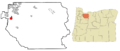
Location in Oregon
See also
 In Spanish: Canby (Oregón) para niños
