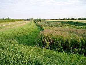
Car Dyke facts for kids
The Car Dyke is a very long ditch, about 85 miles (137 km) long, in eastern England. It runs along the western edge of an area called the Fens. Most people agree that it was built by the Romans a very long time ago. For many centuries, it was thought to mark the western edge of the Fens. But what it was actually used for is still a bit of a mystery!
Contents
What was the Car Dyke for?
People have different ideas about why the Romans built the Car Dyke.
Was it a Roman canal?
In the 1700s, a man named William Stukeley thought it was a canal used to move goods. Many people still believe this today.
- Evidence for a canal:
* At Waterbeach, archaeologists found parts of a Roman boat and pottery. This pottery came from Horningsea, showing that goods were moved along the dyke. This part is now a protected scheduled monument. * Near Boston, digs showed the dyke was about 12 metres (39 ft) wide and 2 metres (7 ft) deep. This is wide and deep enough for boats. * Archaeologists also found coal from the Midlands at Roman workshops between Cambridge and The Wash. This coal was used in forges. This shows that goods were traded and transported along the Car Dyke. * Boats might have carried grain back to places like York to feed Roman soldiers. * At its northern end, some old Roman writings say it was an extension of the Foss Dyke, which was definitely a transport route.
Was it a boundary or a drain?
In some places, the land makes it seem unlikely that the Car Dyke was a simple canal for boats.
- Evidence against a simple canal:
* Near Peterborough, the dyke goes up and down hills. Canals usually need to be flat for boats to travel easily. This suggests it might have been planned for something else. * Some parts in Lincolnshire have untouched ground crossing the dyke, like natural bridges. This would stop boats from passing through. * Some experts think the Romans might not have been able to keep the canal perfectly level. So, they might have left natural barriers to keep water at the right depth in different sections. Goods or boats might have been moved over these barriers.
- Catchwater drain: In some areas, the Car Dyke acts like a "catchwater drain." This means it collects water running off higher ground to the west. Evidence shows that people in the 1600s improved it for drainage, using parts of the original Roman structure.
- Boundary: It's also possible the Car Dyke was mainly a boundary. Around 120 AD, the Roman emperor Hadrian visited Britain. Some parts of the dyke might be linked to his plan to settle the Fens. In some areas, it was definitely used as a boundary in later times.
So, the Car Dyke might have been used for different things in different places. It was probably a boundary, but some parts were also used by boats to carry goods, and other parts helped with drainage.
Where does the Car Dyke go?
It's easier to follow the northern part of the Car Dyke, from Lincoln to Peterborough. It's even shown on old and new maps! However, the southern part, from Peterborough to Waterbeach, is harder to find. Some maps show it ending north of Ramsey, with another separate section near Waterbeach. Modern maps call the section below Peterborough "Cnut's Dike," and some historians think there's no clear link between Peterborough and Waterbeach. This would make the dyke shorter, about 57 miles (92 km) long.
Northern Sections
- Near Washingborough, you can still see parts of the dyke. Some sections are protected as scheduled monuments.
- It runs through places like Branston Booths and Potterhanworth Booths. Many farms along its route are named "Carr-Dyke Farm."
- Much of the dyke's path is now used as part of modern water drainage systems, so the original Roman parts are not always easy to see.
- It passes near Nocton Park Priory and connects to other drainage channels like Nocton Delph.
- Further south, it goes through Metheringham Fen and near Martin and Timberland.
Middle and Southern Sections
- The dyke passes near Walcott and Billinghay, where it joins Billinghay Skirth, which flows into the River Witham.
- It continues south, crossing the River Slea at Ferry Bridge.
- It goes under the A17 road and is crossed by railway lines and other drainage channels.
- Near Swaton, Horbling, and Billingborough, you can find more "Cardyke Farm" names.
- It passes through a small village actually called Dyke, which has another protected section.
Near Bourne and Peterborough
- At Bourne, the dyke turns and joins Bourne Eau. It then weaves through houses before returning to open countryside.
- It passes near Thurlby and crosses the River Glen.
- Its path is harder to see in towns like Baston, Market Deeping, and Deeping St James because of houses.
- When it crosses the River Welland, it enters Cambridgeshire.
- Near Peterborough, it goes through Northborough and Glinton.
- A section near Peakirk is protected, but parts of the dyke are now covered by houses and roads like Frank Perkins Parkway. It eventually reaches the River Nene.
Fens Waterways Link

There's a plan to restore the section of the Car Dyke between the River Nene and River Welland so that small boats can use it again for fun. This project is part of a bigger plan called the Fens Waterways Link. However, because the Car Dyke is so old and important, people are worried about changing it too much. So, another route, the Cat's Water Drain, is also being considered for the new link.
 | Madam C. J. Walker |
 | Janet Emerson Bashen |
 | Annie Turnbo Malone |
 | Maggie L. Walker |


