Ramsey, Cambridgeshire facts for kids
Quick facts for kids Ramsey |
|
|---|---|
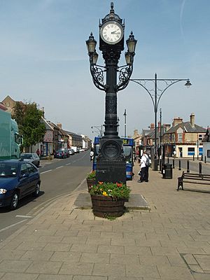 Clock on Great Whyte |
|
| Population | 8,479 (2011 Census) |
| OS grid reference | TL2885 |
| District | |
| Shire county | |
| Region | |
| Country | England |
| Sovereign state | United Kingdom |
| Post town | HUNTINGDON |
| Postcode district | PE26 |
| Dialling code | 01487 |
| Police | Cambridgeshire |
| Fire | Cambridgeshire |
| Ambulance | East of England |
| EU Parliament | East of England |
| UK Parliament |
|
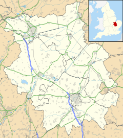
Ramsey is a market town in Cambridgeshire, England. It is located about 9 miles (14 km) north of Huntingdon. The area of Ramsey includes smaller places like Ramsey Forty Foot, Ramsey Heights, Ramsey Mereside, Ramsey Hollow, and Ramsey St Mary's.
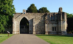
The town grew around Ramsey Abbey, which was a very important monastery. The Abbey was so significant that its abbot (the head monk) was ranked third in Parliament, after only Glastonbury and St Albans. Today, the town's manor house is built where the old Abbey stood, using some of its original materials. Part of the Abbey's remains are now home to Abbey College, Ramsey, a local secondary school.
Contents
History of Ramsey
Scientists have found a very old axe from the Stone Age in Ramsey, but it's thought to be a rare find. There isn't much evidence of people living here during the Stone Age or Roman times. We also don't have many records from the early or middle Saxon periods in Ramsey.
Ramsey Abbey's Story
Ramsey Abbey was a Benedictine monastery founded in the 10th century. Legend says that Ailwyn, a foster brother of King Edgar, started a small hermitage (a place for a hermit) here. King Edgar gave the Abbey a lot of land and special rights in 975.
The Abbey continued to do well even after the Normans took over England. In the 11th century, it was rebuilt. However, during a civil war in the 12th century, a man named Geoffrey de Mandeville took over the Abbey in 1143 and used it as a fort. This caused a lot of damage and made the monks poor.
Later, in the 13th and 14th centuries, the Abbey had rich abbots who started many expensive building projects. The Black Death (a terrible plague) slowed things down, and by the end of the 14th century, the Abbey was struggling financially. But it recovered and continued to thrive until it was closed down in 1537 during the Dissolution of the Monasteries.
After the Abbey closed, the King gave its land and buildings to Richard Williams (alias Cromwell). He tore down many of the Abbey buildings and sold the materials. The land stayed with the Williams/Cromwell family until 1676.
Growth of Ramsey Town
The early history of Ramsey town is not very clear. The Domesday Book of 1086, which recorded much of England, doesn't mention Ramsey. This might be because it was part of a larger area or because it belonged to the Abbey, which had special royal rights.
During the Middle Ages, Ramsey was a small market town that served the Abbey. It never grew into a large city. The first part of the town likely developed near the Abbey, along Hollow Lane. By 1200, the town was big enough to have a weekly market. This market was held where High Street meets the Great Whyte. Later, an annual fair was also held near the church.
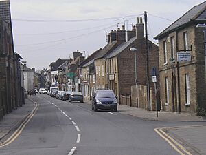
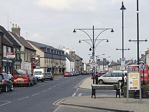
The Great Whyte used to be a canal where boats could travel. By 1854, it was covered over with a brick tunnel, which is why the main street in Ramsey is so wide today.
Many of the buildings along the Great Whyte were built after the Middle Ages. Archeological digs show that this area was often wet because it was part of the fen (wetland). Ramsey has also experienced fires. In 1636, a fire at Little Whyte destroyed about 15 homes. Another big fire in 1731 destroyed a large part of High Street.
Since the 1970s, Ramsey's population has grown, leading to new housing areas around the town and along Bury Road. It's now hard to tell where Ramsey ends and the nearby village of Bury begins, as modern houses connect them.
In the Middle Ages, Ramsey's economy relied on growing garden produce, making cloth, and running alehouses (places to drink and stay). Fishing was also very important in the fen area, along with raising livestock. The waterways of the fenland were used for trade and transport.
Over time, more and more land was enclosed (fenced off for private use). After the Abbey's lands were sold off in the 1500s, this process sped up. From the 1600s, the Great Level (a large fen area) was systematically drained. This created more land for hay and pasture. The remaining common lands were enclosed by an Act of Parliament in 1801.
A Spy in Ramsey
On January 31, 1941, during World War II, a German spy named Josef Jakobs parachuted into the Ramsey area. He broke his ankle when he landed and couldn't move. The next morning, he fired his pistol to get attention. Two local farmers heard the shots and found him. They called the local Home Guard, who took him into custody. The spy was wearing a flying suit and had British money, fake papers, a radio, and even a German sausage! Josef Jakobs became the last person to be executed at the Tower of London.
How Ramsey is Governed
Ramsey has a town council that is elected by the people living in the area. This council has 17 elected members and a clerk. In 2011, Ramsey's town council was the first in the UK to be controlled by the UK Independence Party. However, in the 2015 election, independent councillors gained control.
Ramsey was part of Huntingdonshire until 1965. Then it became part of Huntingdon and Peterborough. In 1974, Ramsey became part of Cambridgeshire county, which it is still part of today.
The next level of local government is Huntingdonshire District Council, which has its main office in Huntingdon. Ramsey is one of the 29 areas that elect councillors to this council. Ramsey elects three of the 52 councillors.
The highest level of local government for Ramsey is Cambridgeshire County Council. Ramsey is an electoral division and has one councillor representing it on the county council.
Ramsey is also part of the national parliamentary constituency of North West Cambridgeshire.
Population of Ramsey
The population of Ramsey has been counted every ten years in the United Kingdom Census.
| Parish | 1911 | 1921 | 1931 | 1951 | 1961 | 1971 | 1981 | 1991 | 2001 | 2011 |
|---|---|---|---|---|---|---|---|---|---|---|
| Ramsey | 5,328 | 5,135 | 5,180 | 5,770 | 5,697 | 5,646 | 5,858 | 6,947 | 8,047 | 8,479 |
| All population census figures from the report Historic Census figures Cambridgeshire to 2011 by Cambridgeshire Insight. | ||||||||||
In 2011, the Ramsey area covered about 15,718 acres (6,361 hectares). The population density was about 345 people per square mile (133 people per square kilometre).
Ramsey's Economy
Ramsey likely had a weekly market by the year 1200. This market was confirmed by King Henry III in 1267, who also allowed an annual fair. Most of the trade at the market was in garden produce.
Fishing was also a very important part of the fen economy. Records from the Abbey show detailed agreements about fishing rights around Ramsey Mere and Whittlesey Mere. Rent was often paid in eels!
Raising livestock, especially cattle, was another key part of the local economy. Parts of the fen were used for growing crops and for pasture. There were often disagreements between the large abbeys of Ramsey, Thorney, and Ely about who owned what land and how much profit they could make.
Some of the jobs in Ramsey included weavers and fullers (people who worked with cloth), and tanners (who prepared leather). The most successful business was running alehouses, which suggests Ramsey had places for travelers to stay. By the 18th century, Ramsey's market had become less important compared to St Ives. By 1881, it was mainly a "pleasure market" selling small items, with only a few pigs being traded.
Ramsey has a Post Office. In the 19th century, it even had its own gas company.
In 1993, Abbey Renewables built a wind turbine in Ramsey, one of the first in the UK. It was replaced with a larger one in 2008. In 2011, a plan was made to add four more turbines to create a five-turbine wind farm that could power over 5,000 homes.
Getting Around Ramsey
Ramsey has local buses that offer regular routes to nearby towns like St Ives, Huntingdon, and Peterborough, as well as to local villages.
Ramsey no longer has a railway station. A branch line from the Great Northern Railway connected Ramsey to the main railway network from 1863. Passenger services on this line ended in 1947, and freight services stopped in 1973. Another branch line, from the Great Northern and Great Eastern Joint Railway, also ended in Ramsey from 1889, giving the town a second station. This line closed in 1930.
Culture and Community
The Ramsey Rural Museum is located in 17th-century farm buildings on Wood Lane. It's a small museum that tells the story of rural life in the Fenland area.
Old documents about Ramsey, like church records, local government papers, maps, and photos, are kept at the Cambridgeshire Archives and Local Studies office in Huntingdon.
Local Media
Local news and TV shows for Ramsey are provided by BBC East and ITV Anglia. Radio stations include BBC Radio Cambridgeshire, Heart East, Greatest Hits Radio East, Star Radio, and HCR FM. The local weekly newspaper is The Hunts Post.
Events in Ramsey
The old custom of ringing a "pancake bell" on Pancake Day was brought back in 1891.
Every year, during the August Bank Holiday weekend, Ramsey hosts "1940s Ramsey." This is one of Britain's biggest living history events, where people recreate the sights and sounds of the 1940s. It used to be held at RAF Upwood but is now at The Camp, Wood Lane. The event raises money for local charities and features re-enactors, period dancing, food, exhibitions, and trade stands.
Churches in Ramsey
St Thomas à Becket Church
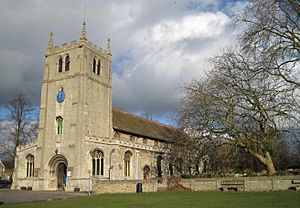
The Church of England parish church of St Thomas à Becket was built in the late 12th century. It was originally part of Ramsey Abbey, possibly a guesthouse. In the early 13th century, it became a parish church. The church was changed and updated in the 14th and 16th centuries, and its west tower was built in 1672. This church is a Grade I listed building, meaning it's a very important historical building.
Salem Baptist Church
Salem Baptist Church was built on High Street in 1857.
Great Whyte Baptist Church
Great Whyte Baptist Church was built in 1894.
Ramsey Methodist Church
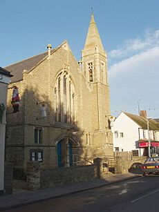
Ramsey Methodist Church on High Street is a Gothic Revival style building that was finished in 1899.
Sports and Fun
Ramsey has a King George's Field, named in memory of King George V. The local football team, Ramsey Town F.C., plays in the Peterborough and District Football League.
See also
 In Spanish: Ramsey (Cambridgeshire) para niños
 | Bayard Rustin |
 | Jeannette Carter |
 | Jeremiah A. Brown |


