Carroll County, Iowa facts for kids
Quick facts for kids
Carroll County
|
|
|---|---|

Carroll County Courthouse
|
|

Location within the U.S. state of Iowa
|
|
 Iowa's location within the U.S. |
|
| Country | |
| State | |
| Founded | 1851 |
| Named for | Charles Carroll of Carrollton |
| Seat | Carroll |
| Largest city | Carroll |
| Area | |
| • Total | 570 sq mi (1,500 km2) |
| • Land | 569 sq mi (1,470 km2) |
| • Water | 0.8 sq mi (2 km2) 0.1% |
| Population
(2020)
|
|
| • Total | 20,760 |
| • Density | 36.4/sq mi (14.06/km2) |
| Time zone | UTC−6 (Central) |
| • Summer (DST) | UTC−5 (CDT) |
| Congressional district | 4th |
Carroll County is a place in the state of Iowa, USA. It's like a special area within the state. In 2020, about 20,760 people lived here. The main town, or county seat, is Carroll. Carroll County is named after Charles Carroll of Carrollton, who was an important person who signed the Declaration of Independence.
Contents
History
Carroll County was created on January 15, 1851. It was named after Charles Carroll of Carrollton, a famous signer of the Declaration of Independence. He was also the only Roman Catholic signer.
In 1855, the county government started in a town called Carrollton. Three years later, in 1858, the first courthouse was built there. A courthouse is where important county decisions are made.
Later, in 1869, the main town moved to Carroll City, which is now just called Carroll. This new location was better because it was in the middle of the county. It also had a connection to the railroad, which helped people travel and trade.
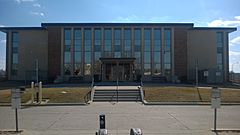
Sadly, the courthouse burned down in 1886. The building you see today was built in 1965. It helps the county government serve the people of Carroll County.
Geography
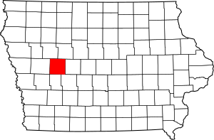
Carroll County covers about 570 square miles. Most of this area is land, about 569 square miles. A very small part, less than one square mile, is water.
Main Roads
Neighboring Counties
Carroll County shares borders with several other counties:
- Sac County (to the northwest)
- Calhoun County (to the northeast)
- Greene County (to the east)
- Guthrie County (to the southeast)
- Audubon County (to the south)
- Crawford County (to the west)
Population Information
| Historical population | |||
|---|---|---|---|
| Census | Pop. | %± | |
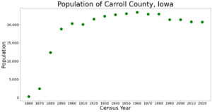
| 1860 | 281 | — | |
| 1870 | 2,451 | 772.2% | |
| 1880 | 12,351 | 403.9% | |
| 1890 | 18,825 | 52.4% | |
| 1900 | 20,319 | 7.9% | |
| 1910 | 20,117 | −1.0% | |
| 1920 | 21,549 | 7.1% | |
| 1930 | 22,326 | 3.6% | |
| 1940 | 22,770 | 2.0% | |
| 1950 | 23,065 | 1.3% | |
| 1960 | 23,431 | 1.6% | |
| 1970 | 22,912 | −2.2% | |
| 1980 | 22,951 | 0.2% | |
| 1990 | 21,423 | −6.7% | |
| 2000 | 21,421 | 0.0% | |
| 2010 | 20,816 | −2.8% | |
| 2020 | 20,760 | −0.3% | |
| 2023 (est.) | 20,522 | −1.4% | |
| U.S. Decennial Census 1790-1960 1900-1990 1990-2000 2010-2018 |
|||
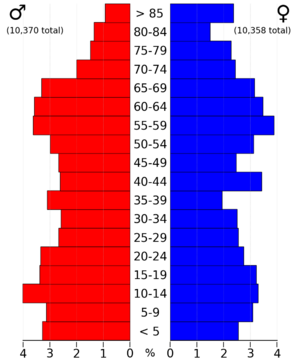
In 2020, the population of Carroll County was 20,760 people. This means there were about 36 people living in each square mile. Most people in the county are White.

Communities
Carroll County has several cities and many townships. A township is a smaller area of land within a county.
Cities
Townships
Carroll County is divided into sixteen townships:
- Arcadia
- Eden
- Ewoldt
- Glidden
- Grant
- Jasper
- Kniest
- Maple River
- Newton
- Pleasant Valley
- Richland
- Roselle
- Sheridan
- Union
- Washington
- Wheatland
See also
 In Spanish: Condado de Carroll (Iowa) para niños
 | Janet Taylor Pickett |
 | Synthia Saint James |
 | Howardena Pindell |
 | Faith Ringgold |


