Chittagong District facts for kids
Quick facts for kids
Chittagong
|
|
|---|---|

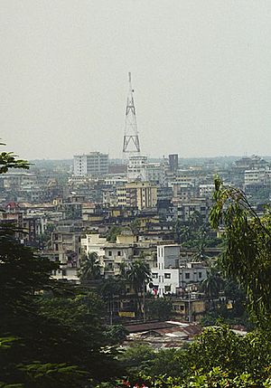
Skyline of Chittagong City
|
|

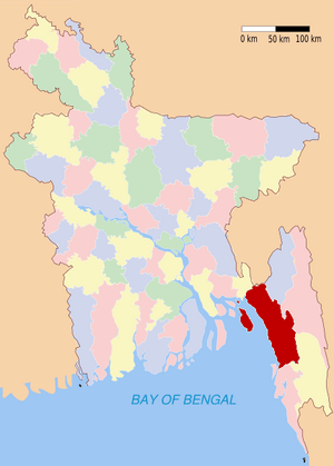
Location of Chittagong in Bangladesh
|
|
| Country | |
| Division | Chittagong Division |
| Area | |
| • Total | 5,282.98 km2 (2,039.77 sq mi) |
| Population
(2011)
|
|
| • Total | 7,509,000 |
| • Rank | 2 |
| • Density | 1,421.36/km2 (3,681.30/sq mi) |
| Literacy rate | |
| • Total | 43.2% |
| Time zone | UTC+6 (BST) |
| • Summer (DST) | UTC+7 (BDST) |
Chittagong District is a region in the south-eastern part of Bangladesh. It is part of the Chittagong Division. The important port city of Chittagong, which is the second largest city in Bangladesh, is located in this district.
History of Chittagong District
Chittagong has always been an important place for trade because of its harbor. Traders from Arab countries visited as early as the 9th century.
In the 16th century and 17th century, kings from Arakan ruled this area. Later, the Mughal army, led by Islam Khan, took control of Chittagong. During the 17th century, the region also faced many attacks from Portuguese pirates.
The Mughals officially made Chittagong a district in 1666. Over time, some parts of the district became separate areas. For example, the Chittagong Hill Tracts were separated in 1860. Much later, Cox's Bazar became its own district in 1984.
People and Religions
Many people live in Chittagong District. According to a census from 1991, most people follow the Muslim faith. About 83.92% of the population were Muslim.
Other religions are also present. About 13.76% of the people were Hindu. Around 2.01% were Buddhist, and 0.11% were Christian. A small number of people followed other religions.
Related Pages
See also
 In Spanish: Chittagong (zila) para niños
 | Ernest Everett Just |
 | Mary Jackson |
 | Emmett Chappelle |
 | Marie Maynard Daly |

