
City Heights, San Diego facts for kids
Quick facts for kids
City Heights, San Diego
|
|
|---|---|
| City Heights | |

City Heights, San Diego
Location in San Diego
|
|
| Country | |
| State | |
| County | |
| City | |
| Population
(2015)
|
|
| • Total | 74,843 |
City Heights is a busy community in central San Diego, California. It is well-known for its many different cultures. This area used to be called East San Diego. City Heights is located south of Mission Valley and northeast of Balboa Park.
City Heights is a special place for many refugees and immigrants. It has large groups of Vietnamese, Somali, Cambodian, Laotian, and Latino people. Many shops, restaurants, and community places are run by or serve these diverse groups. The area is very populated and has mostly apartments and multi-family homes.
Contents
History of City Heights
When Mexico became independent from Spain in 1821, it took control of the land. The mission system, which was run by the church, was changed. Its lands were given to local landowners called rancheros. Later, when the United States took over the land, American settlement began. The Kumeyaay people were moved to reservations starting in 1875. This made way for new towns and buildings.
Early American Settlement
In the 1880s, two American businessmen, Abraham Klauber and Samuel Steiner, bought over 240 acres (0.97 km2) of land. This land was northeast of Balboa Park. They hoped to make money from developing the area. They named it "City Heights." It was also known by the names of its early developers. The land was divided into smaller plots.
On November 2, 1912, people living there voted to become an official city. They called it East San Diego. The population grew quickly from 400 people in 1910 to 4,000 during this time. On December 31, 1923, the City of East San Diego voted to join the City of San Diego. It then became a neighborhood again, known as City Heights. The full process of joining San Diego took a few more years.
Becoming a City Hub
.jpg)
During the 1930s, 1940s, and 1950s, City Heights had suburban homes. It was a business center for middle-class white residents. At this time, people of color were often kept separate in other parts of San Diego. This was due to unfair housing rules.
In the late 1950s, the Caltrans planned to build the I-15 freeway right through the area. This caused many middle-class families to move away. New shopping centers like Fashion Valley and College Grove also drew customers away. This left the University Avenue and El Cajon Boulevard areas with fewer shoppers.
New Residents Arrive
After the Vietnam War, many refugees from Southeast Asia came to the United States. They arrived at Camp Pendleton, near San Diego. Many Vietnamese, Cambodian, and Thai refugees settled in City Heights. This happened during the 1970s and 80s. They chose City Heights because rents were low due to the area's changes. From the 1980s to the 1990s, groups helping refugees sent many people from the Somali Civil War to City Heights.
In the late 20th century, City Heights had many low-income residents. Most of them rented their homes. About 30% of residents lived below the poverty line. During the 1990s, it became harder to get public services, healthcare, and welfare. This was partly due to new laws. Churches in City Heights often helped by providing important services. They continue to be important community centers today.
By the 1990s, local news sometimes described the area as a place where the city met the suburbs. It was often shown as a place with a lot of crime. Some reports unfairly blamed young Somali and African American people for the problems. Officials thought that police action was the only way to fix the issues. Programs aimed at stopping gangs often led to Somali men being arrested. This happened for things like standing around in public or near businesses.
Price Charities Helps Redevelop

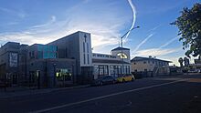
In the mid-1990s, a businessman and philanthropist named Sol Price helped fund a plan. He wanted to create a multi-block "urban village" in City Heights. A new San Diego Police station was a key part of this plan. A local non-profit group and homeowners had suggested building the station in 1993. However, the city did not have the $3 million needed. With Price's funding, the station opened in 1996.
By 2000, Price had spent $70 million to improve City Heights. This was part of his "urban village" idea. This way of developing areas became a model for San Diego's city planning. It was officially adopted in the city's 2002 General Plan. This plan still guides how the city develops its urban areas.
Redevelopment in City Heights continued in the late 1990s and early 2000s. New public buildings opened, like schools, a library, and a community center. These were built through partnerships between public and private groups. Residents liked the new services and businesses. However, some of the new housing built with Price's help was criticized. It mainly served people with moderate incomes. Some people even called the area "Guinea Pig Heights" because of all the experiments.
Since the 1990s, the people living in City Heights have changed. More middle- and upper-class Hispanic and Asian residents have moved in. At the same time, the number of Black residents, especially those with lower incomes, has gone down a lot. Rents and property prices have increased, sometimes by a lot. Still, the area is often cheaper than other central San Diego areas that are changing. It remains home to many refugees and immigrants from Latin America, Africa, Southeast Asia, and Western Asia and North Africa.
Reports from 2017 showed that City Heights has lower rates of violent crime and property crime. This is compared to nearby North Park, Hillcrest, and Downtown Gaslamp. In 2015, San Diego Magazine called City Heights one of the best places to live in San Diego. That year, the San Diego Indiefest music festival was held in City Heights' Urban Village.
By 2019, the area was named an "Economic Opportunity Zone." This gives tax breaks to investors. This policy might cause low-income residents to be pushed out. Changes in North Park have also started to affect City Heights. New events and businesses are attracting higher-income residents. Many of these are middle- and upper-class Hispanic professionals.
Geography of City Heights
City Heights is a large area with many smaller neighborhoods. Fairmount Avenue divides the community into two parts: City Heights East and City Heights West. The community is bordered by Interstate 805 to the west. El Cajon Boulevard is to the north. 54th Street is to the east. Home Avenue, Euclid Avenue, and Chollas Parkway are to the southeast.
The "Downtown" part of City Heights is generally in the Teralta West neighborhood. It is also found along University Avenue.
The community is further divided into fourteen neighborhoods:
- Azalea-Hollywood Park
- Castle
- Cherokee Point
- Chollas Creek
- Colina Del Sol
- Corridor
- Fairmount Park
- Fairmount Village
- Fox Canyon
- Islenair (a historic district)
- Teralta East
- Teralta West
- Swan Canyon
- Ridgeview-Webster
People of City Heights (Demographics)
City Heights had about 65,552 people in 2020. This is according to SANDAG. Most people in City Heights are Hispanic. Many residents have low incomes. The area also has high rates of poverty, unemployment, and health issues like childhood obesity and asthma.
City Heights is home to many Vietnamese, Somali, Cambodian, and Laotian communities.
| Non-Hispanic/ | |||||
|---|---|---|---|---|---|
| Hispanic | White | Black | American Indian | Asian & Pacific Islander | All Other |
| 43,622 | 10,084 | 7,701 | 204 | 11,413 | 1,819 |
About 70% of households earn less than $44,999 per year. The average household income was $29,710 in 2015. The average age of residents is about 30 years old. Most homes in City Heights are multi-family buildings.
| Less than $15,000 | $15k-$29,999 | $30k-$44,999 | $45k-$59,000 | $60k-$74,000 | $75k-$99,999 | $100k-$124,999 | $125k-$149,999 | $150k+ |
|---|---|---|---|---|---|---|---|---|
| 25% | 26% | 19% | 13% | 8% | 6% | 2% | 1% | 0% |
Important Places in City Heights
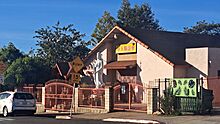
-
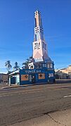
The Tower Bar
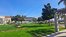
-
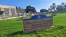
Officer Jeremy Henwood Memorial Park, 4455 Wightman St
-
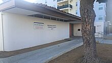
City Heights Performance Annex, 3795 Fairmount Ave
-
Wesleyan United Methodist Church, 5380 El Cajon Blvd
-
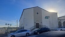
Chinese Friendship Association, Buddhist Temple, 3876 50th St
-
Masjid Al-Ansar Mosque, 4014 Winona Ave
-
Church of Jesus Christ, Apostolic, 4101 48th St
-
Church of Jesus Christ, Apostolic
-
Faith Tabernacle and Nuevo Remanente, 4019 48th St
-
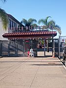
Thien Hau Temple Chùa Bà Thiên Hậu (Buddhist), 4538 University Ave
-
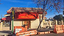
Thien Hau Temple
-
Fairmount Community Church, 4100 Fairmount Ave
-
St. Marks Episcopal Church, 4227 Fairmount Ave
-
Mid City Church of the Nazarene, 4101 University Ave
-
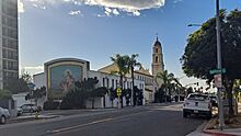
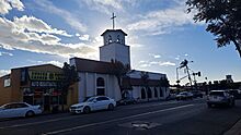
Our Lady of the Sacred Heart Catholic Church, 4177 Marlborough Ave
-
Southern Sudanese Community Center, 4077 Fairmount Ave
-
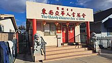
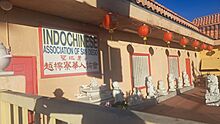
The Elderly Chinese Association of San Diego, 4027 Marlborough Ave.
.jpg)


.jpg)

.jpg)
.jpg)


.jpg)
.jpg)
.jpg)


Environment and Green Spaces
- Chollas Creek Restoration Project: From 2020 to 2022, Chollas Creek will be improved. A $3.5 million grant will help remove concrete from the creek. New walkways, bike paths, and native plants will be added. This will happen along a half-mile part of the creek.
- New Roots Community Farm: This farm is run by farmers who are refugees from many countries. In 2010, Michelle Obama visited the farm. She was promoting her Let's Move! campaign to fight childhood obesity. The City Heights Community Development Corporation (CDC) has managed the farm since 2019. In 2023, the farmers tried to form their own non-profit to run the farm.
- The Azalea Park Arts District (APAD): The Manzanita Gathering Place was built as a creative space. It has art and mosaic tiles made by local residents. At the Azalea Community Park, artists created the Water Conservation Garden. It features succulent plants and sculptures.
- The Revolutionary Grower’s Garden: As of 2023, the San Diego chapter of the Black Panther Party has been taking care of a community garden. It is located near University Ave and 39th Street.
- As of 2017, there were hiking trails in at least seven canyons in City Heights.
Little Saigon District
The Little Saigon San Diego Foundation started in November 2008. Its goal is to improve the Vietnamese business area on El Cajon Boulevard.

On June 4, 2013, the City Council approved the Little Saigon Cultural and Commercial District. This district is a six-block section of El Cajon Boulevard. It runs from Euclid to Highland avenues. The area is known as a center for Vietnamese food and culture. Since 2013, the Little Saigon San Diego Foundation has held a Vietnamese New Year (Tết) festival. This festival helps raise money to develop the district.
On February 1, 2019, signs for Little Saigon were put up. They are near the El Cajon Boulevard exits on Interstate 15.
Getting Around (Transportation)
Major streets for businesses include University Avenue, El Cajon Boulevard, Fairmount Avenue, and Euclid Avenue.
The neighborhood has several bus lines. These include the 215 and 235 Rapid bus lines. Other lines are 1, 7, 10, 13, 60, 852, 955, and 965.
Schools and Learning
City Heights has twelve public elementary schools. It also has three public middle schools and two public high schools. There are two private grade schools and three charter schools. The Mid-City Campus of the San Diego College of Continuing Education is also here.
All public schools are part of the San Diego Unified School District.
Public Elementary Schools
- Cherokee Point
- Hamilton
- Euclid
- Marshall
- Edison
- Central
- Florence Griffith Joyner
- Herbert Ibarra
- Mary Lanyon Fay
- Wilson
- Rowan
- Rosa Parks
Public Middle Schools
- [Clark (Monroe)]
- [Wilson]
- [Mann]
Public High Schools
- Hoover High School
- Crawford Educational Complex (formerly Will C. Crawford High School)
- Community Health and Medical Practices School (CHAMPS)
- Invention and Design Educational Academy (IDEA)
- School of Law and Business (LAB)
- Multimedia and Visual Arts School (MVAS)
Charter Schools
- [Health Sciences High & Middle College (HSHMC)]
- Health Sciences Middle School
- City Heights Prep Academy
- Gompers Preparatory Academy
- San Diego Global Vision Academy
- Arroyo Paseo Charter High School
- Iftin Charter School
Private Schools
- Waldorf School of San Diego (grade school and high school)
Education Gallery
-
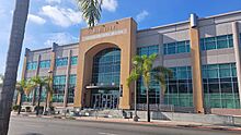
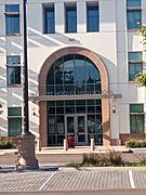
San Diego College of Continuing Education - Mid City Campus
-
City Heights-Weingart Branch of the San Diego Public Library
-
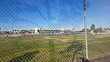
Hoover High School Security Gate
-

Horace Mann Middle School
-
Ibarra Elementary School
-
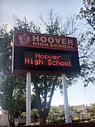
Hoover High School
-
Hoover High School


See also
 In Spanish: City Heights (San Diego) para niños
