Coleman River facts for kids
Quick facts for kids Coleman River |
|
|---|---|
|
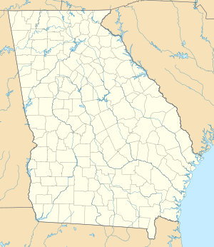
Location of Coleman River mouth
|
|
| Other name(s) | Tributary to Tallulah River |
| Country | United States |
| State | Georgia North Carolina |
| County | Rabun (GA) Clay (NC) |
| Physical characteristics | |
| Main source | Tennessee River divide about 0.25 miles south of Coleman Gap 4,240 ft (1,290 m) 35°00′09″N 083°30′37″W / 35.00250°N 83.51028°W |
| River mouth | Tallulah River about 1 mile southeast of Rock Mountain 1,990 ft (610 m) 34°55′47″N 083°32′45″W / 34.92972°N 83.54583°W |
| Length | 6.89 mi (11.09 km) |
| Basin features | |
| Progression | southwest |
| River system | Tallulah River |
| Basin size | 6.89 square miles (17.8 km2) |
| Tributaries |
|
| Bridges | Eliot Gap Road, Flat Branch Road |
The Coleman River is a stream that flows for about 6.6 miles (10.6 km). It is located in the beautiful Blue Ridge Mountains. Most of the river is found in Rabun County, Georgia.
The Coleman River is one of the main smaller streams, called tributaries, that feed into the Tallulah River.
Contents
About the Coleman River
Where the River Starts and Flows
The Coleman River begins in Clay County, North Carolina. This starting point is called the headwaters. The river flows a short distance before it crosses into Georgia.
About 5.4 miles (8.7 km) of the Coleman River are in Rabun County, Georgia. Some parts of the river flow through private land. Other parts, about 4.1 miles (6.6 km), flow through the Chattahoochee National Forest.
The northern part of the Coleman River in Georgia is special. It is part of the Southern Nantahala Wilderness. This wilderness area also includes the part of the river that is in North Carolina.
Fishing for Trout
The Coleman River is a popular spot for fishing. It is known as a designated trout stream. This means it's a great place to catch trout!
A special rule applies to part of the river. The Wildlife Resources Division of the Georgia Department of Natural Resources says that a section of the river is for "artificial fishing lures only." This means you can only use fake bait, not live bait.
This special fishing section starts where the Coleman River joins the Tallulah River. This joining point is called a confluence. The section continues upstream for about 2.7 miles (4.3 km). It ends at a small bridge on Forest Service Road 54. This road is also known as Coleman River Road.
You can find different kinds of trout in the Coleman River. The brook trout is native, meaning it naturally lives there. Rainbow trout and brown trout have also been introduced to the river. They are not native to this area.
A Scenic River
The Coleman River is very beautiful. In 2004, the Forest Service studied the river. They thought it was special enough to be part of the National Wild and Scenic Rivers System program. This program protects rivers for their natural beauty.
They suggested that the river should be studied more. This is because of its amazing scenery.
You can easily visit about one mile of the lower part of the river. There is a hiking trail that starts in the Coleman River Scenic Area. It's a great way to see the river's beauty up close!
Coleman River Rock Formation
The Coleman River also gives its name to a special rock formation. This formation is part of the Coweta Group.
The Coleman River Formation is made of metamorphic rocks. These are rocks that have changed over time due to heat and pressure. The main types of rock found here are gneiss and schist. Scientists named this formation because these rocks are clearly visible along the Coleman River in Rabun County.
Wildlife Management Area
For many years, the Coleman River was at the center of a special area. This area was called the Coleman River Wildlife Management Area. It was a place managed to protect wildlife.
However, in 1997, this area was no longer part of the wildlife management program. This change happened due to budget adjustments.
 | James B. Knighten |
 | Azellia White |
 | Willa Brown |


