Colinton, Queensland facts for kids
Quick facts for kids ColintonQueensland |
|||||||||||||||
|---|---|---|---|---|---|---|---|---|---|---|---|---|---|---|---|

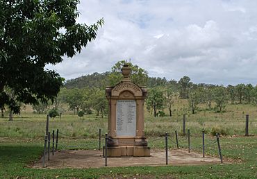
Colinton War Memorial, 2010
|
|||||||||||||||
| Population | 60 (2021 census) | ||||||||||||||
| • Density | 0.43/km2 (1.1/sq mi) | ||||||||||||||
| Postcode(s) | 4314 | ||||||||||||||
| Area | 139.9 km2 (54.0 sq mi) | ||||||||||||||
| Time zone | AEST (UTC+10:00) | ||||||||||||||
| Location |
|
||||||||||||||
| LGA(s) | Somerset Region | ||||||||||||||
| State electorate(s) | Nanango | ||||||||||||||
| Federal Division(s) | Blair | ||||||||||||||
|
|||||||||||||||
Colinton is a small country area in Queensland, Australia. It's part of the Somerset Region. In 2021, only 60 people lived here, making it a very quiet place!
Contents
Exploring Colinton's Geography
Colinton is located near some important waterways. Emu Creek flows through parts of the area. This creek eventually joins the Brisbane River. The Brisbane River forms the eastern border of Colinton.
Roads and Forests in Colinton
A main road, the D'Aguilar Highway, goes through the eastern part of Colinton. Long ago, a railway line, the Brisbane Valley railway line, used to run here too. A large natural area called Benarkin State Forest covers about one-third of Colinton in the west.
Colinton's Mountains
Colinton also has two mountains:
- Glenhowden Mountain is in the east. It rises to 366 meters (about 1,200 feet) high.
- Mount Calabash is in the south. It is taller, rising to 429 meters (about 1,400 feet) high.
Colinton's Past: A Look at History
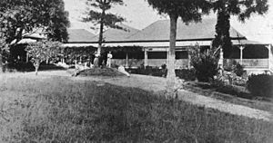
The name "Colinton" comes from a large farm, or "pastoral run," owned by the Balfour family. They named it after their hometown in Scotland.
Early Land and Schools
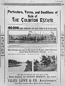
In 1877, a big piece of land, about 23,000 acres, was made available for people to settle. This land was taken from the Colinton pastoral run.
A school called Colinton Provisional School first opened in 1879. It closed briefly but reopened in 1906. In 1909, it became Colinton State School. However, it closed permanently in 1969.
The Railway and War Memorial
In 1910, the Brisbane Valley railway line reached Colinton. There was a train station here called Nurinda railway station. The railway line stopped running in 1993.
The Colinton War Memorial was put up in 1917. It honors soldiers from the area. In 1974, a big flood happened in the Brisbane River. The flood didn't damage the memorial, but it caused changes to the highway. Because of these changes, the memorial was moved to its current spot at the corner of Emu Creek Road and the D'Aguilar Highway.
In 2018, Colinton's postcode changed to 4314.
Who Lives in Colinton?
The number of people living in Colinton has changed over the years.
- In 2011, Colinton was counted with a nearby area, and together they had 315 people.
- In 2016, Colinton itself had 75 people.
- By 2021, the population was 60 people.
Important Places: Heritage Listings
A "heritage listing" means a place is important to history and should be protected. Colinton has one heritage-listed site:
- The Colinton War Memorial at the corner of the D'Aguilar Highway and Emu Creek Road.
Colinton's Economy: Farms and Homesteads
Colinton is a rural area, meaning it has a lot of farms. There are several homesteads (main farmhouses) in the area. Some of these include:
- Colinton Goat Farm
- Colinton Station
- Glenhowden
- Greenfields
- Kanangra
Learning in Colinton: Education
There are no schools directly in Colinton today.
- For primary school (ages 5-12), students can go to Harlin State School in nearby Harlin or Linville State School in Linville.
- For high school up to Year 10, Yarraman State School is an option.
- For high school up to Year 12, students usually travel to Toogoolawah State High School in Toogoolawah or Nanango State High School in Nanango.
 | Georgia Louise Harris Brown |
 | Julian Abele |
 | Norma Merrick Sklarek |
 | William Sidney Pittman |


