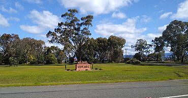
Conara, Tasmania facts for kids
Quick facts for kids ConaraTasmania |
|||||||||||||||
|---|---|---|---|---|---|---|---|---|---|---|---|---|---|---|---|
 |
|||||||||||||||
| Population | 130 (2016 census) | ||||||||||||||
| Postcode(s) | 7211 | ||||||||||||||
| Elevation | 233 m (764 ft) | ||||||||||||||
| Location |
|
||||||||||||||
| LGA(s) | Northern Midlands Council | ||||||||||||||
| Region | Central | ||||||||||||||
| State electorate(s) | Lyons | ||||||||||||||
| Federal Division(s) | Lyons | ||||||||||||||
|
|||||||||||||||
Conara is a small rural area in the Northern Midlands part of Tasmania. It's about 50 kilometres (31 mi) south-east of the town of Longford. In 2016, about 130 people lived in Conara.
Contents
The Story of Conara
Conara became an official place name in 1972. Before that, it was known by names like "The Corner" or "Conara Junction". People believe the name Conara comes from an Aboriginal word. It might mean "coal" or "charcoal".
How Conara Started
Conara's story began in the early 1800s. Settlers James and Catherine Smith were given land here. At first, the area was called "Willis' Corner". It was also known as "Humphrey’s Waterhole".
In 1850, James Smith was asked to build an inn. This inn would offer a place to stay overnight for travelers. These travelers used coach routes between Hobart and Launceston.
The inn was named "The Corners Inn". This name helped the future town become known as "The Corners". Conara was important because it was a key meeting point. It connected coach and train routes in Tasmania. Travelers sometimes called the inn "The Disappearing House". This was because it seemed to vanish behind a hill when seen from the south.
The town's post office opened on August 12, 1862. It was first called "Corners PO". Later, on October 14, 1887, its name changed to "Conara Junction". The original name "The Corners" stayed with the nearby land until 1958.
Conara and the Railways
When railways arrived in Conara in the 1880s, the town grew a lot. It became an important social center in Tasmania's Midlands region. This growth brought more houses and jobs. A church opened in 1892, and a part-time school started in 1891.
In 1903, the local school began full-time classes. However, it closed in 1974 because too few students were attending. The old church is now empty and falling apart. The general store and other shops have also closed down. The post office changed its name from "Conara Junction" to "Conara" on January 1, 1960. But this post office has also closed since then.
Today, Conara is not as busy as it once was. But it is still a useful stop for trains. It also remains a place people pass through between Tasmania's two main cities. Conara has a railway crossing that meets the Midland Highway.
The Conara Junction Railway
In 1872, the Tasmanian Main Line Company built a main railway line. This line connected Hobart and Launceston. It helped the town of Conara grow even more. In 1886, another railway line was built. This "Fingal line" branched east from Conara. It went through Avoca and Fingal. This line reached the Cornwall and Mt. Nicholas coal mines near St Marys.
The town of Conara gets its name from an Aboriginal word for "coal." This is interesting because there isn't any coal found right near Conara.
Conara Junction became a railway town. Trains from Hobart or Launceston passed through daily. Freight trains also used the Fingal line. Most people living in Conara were railway employees. The Railways Institute provided places for fun and housing.
In the 1950s, passenger trains stopped running on the Fingal Line. More money was also put into building highways. Because of this, the importance of railways in Tasmania slowly decreased. Conara was affected by these changes. Many railway workers lost their jobs and moved away. In 1978, the railway system changed hands. Passenger trains stopped running completely. Conara then lost most of its train traffic.
Where Conara Is Located
Most of Conara's borders are straight survey lines. The South Esk River flows through the area from east to west. It then forms a small part of the western border. The Ben Lomond Rivulet also forms part of the western border. This rivulet flows into the South Esk River. The North-South Railway Line runs through the south-west corner of Conara.
Roads in Conara
National Highway 1 goes through Conara from the south-west to the west. The A4 road, also known as the Esk Highway, branches off to the east. This meeting point of roads is where three different road zones (3, 4, and 5) come together.
 | Jewel Prestage |
 | Ella Baker |
 | Fannie Lou Hamer |


