Constantia, New York facts for kids
Quick facts for kids
Constantia
|
|
|---|---|

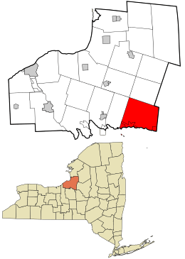
Location in Oswego County and the state of New York.
|
|
| Country | United States |
| State | New York |
| County | Oswego |
| Area | |
| • Total | 99.67 sq mi (258.15 km2) |
| • Land | 56.77 sq mi (147.02 km2) |
| • Water | 42.91 sq mi (111.13 km2) 42.93% |
| Population
(2010)
|
|
| • Total | 4,973 |
| • Estimate
(2016)
|
4,856 |
| • Density | 85.54/sq mi (33.03/km2) |
| Time zone | UTC-5 (Eastern (EST)) |
| • Summer (DST) | UTC-4 (EDT) |
| FIPS code | 36-075-17904 |
Constantia is a town located in Oswego County, New York, United States. In 2010, about 4,973 people lived there. The town is in the southeastern part of Oswego County. There is also a small community, a hamlet, with the same name, Constantia, located within the town.
Contents
History of Constantia
The area that is now Constantia was first settled around 1793. Back then, it was known as "Rotterdam."
The Town of Constantia was officially created in 1808. It was formed from a part of the Town of Mexico. Over the years, the town's size changed. In 1825, some of its land was used to create the Town of Hastings. Later, in 1839, another part was used to form the Town of West Monroe.
Geography of Constantia
Constantia covers a total area of about 99.6 square miles (258.0 square kilometers). A large part of this area is water. About 56.9 square miles (147.3 square kilometers) is land, and 42.8 square miles (110.8 square kilometers) is water. This means water makes up about 42.93% of the town's total area.
Borders and Waterways
The southern border of Constantia is the opposite shore of Oneida Lake. This lake also forms the border with Madison County. To the east, the town shares a border with Oneida County.
An important waterway, the Erie Canal, runs through the town. It uses Oneida Lake as part of its route. The northern boundary of Constantia is marked by the southern edge of the Tug Hill Plateau.
Population and People
| Historical population | |||
|---|---|---|---|
| Census | Pop. | %± | |
| 1820 | 767 | — | |
| 1830 | 1,193 | 55.5% | |
| 1840 | 1,476 | 23.7% | |
| 1850 | 2,495 | 69.0% | |
| 1860 | 3,413 | 36.8% | |
| 1870 | 3,437 | 0.7% | |
| 1880 | 3,124 | −9.1% | |
| 1890 | 2,691 | −13.9% | |
| 1900 | 2,259 | −16.1% | |
| 1910 | 2,023 | −10.4% | |
| 1920 | 1,789 | −11.6% | |
| 1930 | 1,405 | −21.5% | |
| 1940 | 1,538 | 9.5% | |
| 1950 | 1,947 | 26.6% | |
| 1960 | 2,730 | 40.2% | |
| 1970 | 3,547 | 29.9% | |
| 1980 | 4,312 | 21.6% | |
| 1990 | 4,868 | 12.9% | |
| 2000 | 5,141 | 5.6% | |
| 2010 | 4,973 | −3.3% | |
| 2016 (est.) | 4,856 | −2.4% | |
| U.S. Decennial Census | |||
According to the census from 2000, there were 5,141 people living in Constantia. There were 1,893 households, and 1,398 families. The population density was about 90.4 people per square mile (34.9 people per square kilometer).
Households and Age Groups
Out of the households in 2000, 37.3% had children under 18 years old living with them. Most households (61.0%) were married couples living together. About 19.0% of all households were made up of individuals living alone.
The average household had 2.72 people, and the average family had 3.11 people. The population was spread out by age:
- 28.4% were under 18 years old.
- 5.7% were between 18 and 24 years old.
- 31.5% were between 25 and 44 years old.
- 24.7% were between 45 and 64 years old.
- 9.6% were 65 years old or older.
The average age of people in the town was 37 years. For every 100 females, there were about 106.5 males.
Communities and Locations in Constantia
Constantia is home to several smaller communities and interesting locations:
- Bernhards Bay – A small community located right on the shore of Oneida Lake.
- Cleveland – This village is also on the northern shore of Oneida Lake, along Route 49.
- Carroll Corners – You can find this spot between Gay Corners and Dutcherville.
- Constantia – This is the main hamlet of Constantia. It's on the shore of Oneida Lake and Route 49. It used to be an official village but stopped being one in 1923.
- Constantia Center – A hamlet located northwest of the village of Cleveland.
- Doris Park – Another hamlet on the shore of Oneida Lake, found southwest of Constantia village.
- Dutcherville – A hamlet situated north of Nicholsville.
- Gayville – This hamlet is north of Constantia village.
- Halls Corners – A location to the east of North Constantia, near the northern town line.
- Nicholsville – A hamlet located northeast of Constantia village.
- North Constantia – A hamlet found north of Gayville.
- Panther Lake – This is both a hamlet and a resort area, located north of Bernhards Bay.
- Panther Lake – A lake found near the hamlet of Panther Lake.
See also
 In Spanish: Constantia (pueblo) para niños

