County of Warner No facts for kids
Quick facts for kids
County of Warner No. 5
|
||
|---|---|---|
|
Municipal district
|
||
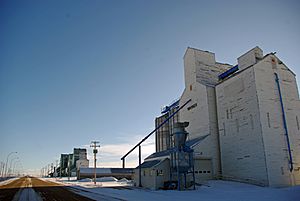
Last surviving elevator row in Alberta, located in Warner
|
||
|
||
| Country | ||
| Province | ||
| Region | Southern Alberta | |
| Census division | No. 2 | |
| Established | 1912 | |
| Incorporated | 1950 | |
| Area
(2016)
|
||
| • Land | 4,531.55 km2 (1,749.64 sq mi) | |
| Population
(2016)
|
||
| • Total | 3,847 | |
| • Density | 0.8/km2 (2/sq mi) | |
| Time zone | UTC-7 (MST) | |
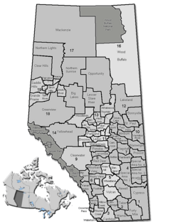
The County of Warner No. 5 is a special kind of local government area in southern Alberta, Canada. It's located right near the border with the United States. The main office for the county is in the small Village of Warner.
Contents
A Look at Warner County
The County of Warner No. 5 has a history that goes back to 1912. It started as a 'rural municipality'. Later, in 1954, it officially became the County of Warner No. 5 as we know it today.
How Many People Live Here?
In 2016, about 3,847 people lived in the County of Warner No. 5. These people lived in 816 homes. The county covers a large area of land, about 4,531.55 square kilometers (that's about 1,750 square miles). This means there aren't many people living in each square kilometer, making it a very spread-out area.
Fun Places to Visit
The County of Warner No. 5 has many interesting places to explore! From historic sites to natural wonders, there's something for everyone.
- Stirling Agricultural Village: This is a National Historic Site. It's like stepping back in time to see how early settlers lived and farmed.
- Warner elevator row: This is the last group of old "grain elevators" left in Alberta. These tall buildings were used to store grain from farms.
- Galt Historic Railway Park: Here you can learn about the history of trains and railways in the area.
- Michelsen Farmstead: Another historic farm where you can see how people lived long ago.
- Lost Frontier Mini-Railway: A fun miniature train ride for visitors.
- Writing-on-Stone Provincial Park: This park is famous for its amazing rock formations and ancient rock carvings by Indigenous peoples. It's a beautiful place to hike and learn about history.
- Devil's Coulee Dinosaur Heritage Museum: If you love dinosaurs, this museum is a must-see! It's home to dinosaur fossils and tells the story of these ancient creatures.
- Centennial Park: A nice park for outdoor activities.
- Raymond Golf Club and Milk River Golf Club: Great places for golf lovers.
Exciting Events
The county also hosts some fun events throughout the year:
- Stirling Settler Days: A celebration of the area's pioneer history.
- Victorian Prairie Christmas: A special Christmas event held at the Galt Railway Park.
- Raymond Stampede: A thrilling rodeo event that brings the community together.
How the County Was Formed
The County of Warner No. 5 is made up of about 50 "townships." A township is a land area. The county's southern edge is the border with the United States. It was formed by combining two older areas: the Municipal District of Warner No. 36 and part of the Municipal District of Sugar City No. 37.
Here are some important dates in the county's history:
- 1913: The Municipal District of Warner No. 36 was officially created.
- 1923: The Municipal District of Sugar City No. 37 was created.
- 1942: The Sugar City area grew bigger, adding more land.
- 1950: The Warner area also grew, adding the Milk River, Coutts, and Masinasin districts.
- 1953: The Sugar City area was closed down, and part of it was added to the Warner area.
- 1954: The County of Warner No. 5 was officially formed!
Towns and Villages
The County of Warner No. 5 surrounds several towns and villages. These communities are important parts of the county.
Urban Communities
Smaller Communities
- Hamlets: These are smaller communities within the county.
- Localities: These are even smaller places, often just a few homes or a historic site.
- Other Places:
- Allerston (also known as Doran)
- Mammoth
- One-Seventeen
- Two-Fifteen
Education in the County
Two main school divisions help provide education in the County of Warner No. 5: Westwind School Division No. 74 and Horizon School Division No. 67.
Historic Schools
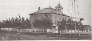
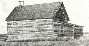
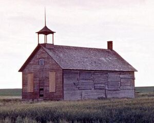
Many years ago, there were smaller school districts that served the communities in the county. Here are a few examples:
| Name & SD No. | Image | Location | Date Established | Notes |
|---|---|---|---|---|
| Galt/Stirling No. 647 | 29 - 6 - 19 - W4 | 19 November 1901 | Originally named Galt, it changed to Stirling in 1957. | |
| Raymond No. 700 | 8 - 6 - 20 - W4 | 1 May 1902 | ||
| Warner No. 1675 | 10 - 4 - 17 - W4 | 31 July 1907 | ||
| Milk River Valley/Masinasin No. 2024 | 15 - 2 - 13 - W4 | 24 August 1909 | Changed to Masinasin in 1941. | |
| Clarinda No. 2459 | 8-1-13 -W4 | 10 June 1911 | ||
| Sleepy Hollow No. 2634 | 24-2-15-W4 | 25 January 1912 | ||
| Bankview No. 3042 | 16-1-17-W4 | 1913 | Closed in 1953. |
Images for kids
 | Bessie Coleman |
 | Spann Watson |
 | Jill E. Brown |
 | Sherman W. White |


