
Currency Creek, South Australia facts for kids
Quick facts for kids Currency CreekSouth Australia |
|||||||||||||||
|---|---|---|---|---|---|---|---|---|---|---|---|---|---|---|---|

Currency Creek
Location in South Australia
|
|||||||||||||||
| Established | 1840 (town) 31 August 2000 (locality) |
||||||||||||||
| Postcode(s) | 5214 | ||||||||||||||
| Time zone | ACST (UTC+9:30) | ||||||||||||||
| • Summer (DST) | ACDT (UTC+10:30) | ||||||||||||||
| LGA(s) | Alexandrina Council | ||||||||||||||
| Region | Fleurieu and Kangaroo Island | ||||||||||||||
| County | Hindmarsh | ||||||||||||||
| State electorate(s) | Finniss | ||||||||||||||
| Federal Division(s) | Mayo | ||||||||||||||
|
|||||||||||||||
|
|||||||||||||||
| Footnotes | Adjoining localities | ||||||||||||||
Currency Creek (postcode 5214) is a small town and area in South Australia. It sits on the western shore of a large lake called Lake Alexandrina. The town is about 6 kilometers north of Goolwa. A stream with the same name, Currency Creek, flows into Lake Alexandrina here. This stream only flows at certain times of the year. The area also includes a point of land called Finniss Point. This point separates the mouths of Currency Creek and the Finniss River.
Contents
History of Currency Creek
Parts of Lake Alexandrina near Currency Creek were first explored in 1830. An explorer named Charles Sturt used an open boat for this journey. However, he did not see the creek itself during his trip.
How Currency Creek Got Its Name
In December 1837, a group led by Thomas Bewes Strangways and Young Bingham Hutchinson explored the lake. They were looking for other ways the Murray River could reach the sea. They used a whaleboat they borrowed from a local fishing spot. This whaleboat was named Currency Lass. It had been sold from a schooner (a type of sailing ship) with the same name. Because the whaleboat was called Currency Lass, they decided to name the creek in its honor. The explorers also reported that the area had good grassland. They thought it would be a good place for farming.
Development of the Town
The town of Currency Creek was planned in 1840. However, it never grew very big. This was mainly because the larger town of Goolwa was very close by. In the late 1800s, many market gardens grew along the fertile river flats. These gardens produced fresh food for sale.
The Currency Creek Cemetery is quite large, especially compared to the small town. This is because it has served the entire surrounding area for over a hundred years. Many old gravestones can be found there.
.jpg)
The official boundaries for the Currency Creek area were set on August 31, 2000. This made the "long established name" official.
Wine Industry
Currency Creek also gives its name to a special wine region. This area stretches from Port Elliot in the west to Lake Alexandrina in the east. It also includes Hindmarsh Island.
Grape Varieties and Production
The main types of grapes grown here are Chardonnay, Sauvignon blanc, Cabernet Sauvignon, and Shiraz. The first vineyards (grape farms) were started in this area in 1969. The region then produced its very first wine in 1972.
Currency Creek Arboretum
The Currency Creek Arboretum is a special place named after the nearby town and creek. An arboretum is like a botanical garden, but it focuses on trees and woody plants.
Research and Purpose
This arboretum was started by Dean Nicolle and is supported by volunteers. Its main goal is to research eucalypts. Eucalypts are a very common group of trees in Australia. They include Angophora, Eucalyptus, and Corymbia trees. The arboretum helps scientists learn more about these important Australian plants.
Images for kids
Memorials to River Murray pioneers at Currency Creek cemetery include:
-
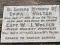
Captain Wolter
-
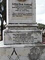
Captain Johnston
-
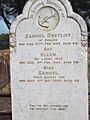
Captain Shetliff
-
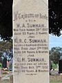
Captain Sunman
-
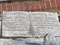
Charles Goode
-
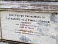
Catharine Goode
-
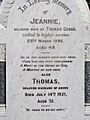
Jeannie Goode
-
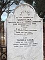
Georgina Johnston
-
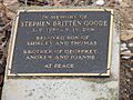
Stephen Goode
-
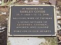
Shirley Goode
-
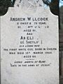
Andrew Willcock
-

Captain Sunman
-
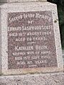
Edward Dashwood Scott
-
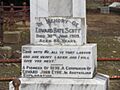
Edward Bate Scott
-
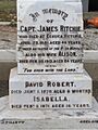
Capt. Ritchie
-
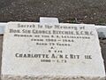
Sir George Ritchie
-
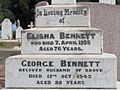
Elisha and George Bennett
-
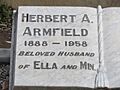
Herbert Armfield
-
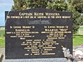
Keith Veenstra


