
Daceyville facts for kids
Quick facts for kids DaceyvilleSydney, New South Wales |
|||||||||||||||
|---|---|---|---|---|---|---|---|---|---|---|---|---|---|---|---|

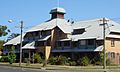
Cottages on Cook Avenue, Daceyville
|
|||||||||||||||
| Population | 1,164 (2016 census) | ||||||||||||||
| • Density | 2,900/km2 (7,500/sq mi) | ||||||||||||||
| Established | 1912 | ||||||||||||||
| Postcode(s) | 2032 | ||||||||||||||
| Area | 0.4 km2 (0.2 sq mi) | ||||||||||||||
| Location | 7 km (4 mi) south-east of Sydney CBD | ||||||||||||||
| LGA(s) | Bayside Council | ||||||||||||||
| State electorate(s) | Maroubra | ||||||||||||||
| Federal Division(s) | Kingsford Smith | ||||||||||||||
|
|||||||||||||||
Daceyville is a suburb in the Eastern Suburbs of Sydney, New South Wales, Australia. It is about 7 kilometers south-east of the Sydney city center. Today, Daceyville is part of the Bayside Council. It was once known as Dacey Garden Suburb.
This quiet, green suburb is surrounded by Pagewood and Kingsford. Some parts of Pagewood were actually planned as an extension of Daceyville. Many of the streets and parks there still look like they did in the original Dacey Garden Suburb plan.
Daceyville is special because it has Australia's first cul-de-sac street. This is a street that is closed off at one end. You can find it on Colonel Braund Crescent. Cook Avenue and Banks Avenue are also unique. They have trees lining both sides of the road. What's unusual is that they also have trees in the middle sections, similar to Anzac Parade.
Contents
History of Daceyville

Daceyville was named after John Rowland Dacey (1854–1912). He was a politician for the area. John Dacey wanted to create a "garden suburb." This idea came from places like Letchworth in England. The goal was to build affordable homes for working-class families.
The plan for Daceyville was put into action after John Dacey passed away. Rowland Park in Daceyville is also named after him.
The design of Daceyville was very thoughtful. It aimed to create a healthy and pleasant place to live. For example, there were no narrow laneways. These were often linked to diseases. Every home had enough land for residents to grow their own food. There were also no front or back fences. This was meant to help neighbors look out for each other. Homes opened at the back onto small parks. Children were expected to play safely in these areas.
Sir John Sulman (1849–1934) helped plan the suburb. He used land that was originally set aside for water conservation. Daceyville was recognized for its special design in 1991. It was listed on the Register of the National Estate.
In 1974, the government wanted to knock down Daceyville's houses. They planned to build taller apartment buildings. Residents formed the Daceyville Preservation Society to stop this. They got help from a group called the Builders Labourers Federation. This group was known for its "Green Bans," which stopped certain developments. Because of these efforts, the Daceyville Garden Suburb Heritage Conservation Area was created. The government then dropped its plans for large public housing towers.
In the 1980s, some new two-story apartment buildings were added. These were built in a style that matched the existing homes. They were mostly built on empty land that used to be back gardens or small parks. This change meant some areas of Daceyville now have more houses. For example, between Astrolabe Road and Boussole Road, there are three rows of houses.
Street Names in Daceyville
Many streets in Daceyville are named after important people and events. Rowland Park is named after John Rowland Dacey, who first imagined Daceyville.
Astrolabe Park, Astrolabe Road, and Boussole Road are named after two ships. These ships belonged to La Perouse, a French explorer. He arrived at Botany Bay shortly after the First Fleet in 1788. Other streets are also named after the First Fleet. Examples include Cook Avenue, Endeavour Road, Solander Road, and Banks Avenue.
After World War I, Daceyville provided homes for soldiers returning from the war. Some streets were named after Australian and British war heroes. Haig Park and Haig Avenue are named after Douglas Haig, a British commander. Other examples include Major General Bridges Crescent, named after William Bridges, and Captain Jacka Crescent, named after Albert Jacka.
Burke Crescent and Wills Crescent were named after explorers of the Burke and Wills expedition. This expedition tried to cross Australia. In the 1960s, Burke Crescent was renamed Colenso Crescent. This was to honor four brothers who fought in World War II, two of whom died during the war.
Trams and Light Rail in Daceyville
A tram line opened in Daceyville in 1913. Trams ran from Circular Quay through Waterloo. The line branched off at Gardeners Road and went east to Anzac Parade. This tram line closed in 1957.
In 2020, a new light rail line opened. It connects Circular Quay to Daceyville. The last stop is near Dacey Gardens park, called Juniors Kingsford.
Daceyville Public School
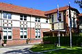
Daceyville Public School is located on a five-acre site. It sits between Bunnerong Road and Banks Avenue. The first request for a school here was made in 1913. An infants school opened on Astrolabe Road in 1914. It became a primary school in 1917.
As Daceyville grew, the school became too small. A new site was obtained, and a new building was constructed in 1921. However, the school quickly outgrew this new building too. More extensions were completed in 1925.
Who Lives in Daceyville?
According to the 2016 census, there were 1,209 people living in Daceyville. About 6.6% of residents were Aboriginal and Torres Strait Islander people. This is higher than the national average. Daceyville also has many older residents, with 35.5% of people being over 65 years old.
The most common backgrounds in Daceyville were Australian, English, and Irish. Most people (56.9%) were born in Australia. About 65.2% of people spoke only English at home. The most common religions were Catholic and No Religion. The average household income in Daceyville was $498 per week. This was lower than the national average.
Images for kids
-
Public housing in General Bridges Crescent
-
St Michael's Catholic Church, Banks Avenue
-
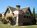
Maintenance depot, Dacey Gardens
-
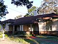
Homes in Federation Bungalow style, Gardeners Road
-
Daceyville Public School
-
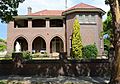
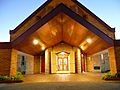
OLSH Convent, Haig Avenue
-
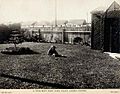
A Daceyville backyard, 1918
-
David Phillips Oval before it was redeveloped
-
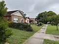
Cottages on Cook Avenue, Daceyville
-
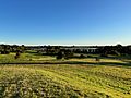
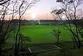
View from Astrolabe Park looking towards the Botany Dams

St_Michaels_Church_Daceyville.jpg)


Daceyville_Public_School_001a.jpg)
Our_Lady_of_the_Sacred_Heart_Convent_Daceyville-6a.jpg)
.jpg)


