Dawson River (Queensland) facts for kids
Quick facts for kids Dawson |
|
|---|---|

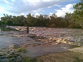
Dawson River near Moura
|
|
|
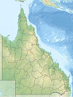
Location of Dawson River mouth in Queensland
|
|
| Country | Australia |
| State | Queensland |
| Region | Central Queensland |
| Towns | Baralaba, Theodore, Taroom |
| Physical characteristics | |
| Main source | Carnarvon Range northwest of Upper Dawson 642 m (2,106 ft) 25°17′52″S 148°34′03″E / 25.29778°S 148.56750°E |
| River mouth | confluence with the Mackenzie River to form the Fitzroy River northeast of Duaringa 55 m (180 ft) 24°57′50″S 150°04′23″E / 24.96389°S 150.07306°E |
| Length | 735 km (457 mi) |
| Basin features | |
| River system | Fitzroy River |
| Basin size | 50,800 km2 (19,600 sq mi) |
| Tributaries |
|
| National parks | Carnarvon National Park; Expedition National Park; Precipice National Park |
The Dawson River is an important river in Central Queensland, Australia. It stretches for about 735 km (457 mi), making it a long and vital waterway. The river starts in the Carnarvon Range and eventually joins with the Mackenzie River to form the larger Fitzroy River.
Contents
Journey of the River
The Dawson River begins its journey in the Carnarvon Range. This area is part of the beautiful Carnarvon National Park. From there, the river flows generally south and then east.
Towns Along the Way
As the river travels, it passes through several towns.
- It is crossed by the Carnarvon Highway.
- It flows through Taroom, where the Leichhardt Highway crosses it.
- Further north, it passes Theodore, where the Leichhardt Highway crosses it again.
- The river then flows through Baralaba and towards Duaringa. Here, the Capricorn Highway crosses the river.
Joining Other Rivers
A little further north of Duaringa, the Dawson River meets the Mackenzie River. When these two rivers join, they create the Fitzroy River. The Dawson River has many smaller streams, called tributaries, flowing into it. There are sixty-four tributaries in total, including the Don River.
River Features
The Dawson River drops about 587 metres (1,926 ft) from its source to its mouth. Its catchment area is huge, covering about 50,800 square kilometres (19,600 sq mi). To help with farming, several weirs have been built along the river. These weirs store water for growing crops like cotton and for dairy farms.
Protected Areas and Floods
The Dawson River flows through or near important protected areas. These include Expedition National Park and Precipice National Park. These parks help protect the natural environment around the river.
Major Floods
The Dawson River can sometimes experience big floods. One major event was the 2010–2011 Queensland floods. During these floods, the river overflowed its banks. The town of Theodore, which is on the river, had to be completely evacuated. This was the first time an entire town in Queensland had to be evacuated due to floods.
River History
The Dawson River area has a rich history, including its naming and early settlement efforts.
First Peoples of the River
The Gungabula people are the traditional owners of the land around the headwaters of the Dawson River. Their language, also known as Kongabula or Khungabula, is an Australian Aboriginal language. Their traditional lands include areas within the Maranoa Region, such as Charleville, Augathella, Blackall, and the Carnarvon Range.
Naming the River
The river was explored by Ludwig Leichhardt in 1844. He named it in honor of Robert Barrington Dawson. Robert Dawson was one of the people who helped fund Leichhardt's explorations.
Farming Plans
In the 1920s, after the First World War, an Australian politician named Ted Theodore had a plan for the Dawson River. He wanted to use the river for an irrigation program. His idea was to give land along the river to soldiers returning from the war so they could become farmers. This was meant to help them find jobs and prevent economic problems after the war. However, this plan was later stopped. It was found that the soil was not very good for farming, and many of the soldiers did not have farming experience.
 | William L. Dawson |
 | W. E. B. Du Bois |
 | Harry Belafonte |


