Taroom facts for kids
Quick facts for kids TaroomQueensland |
|||||||||||||||
|---|---|---|---|---|---|---|---|---|---|---|---|---|---|---|---|
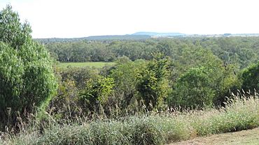
View towards the north-west from Gilbert's Lookout, 2014
|
|||||||||||||||
| Population | 885 (2021 census) | ||||||||||||||
| • Density | 980/km2 (2,500/sq mi) | ||||||||||||||
| Postcode(s) | 4420 | ||||||||||||||
| Area | 0.9 km2 (0.3 sq mi) | ||||||||||||||
| Location | |||||||||||||||
| LGA(s) |
|
||||||||||||||
| State electorate(s) | Callide | ||||||||||||||
| Federal Division(s) | Flynn | ||||||||||||||
|
|||||||||||||||
Taroom /təˈruːm/ is a town and area in Queensland, Australia. It is part of the Shire of Banana and the Western Downs Region. In 2021, about 885 people lived in Taroom.
Contents
Where is Taroom?
Taroom is located on the Dawson River. It is also on the Leichhardt Highway. The town is about 380 kilometres (236 mi) north-west of Brisbane, the state capital. It is also 302 kilometres (188 mi) from Toowoomba.
The Leichhardt Highway runs through Taroom from south to north. The Roma-Taroom Road also connects to the town from the south-west.
Taroom's Weather
| Climate data for Taroom Post Office (1991–2020 normals, extremes 1957–present) | |||||||||||||
|---|---|---|---|---|---|---|---|---|---|---|---|---|---|
| Month | Jan | Feb | Mar | Apr | May | Jun | Jul | Aug | Sep | Oct | Nov | Dec | Year |
| Record high °C (°F) | 45.3 (113.5) |
44.6 (112.3) |
42.2 (108.0) |
36.9 (98.4) |
34.7 (94.5) |
33.0 (91.4) |
30.0 (86.0) |
37.0 (98.6) |
41.4 (106.5) |
41.2 (106.2) |
42.8 (109.0) |
44.0 (111.2) |
45.3 (113.5) |
| Mean daily maximum °C (°F) | 34.7 (94.5) |
33.5 (92.3) |
32.4 (90.3) |
29.3 (84.7) |
25.4 (77.7) |
22.2 (72.0) |
22.0 (71.6) |
24.3 (75.7) |
28.0 (82.4) |
30.7 (87.3) |
32.6 (90.7) |
33.9 (93.0) |
29.1 (84.4) |
| Daily mean °C (°F) | 28.0 (82.4) |
27.1 (80.8) |
25.5 (77.9) |
21.8 (71.2) |
17.6 (63.7) |
14.6 (58.3) |
13.9 (57.0) |
15.6 (60.1) |
19.7 (67.5) |
22.9 (73.2) |
25.4 (77.7) |
27.0 (80.6) |
21.6 (70.9) |
| Mean daily minimum °C (°F) | 21.3 (70.3) |
20.8 (69.4) |
18.6 (65.5) |
14.2 (57.6) |
9.9 (49.8) |
7.0 (44.6) |
5.8 (42.4) |
7.0 (44.6) |
11.4 (52.5) |
15.2 (59.4) |
18.2 (64.8) |
20.1 (68.2) |
14.1 (57.4) |
| Record low °C (°F) | 12.6 (54.7) |
11.1 (52.0) |
7.2 (45.0) |
2.9 (37.2) |
−3.3 (26.1) |
−4.6 (23.7) |
−5.6 (21.9) |
−4.0 (24.8) |
−2.8 (27.0) |
2.2 (36.0) |
5.2 (41.4) |
8.7 (47.7) |
−5.6 (21.9) |
| Average precipitation mm (inches) | 88.7 (3.49) |
94.5 (3.72) |
55.1 (2.17) |
25.9 (1.02) |
24.8 (0.98) |
33.4 (1.31) |
18.2 (0.72) |
26.9 (1.06) |
34.8 (1.37) |
61.4 (2.42) |
60.3 (2.37) |
91.0 (3.58) |
614.9 (24.21) |
| Average precipitation days (≥ 1 mm) | 5.6 | 5.6 | 4.0 | 2.6 | 2.8 | 3.3 | 2.6 | 2.6 | 3.3 | 5.2 | 5.9 | 6.9 | 50.3 |
| Average dew point °C (°F) | 18.1 (64.6) |
18.5 (65.3) |
16.5 (61.7) |
13.2 (55.8) |
10.4 (50.7) |
8.2 (46.8) |
6.7 (44.1) |
6.5 (43.7) |
9.2 (48.6) |
11.8 (53.2) |
14.5 (58.1) |
16.8 (62.2) |
12.5 (54.5) |
| Source 1: National Oceanic and Atmospheric Administration | |||||||||||||
| Source 2: Bureau of Meteorology | |||||||||||||
Taroom's Past
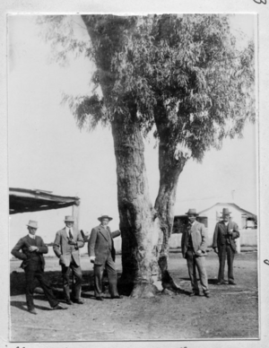
An explorer named Ludwig Leichhardt visited this area in 1844. He carved his initials and the date into a coolibah tree. This tree is now in the middle of town. The carving is no longer there.
Settlers started moving to the area in 1845. By 1850, a town had grown up near the Dawson River. It was first called Bonners Knob. In 1856, it was renamed Taroom. This name might come from the nearby Taroom cattle station. The word tarum means wild lime in the Waka Aboriginal language.
Taroom is the oldest inland town in Queensland after Ipswich.
Early Schools and Events
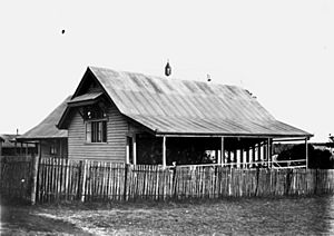
Taroom State School opened on 11 April 1871 as a primary school. In 1964, it added a secondary department for students up to Year 10.
In 1883, a police officer named William O'Dwyer was killed near Wandoan. He was trying to arrest a man. A plaque was put up in 2012 to remember him.
The Taroom Aboriginal Mission was open until 1927. Its residents then moved to Woorabinda, Queensland.
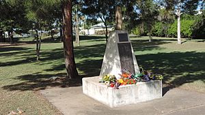
The Taroom War Memorial remembers people from the area who served in World War I, World War II, and the Vietnam War. It was moved to the Taroom Museum in 2018.
The Taroom Town Hall was built in 2004. It is a place for town events and can seat 300 people. The Taroom Public Library opened in 1976.
A Missing Family Found
In December 2014, a man and his two sons were found near Taroom. They had been missing for eleven days. They were on a road trip when their car got stuck in Expedition National Park. A local grazier found them after seeing news reports. They had survived by drinking rainwater and eating old bread. The boys were taken to Taroom Hospital to recover.
What Taroom Does
Taroom is a big centre for the Queensland beef industry. Other important industries include growing wheat and forestry (managing forests).
Learning in Taroom
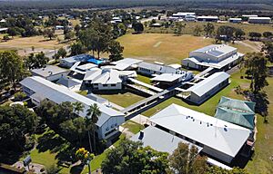
Taroom State School is a government school for students from Prep (kindergarten) to Year 10. It teaches both boys and girls. In 2018, it had 157 students.
Taroom also had a Catholic primary school called St Mary's Primary School for 94 years. It closed in June 2015.
Fun Things to See and Do
Unique Windmill
Taroom has a rare windmill on the banks of the Dawson River. It was made by the Steel Wings Company between 1907 and 1911. This type of windmill is very unusual. Only two working examples are known in the world, and one is in Taroom!
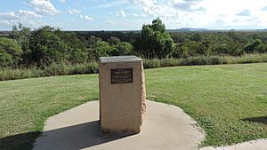
Gilbert's Lookout
There is a lookout called Gilbert's Lookout at the top of Kelman Street. It is named after John Gilbert, a naturalist who explored with Ludwig Leichhardt in 1844. The lookout offers great views of the town and the land around it.
Nearby Parks
Several national parks are close to Taroom. These include Isla Gorge National Park, Precipice National Park, and Expedition National Park. They are great places to explore nature.
Getting Around Taroom
Coach Services
Greyhound Australia offers long-distance bus services. Taroom residents can use the service between Toowoomba and Rockhampton.
Taroom Airport
The Taroom Airport is about 20 kilometres (12 mi) south-east of town. It is used by private planes, emergency services, and for flying workers in and out.
Heavy Transport
Truck drivers often pass through Taroom. They use the Leichhardt Highway and other roads. Taroom is a good place for them to stop for breaks and meals.
In 1972, a truck carrying chemicals exploded on the Taroom-Bauhinia Road. Three men were sadly killed. A memorial was put up in Taroom, and another at the accident site in 2013.
Proposed Rail Link
Unlike some nearby towns, Taroom never got a train line. People in Taroom tried for many years to get the government to extend the Wandoan railway line to their town. However, the project never happened. Today, there is a plan for a new railway line for coal transport. This line is expected to go around Taroom.
Flooding in Taroom
Taroom is on the banks of the Dawson River, so it sometimes floods. There have been four major floods since European settlement.
Big Floods
- The biggest flood was in 1890. The water reached 8.74 metres (28.7 ft) above ground level. You can see a mark on the Leichhardt Tree showing how high it was.
- The second biggest flood was in December 2010. The water peaked at 4.39 metres (14.4 ft) above ground level. Taroom was cut off for several weeks. This flood helped authorities know when to evacuate towns further downstream, like Theodore.
- The third biggest flood was in 1956, reaching 3.23 metres (10.6 ft) above ground.
- The fourth largest flood was in 1983, with water rising to 1.42 metres (4.7 ft) above ground.
Flood Marker
All four major floods are marked on a special pole at the northern entrance to town. This flood marker helps people remember the history of flooding in Taroom.
River Crossings
Crossing the Dawson River has always been a challenge because of floods. Four bridges have been built over the years:
- The first bridge was built in 1863.
- A second bridge opened in 1863, and parts of it are still visible.
- A third bridge was built in 1956. It is now only for walkers and cyclists, and it's a popular spot for fishing.
- The fourth bridge, the William Harold Copeland bridge, opened in 1990. It is usually above flood level but still closes during very big floods.
What Happens in Taroom
Taroom has many events throughout the year:
- January: New Year Races.
- March: Annual St Patrick's Day campdrafting competition.
- April: Golden Horse Shoe campdraft.
- May: Annual Taroom Agricultural Show.
- June: A fishing competition at the Glebe Weir.
- July: An Australian Professional Rodeo Association rodeo.
- September: Annual Leichhardt Festival and the Spring Races.
- The Taroom Polocrosse Carnival is also held every year.
Important Places in Taroom
Taroom has several places listed for their history:
- Fraser family grave site and memorial, Hornet Bank, Hornet Bank Road, Eurombah
- Former Taroom Aboriginal Settlement, on Bundulla
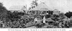
- The Glebe Homestead, Taroom-Cracow Road, Glebe
- Leichhardt Tree, Yaldwyn Street
News and Media
Newspapers
Taroom does not have its own newspaper. However, the Central Telegraph from Biloela often has news about Taroom. Other regional newspapers are also available.
Radio
Taroom does not have a local radio station. But there are several FM repeaters that help people get clear radio signals from other places. These include ABC Southern Queensland, ABC Radio National, The Breeze, Rebel FM, and Vision Radio.
| Name | Frequency | Owner |
|---|---|---|
| Vision Radio | 87.6 FM | United Christian Broadcasters |
| Rebel FM | 92.5 FM | Rebel Media |
| The Breeze | 94.1 FM | Rebel Media |
| ABC Southern Queensland | 106.1 FM | Australian Broadcasting Corporation |
| ABC Radio National | 107.7 FM | Australian Broadcasting Corporation |
Television
Taroom is in the Remote Central and Eastern Australia television area. This means it gets TV channels like Imparja Television, Southern Cross Television, and Ten Central through satellite.
Taroom's Population
| Year | Population |
|---|---|
| 2001 | 691 |
| 2006 | 629 |
| 2011 | 897 |
| 2016 | 869 |
| 2021 | 885 |
 | Selma Burke |
 | Pauline Powell Burns |
 | Frederick J. Brown |
 | Robert Blackburn |


